Hiking the South West Coast path has long been on my bucket list. This summer I completed the section between Newquay to Penzance
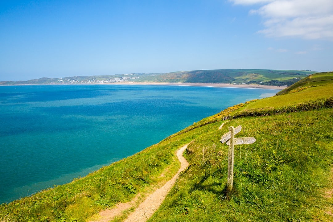
The South West Coast path, Britain’s longest national trail, has long been on my hiking to-do list. It’s one of the finest long distance hiking trails in the world and showcases Britain at its best. Tent on back, I set off for a taste this summer.
I would love to spend a couple of months hiking the entire path but I didn’t have time for a thru-hike this summer, so decided to complete a section between Newquay and Penzance in Cornwall.
The total height climbed over the entire course of hiking the South West Coast path has been calculated as 35,031m (114,931ft): almost four times the height of Mount Everest. The whole trail runs from Minehead in Somerset along the coasts of Devon and Cornwall to Poole Harbour in Dorset. I have previously hiked a lot in Devon so decided to start from Newquay in Cornwall and see a part of Britain that was largely new to me.
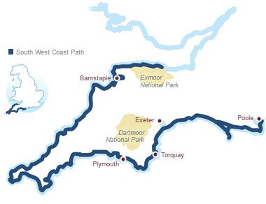
I decided to head around the Cornish peninsular to Penzance via St Ives, Cape Cornwall and Land’s End. Both Newquay and Penzance have excellent transport links and I would be travelling down from London, so it made perfect sense to start and end my hike at these well-connected seaside towns.
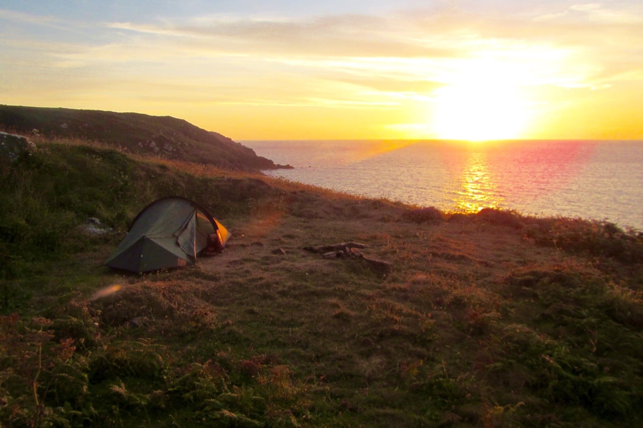
It took me seven days and six nights to walk a total of 135km (84mi). I camped every night: three nights on farms and campgrounds and three nights wild camping along the clifftops above the Atlantic Ocean, all the while amid some of the most diverse and striking scenery in Britain.
Below, I break down my route day by day.
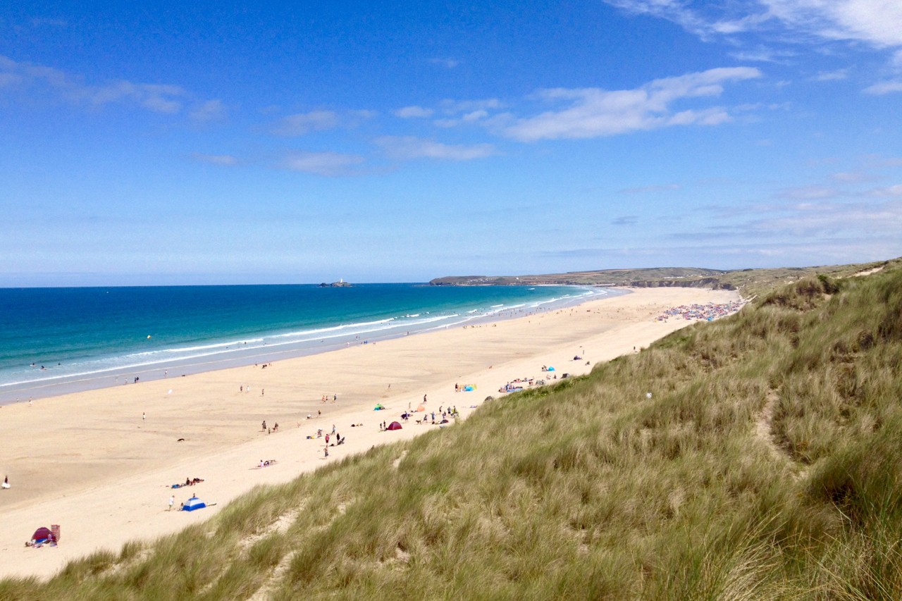
Newquay to St Agnes Head
Distance: 29.1km (18.1mi)
I arrived at a cool and cloudy Newquay early in the morning on a night bus from London, so found the trail and started walking by 7am. As such, I made good time and covered a lot of distance that day. Others may prefer to take it easier and stop around Perranporth making the stint a little more moderate 20.2km (12.6mi).
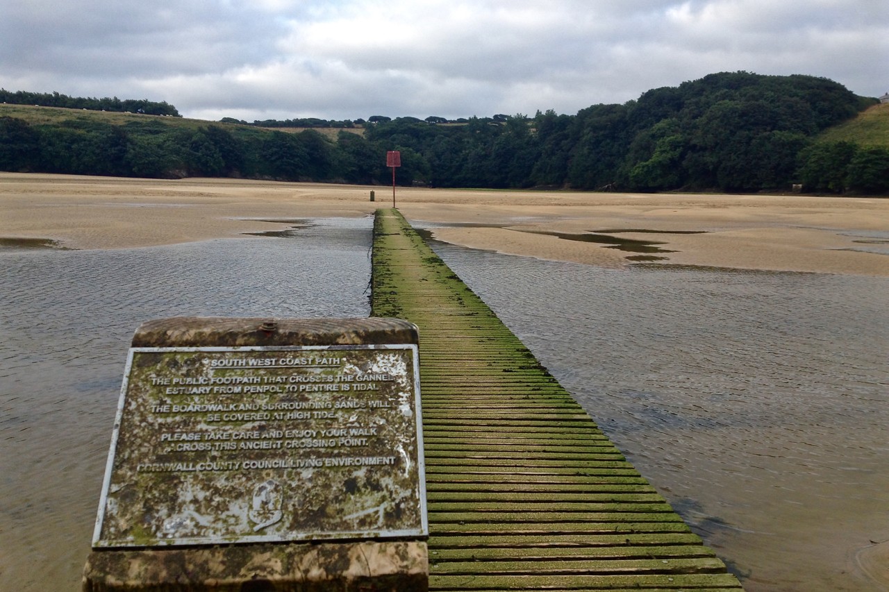
The route is relatively easy but you can be delayed crossing The Gannel at Newquay depending on if the tide is in or out. I was lucky (the tide was out), so I crossed the estuary quickly by the shortest route.
If the tide is in, you may have to hike inland and cross further on or take a private ferry across the water at Fern Pit. Either option will be longer and add at least a couple of kilometres to your journey.
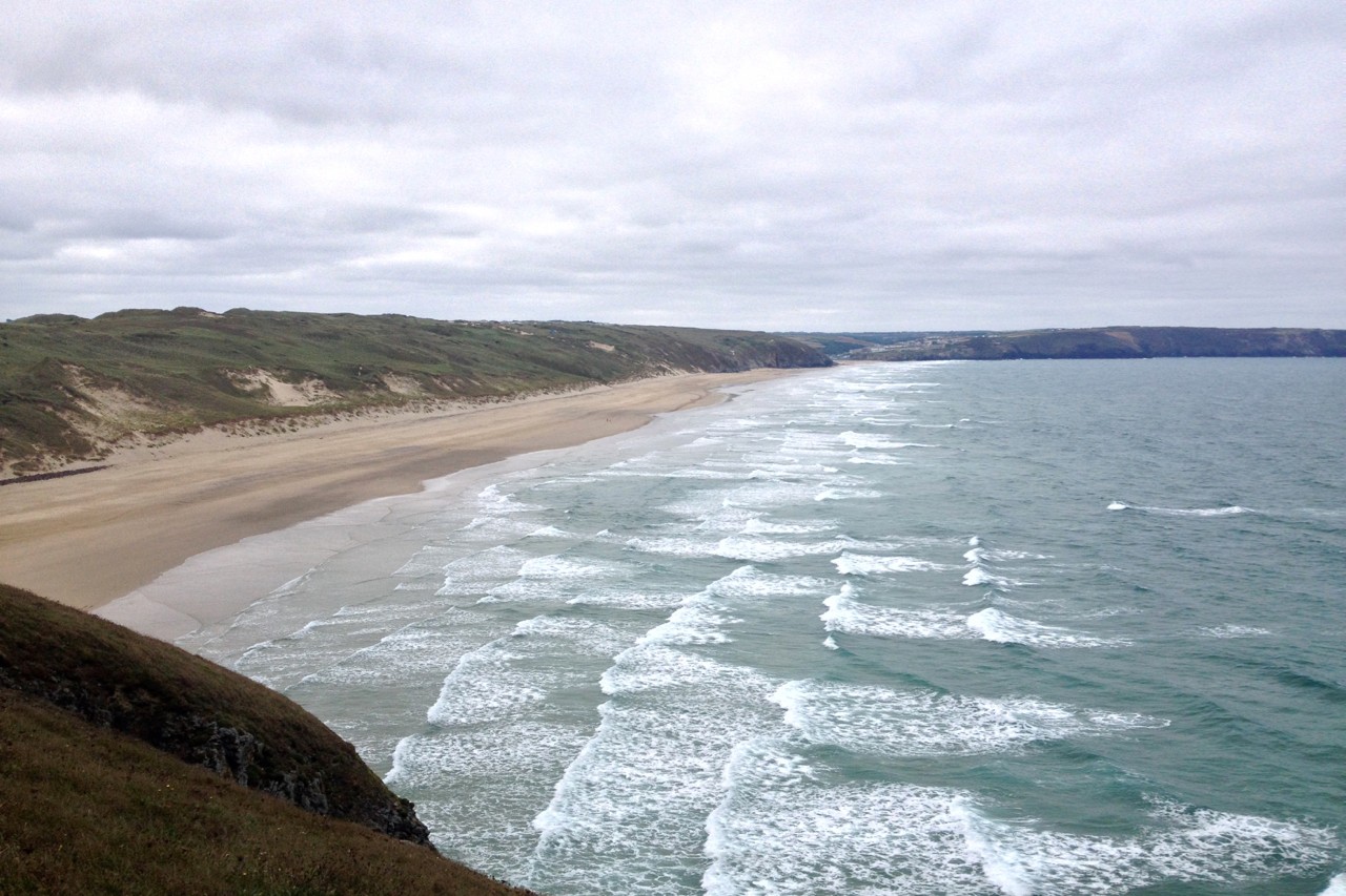
Another slow section is a 3.5km (2.2mi) stretch along Perran Beach. At low water it’s easier to walk along the beach near the water’s edge where the sand is harder and flatter.
However, at high water you’ll have to take the path along the undulating dunes which is slower and tougher. I struck it lucky again and walked along the beach, playing with the dogs running up and down on their morning walks with their owners.
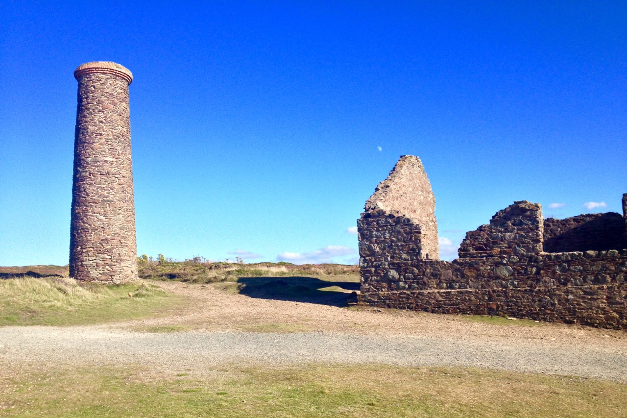
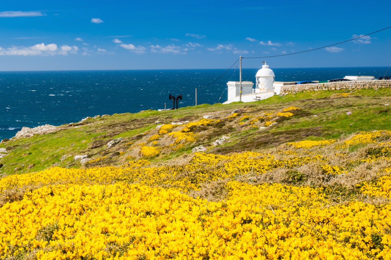
Between Perranporth and St Agnes there is a beautiful stretch of path running between the clifftops and the airfield where there are good opportunities for wild camping. Cligga Head in particular is a great spot. There is also lots of evidence of mining along this stretch with disused quarries and mine shafts near the path, particularly at Trevellas Porth.
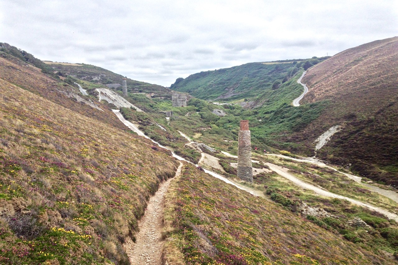
The sun was coming out, the views incredible and the going good so I kept pushing on. I was keen to make it to a campsite at Beacon Farm just after St Agnes so I walked on for a couple more hours. I arrived at the campsite with enough time to pitch my tent and wander down to the excellent remains of Wheal Coates tin mine just a five-minute walk away.
ST AGNES HEAD TO PORTREATH
Distance: 14km (8.7mi)
I slept late and didn’t get on the path until midday, which suited me fine as I was tired and the weather was misty and wet first thing. I was happy to take it slower as I’d made good ground the previous day and the scenery was nothing short of stunning.
The hiking is fairly easy following well-trodden trails along the top of the clifftops. The hike is broken up fairly regularly by coves that require a steep descent and ascent to cross the valleys – a regular feature of hiking the South West Coast Path.
The two settlements of Porthtowan and Portreath break up the route offering pubs, refreshments and public conveniences, ideal for refilling empty water bottles and grabbing a snack before hiking back up to the clifftops.
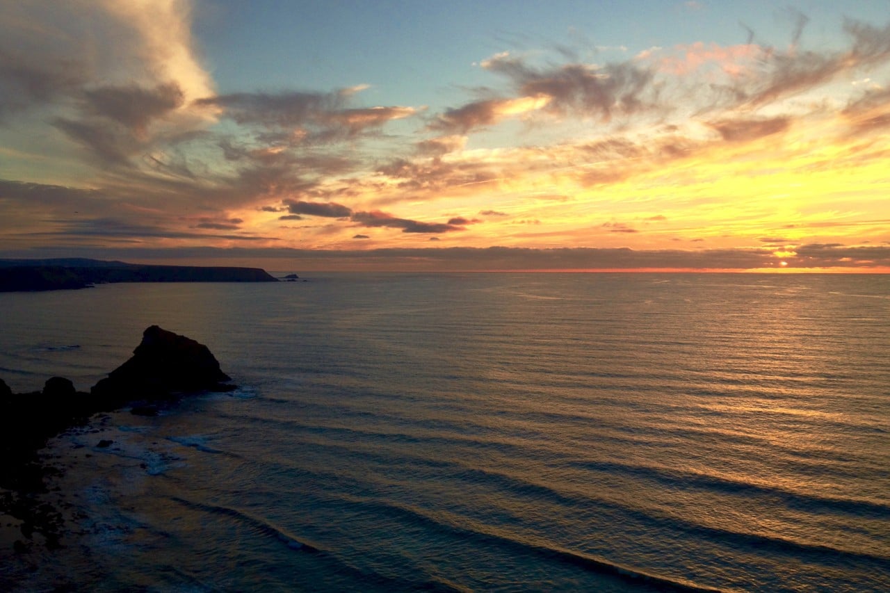
I pitched about two kilometres past Portreath, just after a cove called Carvannel Downs which had a spring for fresh water, and was treated to a glorious sunset over the Celtic Sea and North Atlantic.
PORTREATH TO ST IVES
Distance: 28.7km (17.8mI)
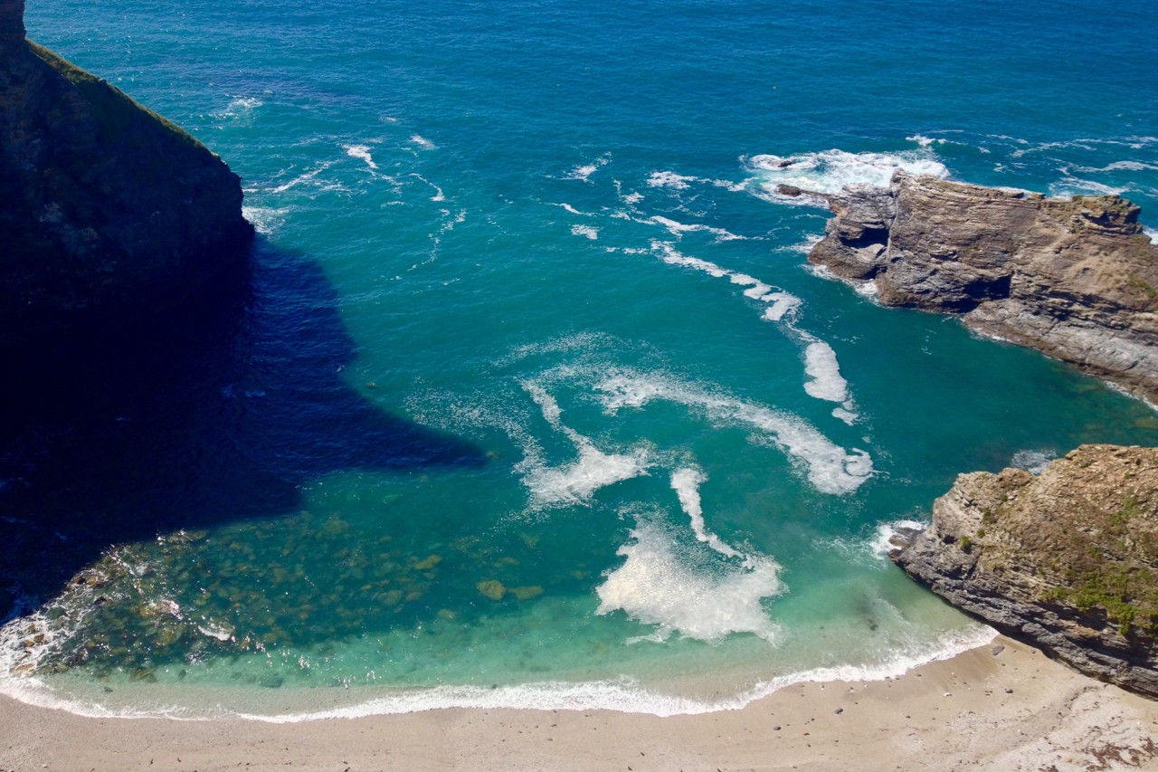
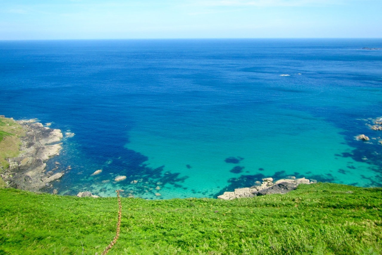
The next day was a mixed one to say the least. I saw some of best scenery of the trip including golden beaches, turquoise waters and dramatic bays. However, there was also some torturous terrain which, surprisingly, didn’t come in the way of steep cliffs and valleys.
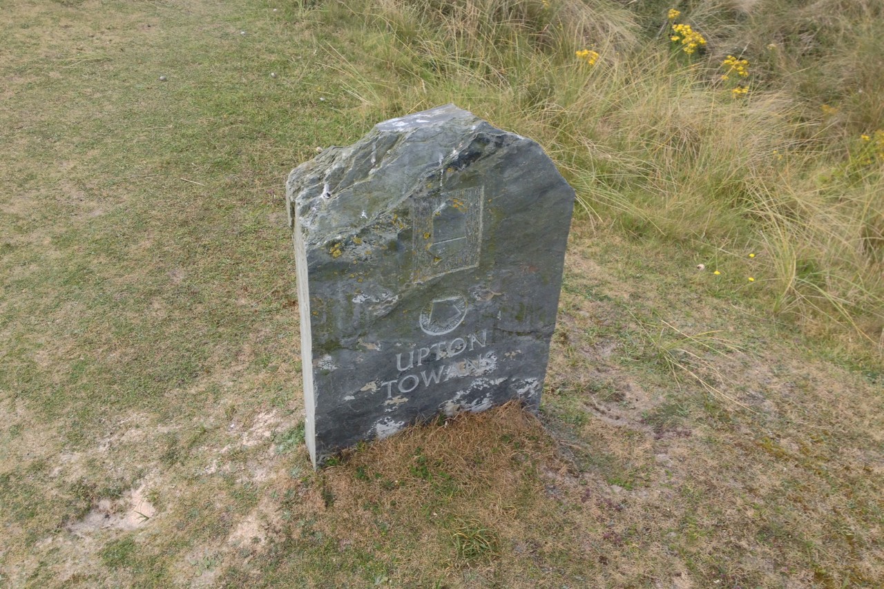
The day started well with some gorgeous and largely flat clifftop hiking towards Godrevy Point. I was having a great time until I hit nearly five kilometres of tedious trail-finding through the dunes around Gwithian and Phillack.
I could have taken the beach route but the sun was shining and the beaches were crowded with surfers, bathers and sun loungers. I chose to pick my way through almost-deserted dunes as opposed to sun seekers.
The dunes, known as Gwithian and Upton Towans (towans is the Cornish word for dunes), felt like a never-ending labyrinth of ever-undulating mini-torments. It was slow work as I picked my way through the dunes while my boots sank deep into the sand, making a testing task decidedly torrid. The route is waymarked but often irregularly and there is no clear trail as such, just slightly firmer sandy paths to be taken.
Unfortunately, as soon as that was over, I was met with four or five kilometres of pavement-pounding around the Hayle Estuary. The path cuts inland here around the extensive Hayle river mouth and unfortunately follows largely busy and charmless roads throughout.
In hindsight, I wished I had jumped on the train at Hayle and taken the 11-minute ride to Lelant Saltings via St Erth and saved myself over an hour of rather depressing walking.
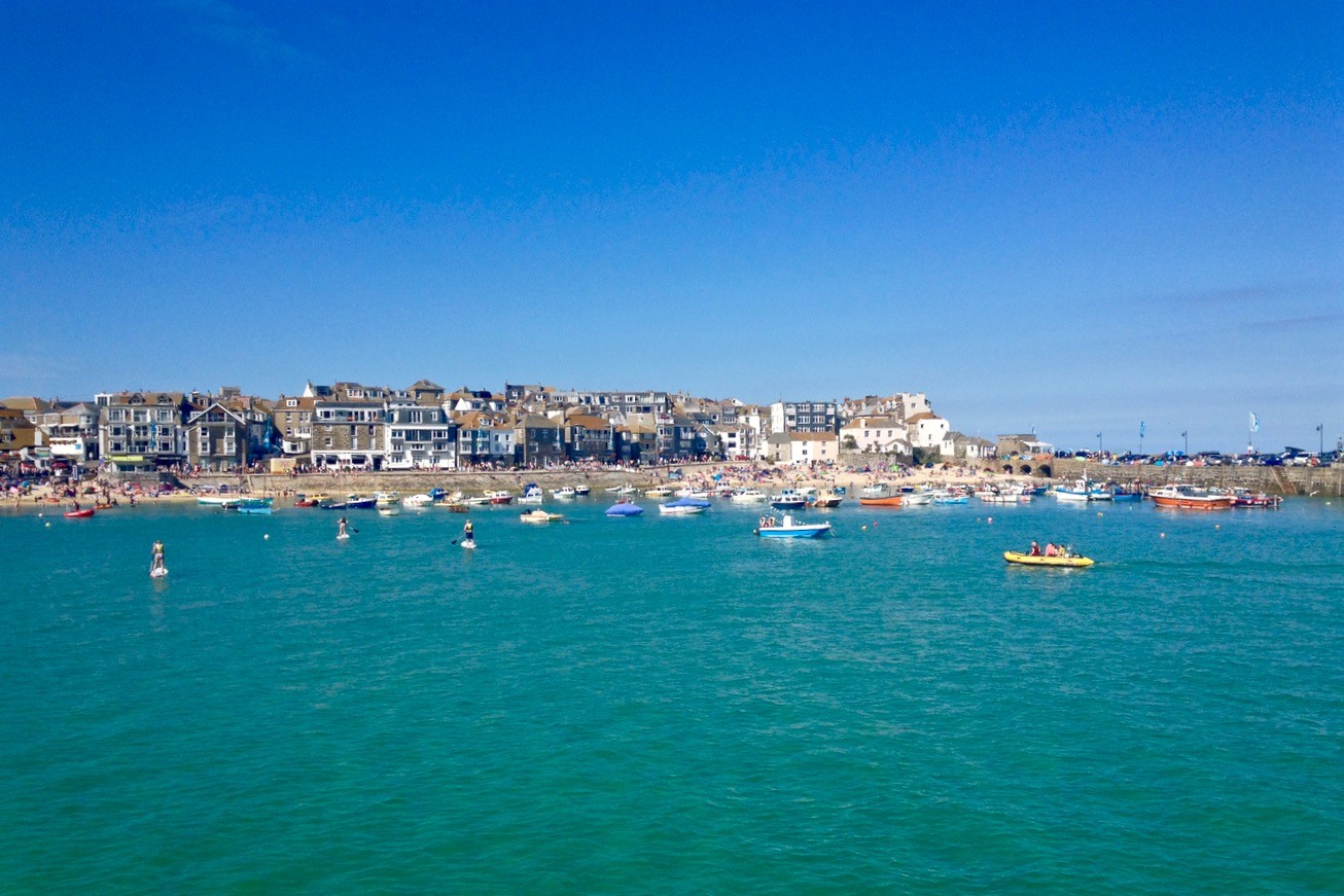
You can take the train all the way into St Ives but if you don’t alight at Lelant, you’ll miss the stunning path above the beautiful beaches around Carbis Bay. The beaches here look like Britain’s answer to the Caribbean.

After finally reaching St Ives I paused to have a wander, take some photos and refill my drinking bottles before heading out of town past Tate St Ives on the path towards Clodgy Point.
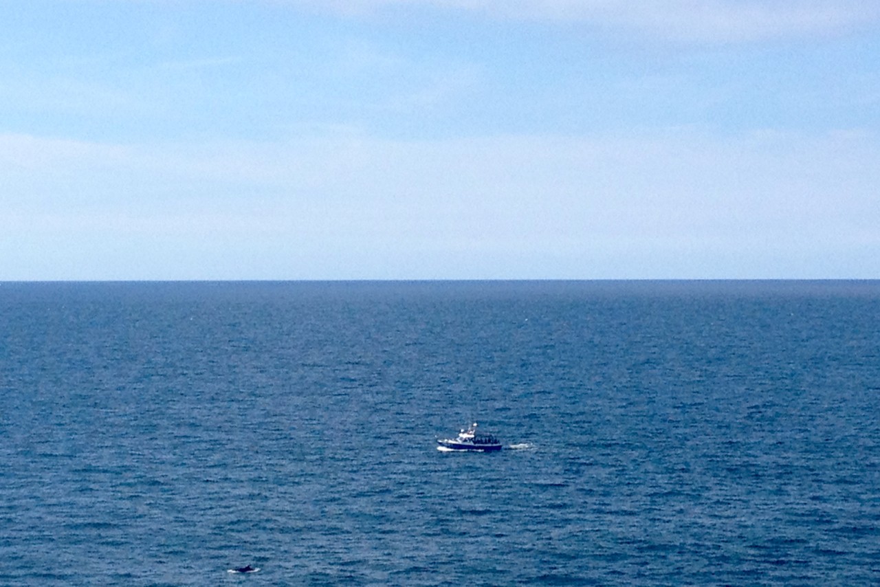
There are some excellent views here looking back towards town as well as out to sea. It was here I saw, albeit from some distance, several dolphins breaching the surface below me.
Unfortunately, the National Trust appears to lose interest in signposting the coast path here. This unfortunately coincides with a rather confusing section where several private paths leading to various holiday parks and farms criss-cross the area.
Don’t do what I did and waste 20 minutes following a misleading signpost! Instead, trust in your instincts, keep close to the coast and avoid straying inland even if signposts suggest otherwise!
I stopped and pitched my tent in a camping spot about two kilometres beyond St Ives near Hellesveor Cliff. The spot was ideal: sheltered, away from the path and flat.
ST IVES TO ZENNOR HEAD
Distance: 10.4km (6.5mi)
With my feet exhausted from the previous day’s exploits, I took things very easy this day. The path between St Ives and Zennor is testing to say the least. It winds its way through boggy underground with high-growing ferns either side of the path. The terrain is clearly greener and lusher along this stretch and the trail reflects this.
Stepping-stones and boardwalks make life easier in places but you need to watch your footing as the path is uneven and actually requires a spot of light scrambling in places. There is also plenty of undulation, making the short section particularly challenging.
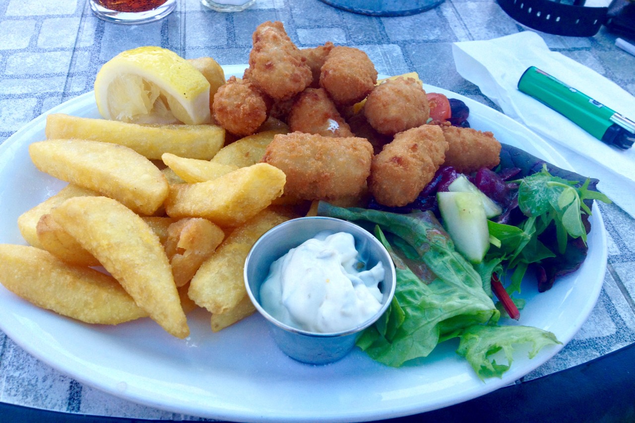
Don’t worry though – there are rewards on hand. The village of Zennor, just a few hundred meters inland, has an excellent pub with a lovely garden and a hearty menu.
The Tinners Arms was bathed in sunshine when I arrived and so I sat in the beer garden for nearly two hours enjoying my scampi and chips while chatting to holidaymakers and hikers passing through. Eventually, I peeled myself out of my chair, refilled my water and headed back to the path.
Stupefied from my first proper meal in days I didn’t make it far along the path before I found another great spot to spend the night. I spent the rest of the afternoon lazing and reading in the sun before pitching my tent at sunset and turning in.
ZENNOR HEAD TO CAPE CORNWALL
Distance: 18km (11.2mi)
This stretch offers somewhat easier hiking than the previous day, albeit punctuated with rough, steep sections crossing coves and inlets. Underfoot, the path does improve but there are still boggy sections amid high ferns and gorse bushes. This is the most remote part of the trail between Newquay and Penzance with no accommodation, shops or pubs on the actual trail until Cape Cornwall and the surrounding villages.
Another issue along this section is water. There are no public conveniences on the trail, so hikers need to either walk inland at villages such as Pendeen and Botallack or take water from the springs along the trail. Luckily, these are fairly regular but often not much more than a trickle during summer. Something like the SteriPEN water purifier comes in very handy here. Pendeen and Botallack both have pubs and camping options.
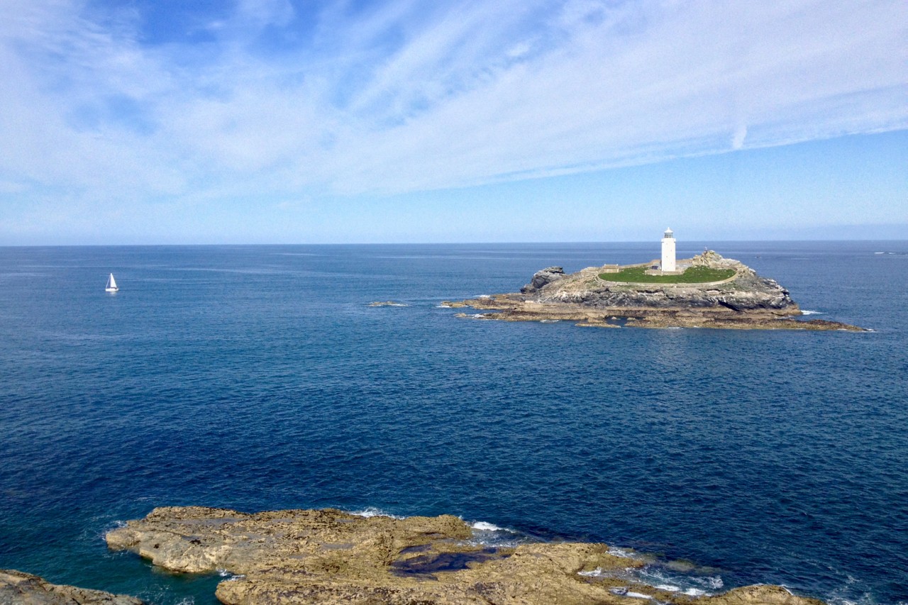
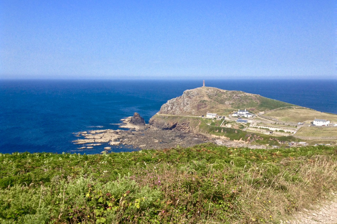
Halfway along the route is the glorious Pendeen Watch Lighthouse standing atop sheer cliffs above treacherous waters. The lighthouse has been guiding ships through the area for over 100 years since it was built in 1900. Its squat but brilliant white tower stands out from the surrounding gorse and grassy grounds and makes for the perfect spot to break for lunch.
Once past the impressive Cape Cornwall peninsular I headed inland at Cot Valley intending to camp at the YHA Youth Hostel for the night. It was fully booked which actually turned out to be a blessing in disguise. A staff member knew of an eco-campsite nearby and helpfully gave me a lift to Bosavern Community Farm with its excellent farm shop and quiet grounds.
CAPE CORNWALL TO PORTHCURNO
Distance: 18.4km (11.4mi)
This was an excellent day’s hiking full of famous landmarks, secluded beaches and classic Cornish coves.
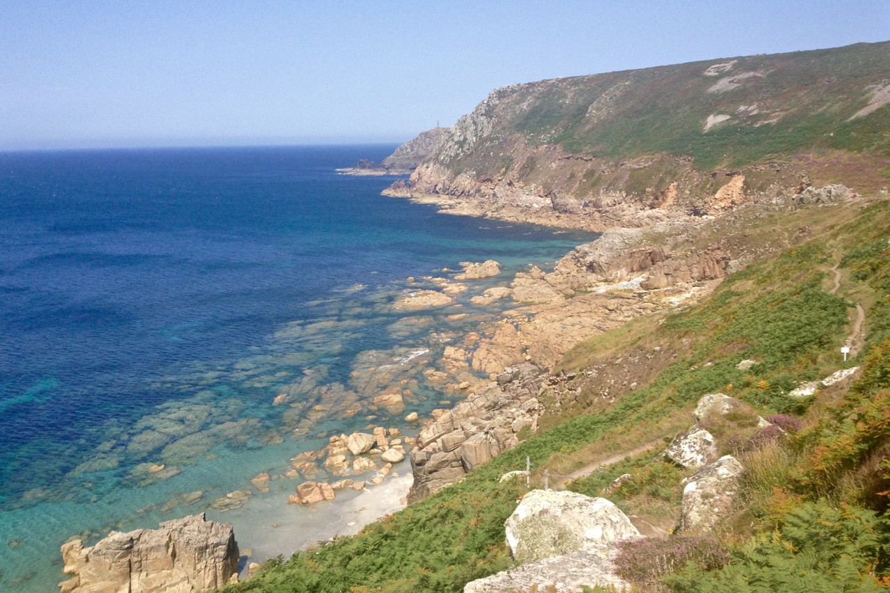
I rejoined the trail back at Cape Cornwall and was immediately met with a gruelling hike out of the valley onto the top of the cliffs. Once aloft though it was fairly good going all the way along the flat clifftops, all the time in sight of the distinctive landmark of Land’s End.
Just before Land’s End there is the somewhat trying stretch of Whitesand Bay. At low water you may prefer to walk along the beach but be prepared to dodge beach goers during the high season.
I chose to stick to the path, following the high water mark and staying further inland. After the trials of Gwithian and Upton Towans around Hayle, this felt like a walk in the proverbial park.
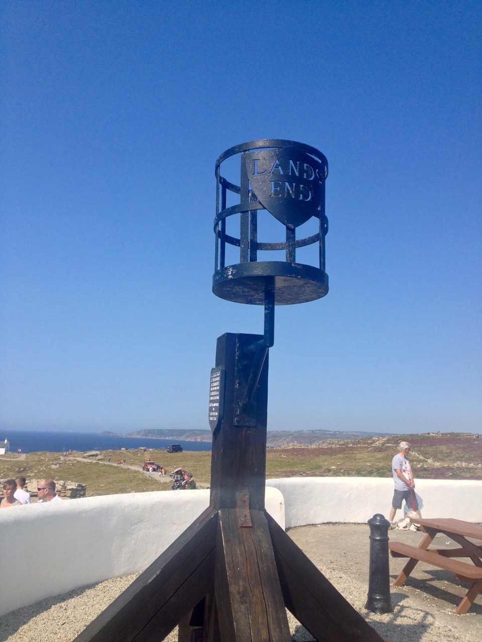
The hike up to the cliffs around Land’s End is more gradual and less punishing than other elevation changes. Land’s End itself is a tourist trap complete with a theme park, cafes and public conveniences. Once clear of the crowds, the path really opens up and a hiker can cover a lot of ground very quickly.
I was keen to make it to a great campsite I knew of so kept up the pace. By now, after several days on the path, my legs had become accustomed to the rise and fall of the terrain with every river mouth and inlet. Unfortunately, my feet were not being so accommodating and were starting to develop some pretty unhealthy blisters that I frantically covered with Compede.
By now, it felt like the home straight as I knew the next day was going to be a rest day around the campsite before the final push to Penzance. With this in mind, I managed to motivate myself to get down and up the final inlets at Porthgwarra and Porthcurno before cutting inland after the Minack outdoor theatre to Treen Farm Campsite.
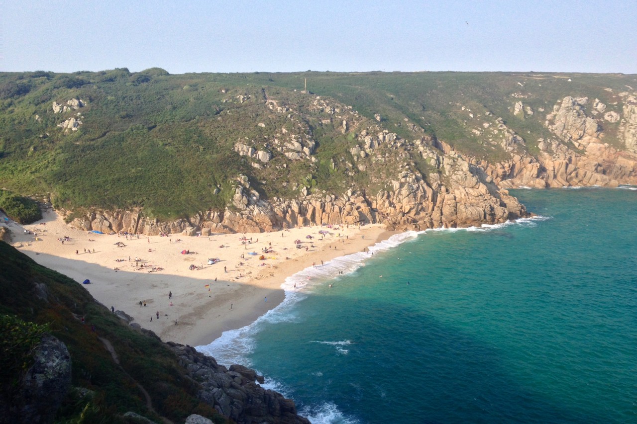
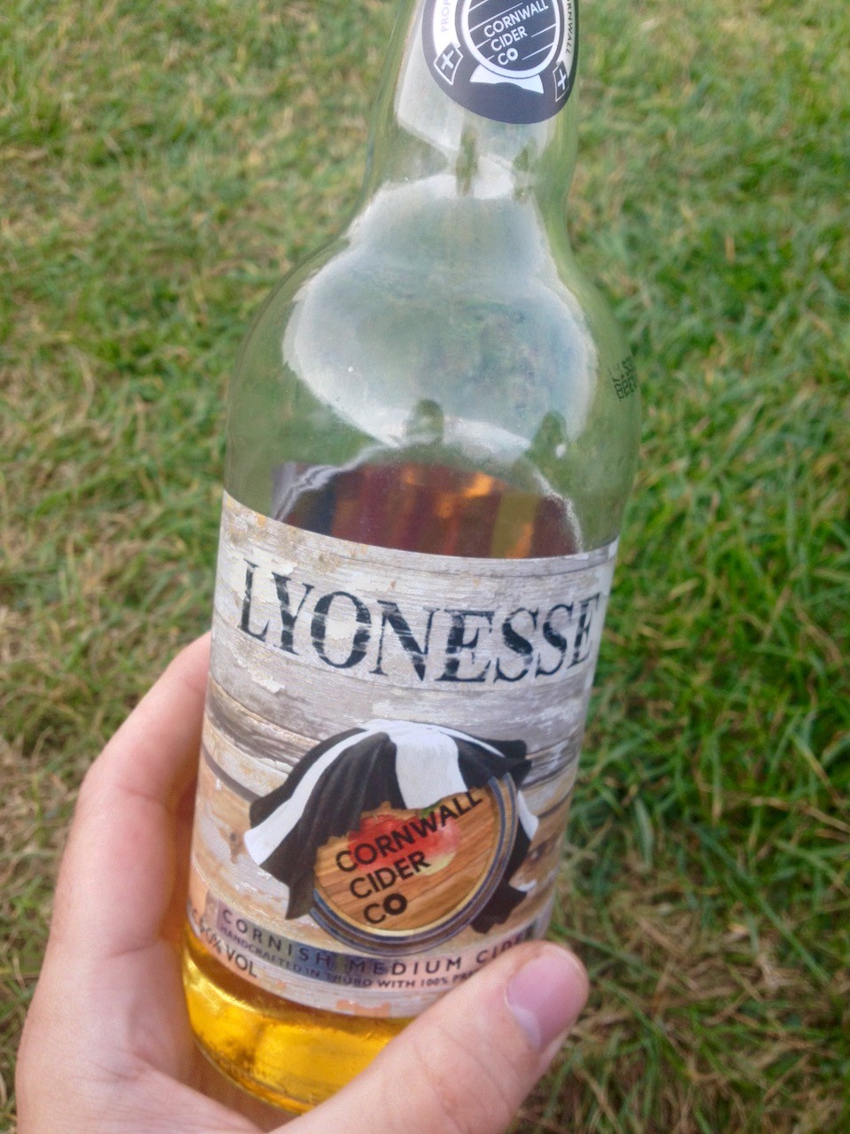
The campsite at Treen is in an excellent position on the clifftop but still offers enough shelter from the strong winds. It has everything a hiker needs at the end of a long day including a small shop with cold drinks and a homely pub with delicious food, cold beer and cheerful staff just down the road. The perfect spot for a rest day, or so I thought…
PORTHCURNO TO PENZANCE
Distance: 18.5km (11.5mi)
Unfortunately, my rest day didn’t quite go to plan. The campsite has a rather unusual policy for hikers. For some baffling reason, I wasn’t allowed to book two nights’ camping upon arrival and was asked to pack my tent at 10am and, if there was space, re-pitch my tent at 10.30am.
I asked why this was necessary and was told it was to ensure there was always space for late arrivals. I was none the wiser but thought I’d play along.
Once I packed up though, I decided I might as well keep walking, so headed off regardless. This obscure rule aside, it really is an excellent campsite with very friendly staff. I’m sure there is some method to their madness…
At this point, the weather took a turn for the worse. Fog and light rain rolled in but it was still warm, making for for a wet and humid day’s hiking. The section has a lot going for it with the unspoilt 19th-century hamlets of Penberth Cove and Porthguarnon and the almost-tropical St Loy farm with its lush ferns, trickling streams and narrow beach.
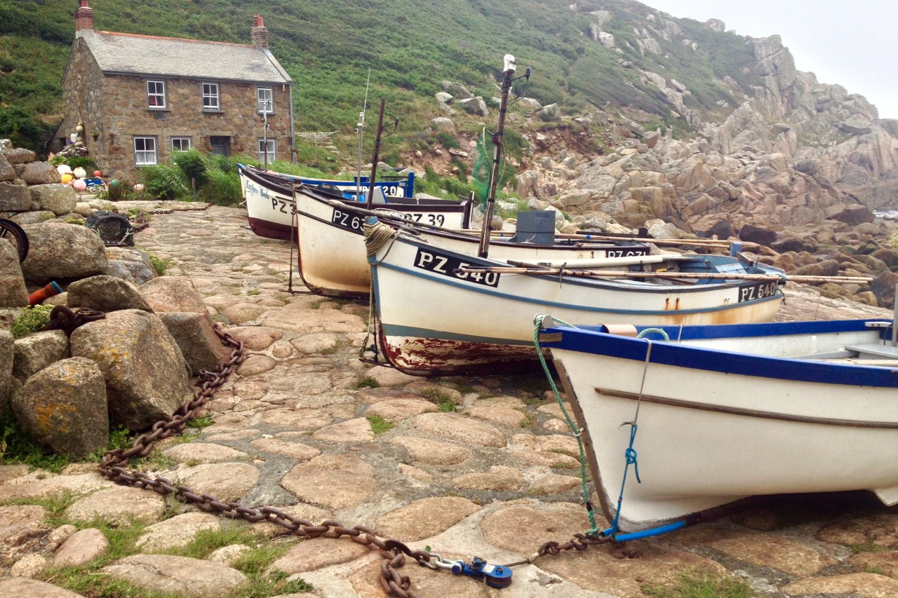
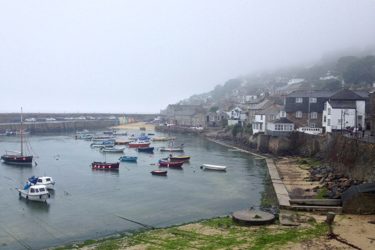
The wilderness ends at Lamorna where there are several facilities including a cafe, pub and toilets. Soon after, the path joins a road leading into the village of Mousehole (pronounced ‘Mowzol’) which, although quaint in its setting, suffers from traffic congestion. As a hiker I’d never found myself in a traffic jam until I walked into Mousehole!
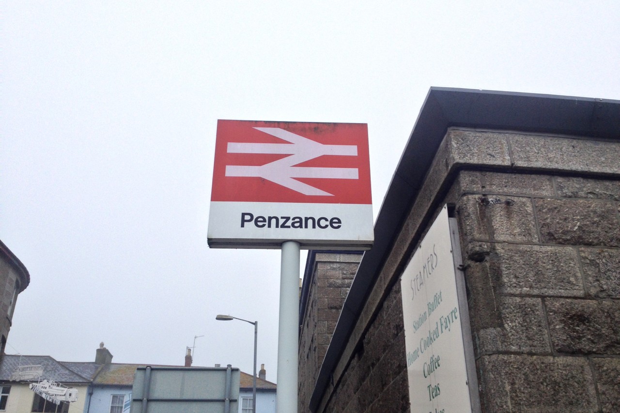
By now I was soaked through, either from sweating all day in the humid climate or from the persistent mist that had surrounded the coast – I couldn’t tell. It didn’t matter as the heavens now fully opened and the fun was over. I pulled on my waterproofs and made short work of the remaining few kilometers past the harbour at Newlyn and into Penzance.
Finishing in the drizzle at the train station of Penzance was a somewhat underwhelming end to a thoroughly splendid week hiking the South West Coast Path.
I felt I wanted a night or two more in the wilderness so hopped on a train to Ivybridge for a spot of truly wild camping on Dartmoor – a much better way to end a great week hiking the South West Coast Path.
Hiking the South West Coast Path Resources
South West Coast Path + distance calculator: southwestcoastpath.org.uk/walk-coast-path/distance-calculator
National Trails: nationaltrail.co.uk/south-west-coast-path
Visit Cornwall: visitcornwall.com/things-to-do/south-west-coast-path
South West Coast Path: Padstow to Falmouth
This was the guide I used and it largely served me well, mainly because it includes excellent Ordnance Survey maps covering most of the route. However, the author tends to spend a lot of time talking about Cornish mining and neglects details such as terrain and accommodation options. It is clearly aimed at day walkers as opposed to hikers. His description of the punishing day spent crossing the endless dunes near Hayle was “easy walking”… bastard!
The South West Coast Path
The guidebook divides hiking the South West Coast Path into 45 stages of between 12.5-37.5km. It’s packed with lots of information for planning your walk, including clear step-by-step route descriptions and OS map extracts, public transport links, accommodation and facilities along the way.
The Man Who Hated Walking: The South West Coast Path
In February 2003, Overend Watts then aged 55 attempted hiking the South West Coast Path – the greatest challenge of his life. He frequently got lost over the two months it took him to achieve this feat of endurance. The Man Who Hated Walking is a wonderful document of his achievement.
Enjoyed this post? pin it for later…