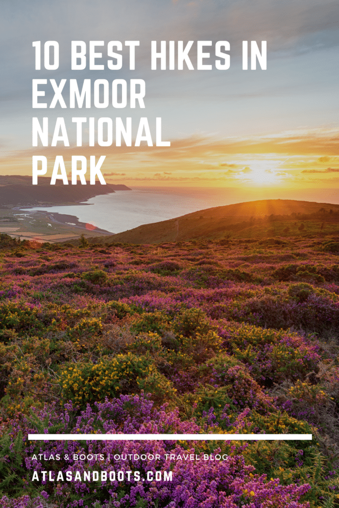
The best hikes in Exmoor National Park showcase one of England’s wildest and most diverse landscapes
My first experience of Exmoor was in youth when I read a children’s illustrated version of Lorna Doone: A Romance of Exmoor. The historical novel of high adventure is set in the 17th century and features a lawless clan (the Doones) roaming a wild landscape (Exmoor).
The novel is essentially a love story with a dash of kidnap, revenge and rebellion thrown in for good measure – everything a young boy who dreams of adventure and rescuing damsels wants in a book (especially one with pictures).
Years later, I hiked the Doone Valley during a family holiday and was captivated by the higher moor’s ethereal beauty. It is an expansive landscape of moorland, woodland, valleys and farmland that, at times, can feel remarkably empty beneath its big skies.
The wildness, tranquillity and cream teas of Exmoor reminds me of Dartmoor in many ways. But with a thrilling coastline of lofty cliffs towering above the Bristol Channel, Exmoor boasts another element to its scenery that boosts its credentials as one of England’s foremost hiking destinations.
As such, we’ve put together the best hikes in Exmoor National Park, an inspiring area of England with an extraordinary variety of landscapes.
Best hikes in Exmoor National Park
Designated a national park in 1954, Exmoor National Park covers an area of 693km2 with over 1,000km of footpaths and bridleways, and some outstanding hiking trails.
From coastal walks above coal-black cliffs to lengthy tramps over desolate moorland, we’ve picked out the best hikes in Exmoor National Park.
For more information on things to do and where to stay in Exmoor, visit the national park website.
1. Valley of Rocks
Distance: 5.8km (3.6mi)
Duration: 2 hours
Difficulty: Moderate
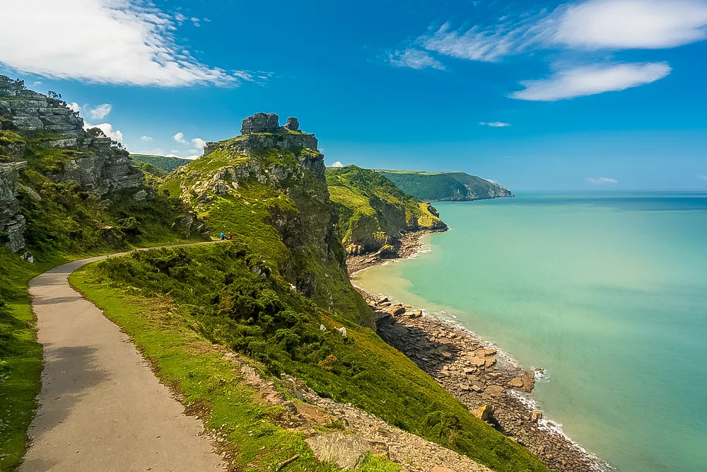
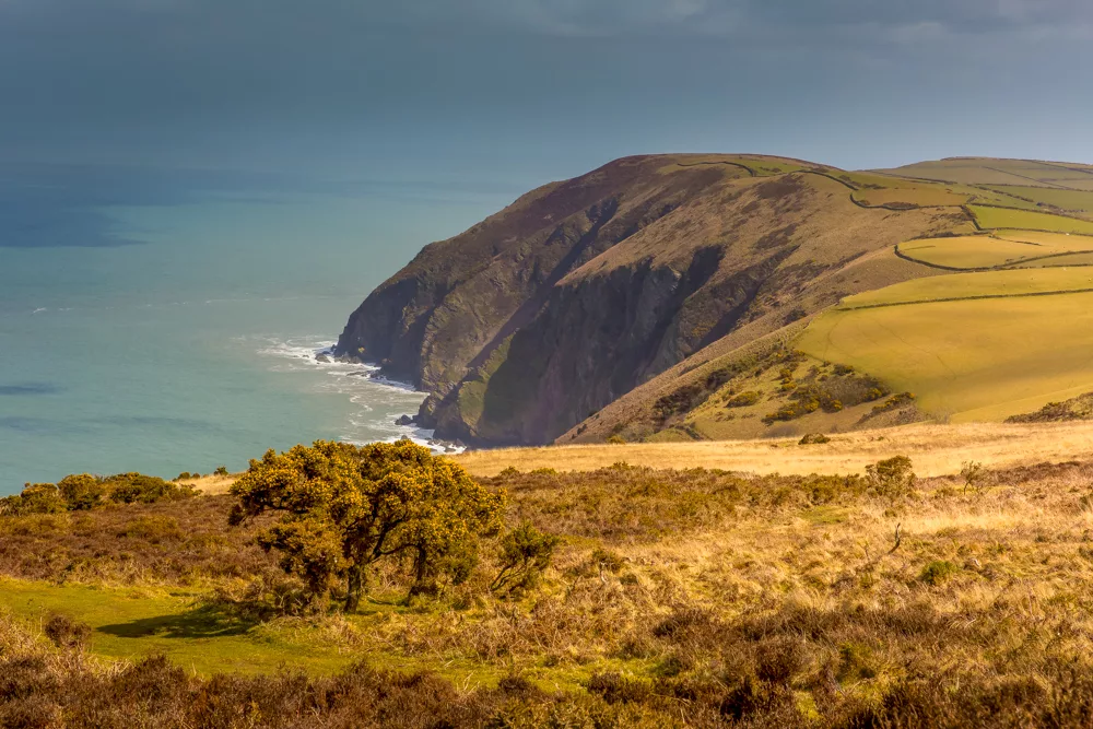
This atmospheric circular walk takes in the coastal boundary of the park as well as a rugged valley that used to host the River Lyn until it changed course to Lynmouth. In its wake, the river left the eerie Valley of Rocks which has inspired writers such as Samuel Taylor Coleridge and William Wordsworth.
The highlight of the route is the sharp-angled Devonian stone of Castle Rock towering above the delightfully secluded cove of Wringcliff Bay. On a clear day, the scene is idyllic, but when the mist rolls in, the landscape takes on a lost world feel straight from Arthur Conan Doyle’s classic novel.
2. Dunster
Distance: 6.4km (4mi)
Duration: 2 hours
Difficulty: Easy-moderate
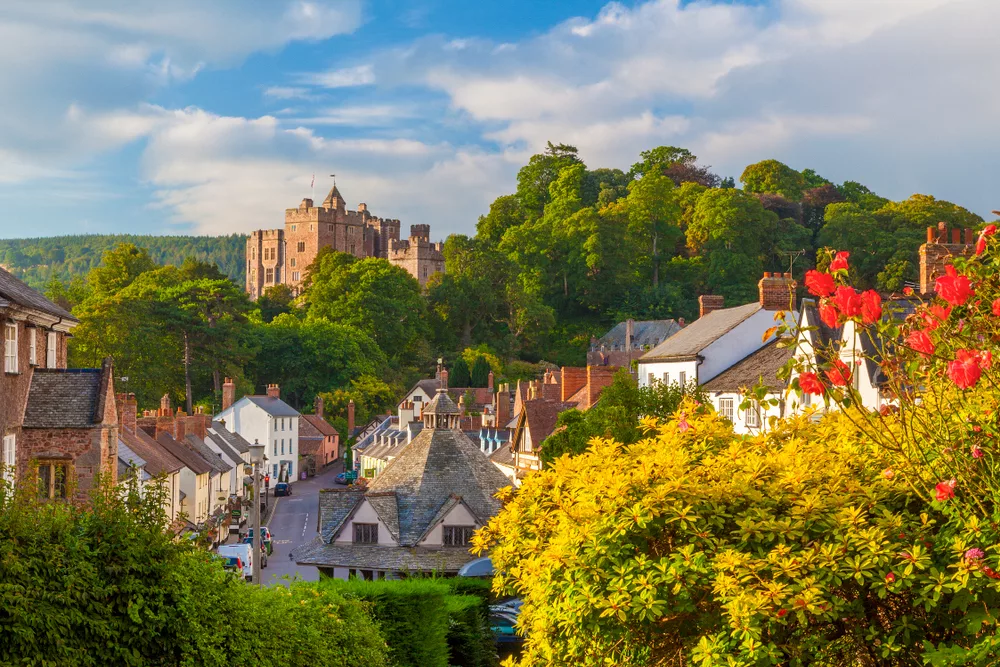
Near the eastern boundaries of the park, high on a Somerset hill, is Dunster Castle overlooking the alluring medieval village of Dunster. The trail begins in the village, taking in a number of landmarks such as a churchyard, a restored 16th-century tithe barn and a 17th-century marketplace all under the watch of the imposing castle.
The trail then heads south out of the village and crosses the River Avill before completing a circuit of the surrounding countryside which includes a deer park and an Iron Age hill fort. Here await striking panoramic views of Dunster Castle, the Bristol Channel and South Wales and, inland, the Quantock Hills and rolling Exmoor.
3. Horner Wood
Distance: 7.8km (4.8mi)
Duration: 2-3 hours
Difficulty: Moderate
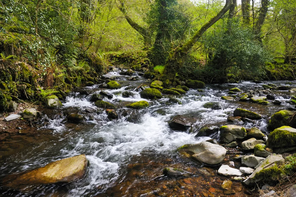
This exceptional hike along a well-maintained bridle trail explores Holnicote Estate and the encircling 800-acre Horner Wood, one of Exmoor’s best-preserved ancient oak woodlands and a designated Site of Special Scientific Interest.
Horner Wood is one of the park’s best places for wildlife spotting with red deer, butterflies and birds (including pied flycatcher, wood warbler and woodpecker) all likely to be seen. The woodland is also a sanctuary to over 400 species of fungi, 200 species of lichen and 14 bat species.
The final part of the hike follows the River Horner, also known as Horner Water, through the hamlet of the same name where you could (should) pause at the Horner Tea Gardens for some lunch, scones or cake (or all three).
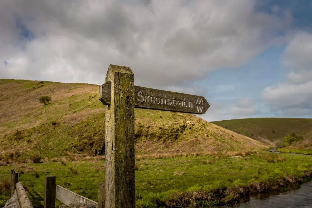
4. Doone Valley Circuit
Distance: 8.8km (5.5mi)
Duration: 2 hours
Difficulty: Easy-moderate
Home to the wicked Doone family in the novel, the mystical Badgworthy Valley – aka Doone Valley – offers a number of peaceful walks and historic sites. If you’ve read the book it’s easy to spot the Exmoor scenery that inspired RD Blackmore’s classic tale.
When I visited Doone Valley, I completed a route from Cloud Farm Campsite to Malmsmead. The circular trail we’ve selected takes in the celebrated valley as well as an extended loop around the countryside via the hamlet of Oare and the rolling hills of County Gate, where Devon and Somerset meet.
The National Trust website also recommends a number of alternative walks around the Doone Valley.
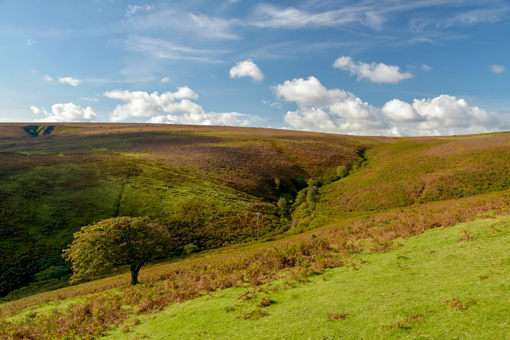
5. Dunkery Beacon
Distance: 10km (6.2mi)
Duration: 2-3 hours
Difficulty: Easy-moderate
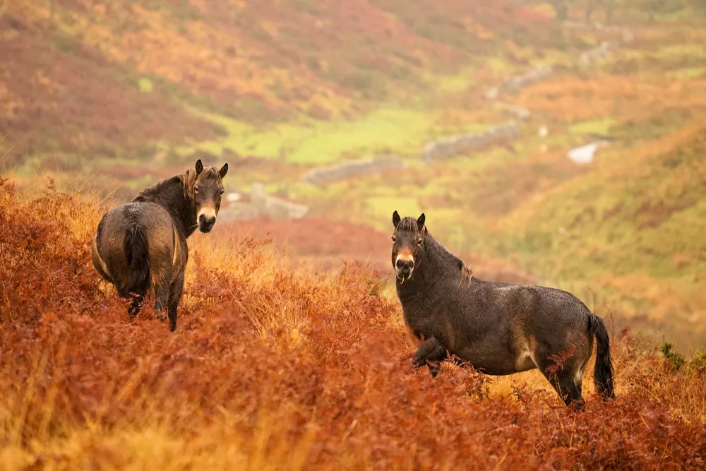
At 519m (1,703ft), Dunkery Beacon at the summit of Dunkery Hill, is the highest point in Exmoor and Somerset. En route to the summit, it’s highly likely you’ll spot an Exmoor pony or two.
According to the Exmoor Pony Society, founded in 1921 to preserve the now-rare horse breed, the Exmoor Pony is Britain’s oldest breed of native pony and is thought to be virtually unchanged from the original wild ponies that roamed Britain thousands of years ago.
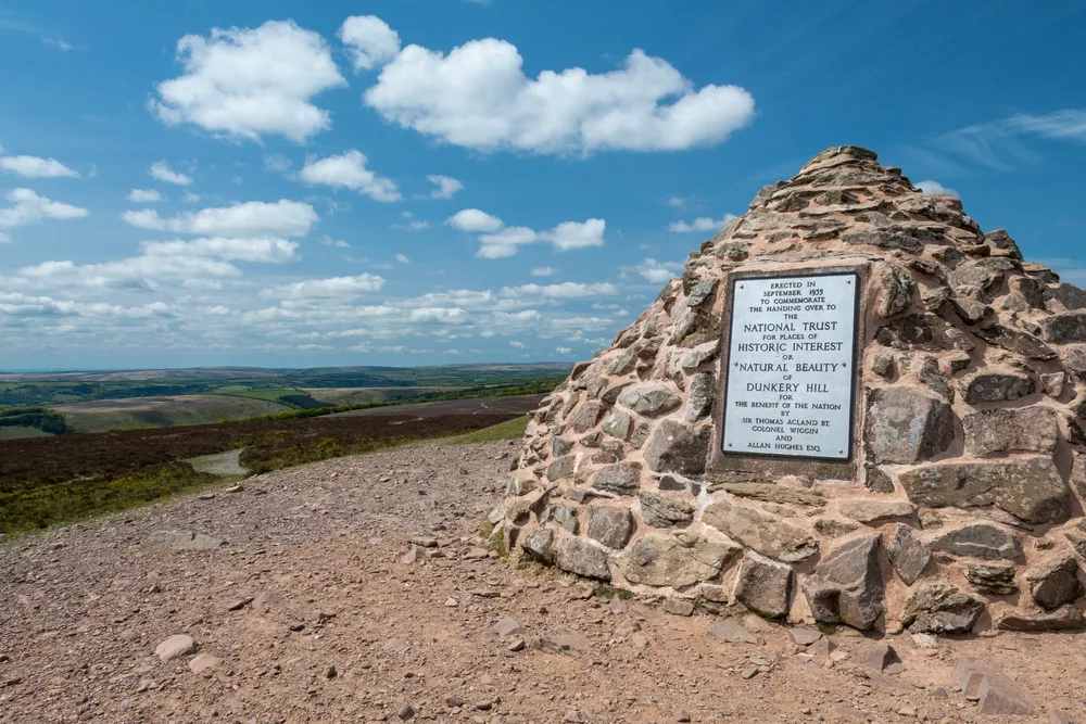
The summit of the hill is marked with a large distinctive cairn and boasts phenomenal 360-degree views. On a clear day, you can see as far south as Dartmoor, east to the Mendips and Quantock Hills, north across the Bristol Channel to South Wales, and westwards beyond the checkerboard fields of North Devon to the rocky outcrop of Hartland Point on the northwestern tip of the Devon coast.
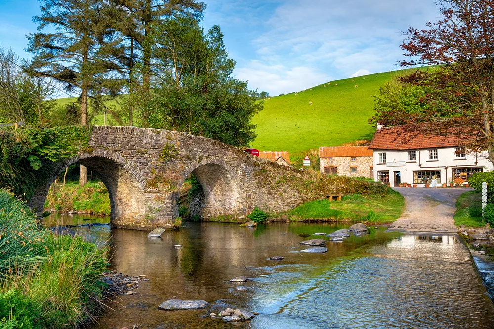
6. East Lyn River
Distance: 11km (6.8km)
Duration: 3-4 hours
Difficulty: Easy-moderate
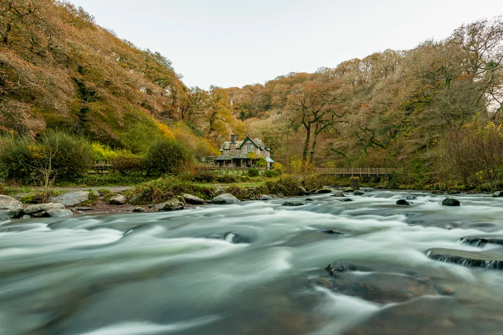
Climbing high above Exmoor, the East Lyn River courses along Devon’s East Lyn Valley to the charming village of Lynmouth. This popular figure-of-eight trail starts at Lynmouth and follows the river upstream to Rockford before heading back to the coast.
The trail crosses the river at Watersmeet, where the rivers of East Lyn and Hoar Oak converge. Here, Watersmeet House has been serving teas since 1901 and really shouldn’t be missed.
The Rockford Inn, secluded in the remote Brendon Valley, also makes for an alternative – or additional – halfway pitstop.
7. Tarr Steps
Distance: 11.7km (7.3mi)
Duration: 3-4 hours
Difficulty: Moderate
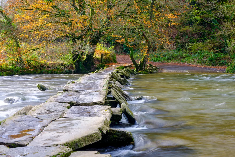
The gentle ramble alongside the winding River Barle and through deep forests is a firm favourite among visitors to Exmoor. The steps, an ancient clapper bridge built entirely from large stone slabs and boulders dates to around 1000 BC and is the longest of its kind in Britain.
Legend has it that the enormous slabs (each weighing up to five tonnes) were placed by the Devil to win a wager with a local giant. The route meanders along the river before curving through Withypool and climbing for superb views across Exmoor.
8. Elwill Bay
Distance: 11.9km (7.4mi)
Duration: 3-4 hours
Difficulty: Moderate
This striking circular coastal hike follows part of the South West Coast Path before turning inland to the mini-summit of Holdstone Hill (347m/1,139ft).
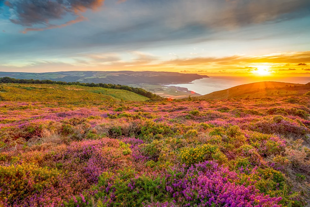
Aside from spectacular sea views across Elwill Bay, the trail passes through a charming wood alongside a pretty stream and over fields of heather which is at its most vibrant purple in July and August.
Most who complete the circuit end up at the Hunter’s Inn which serves a range of hearty pub classics as well as light bites, snacks and hot and cold drinks.
9. Porlock Bay
Distance: 13.6km (8.5mi)
Duration: 4-5hours
Difficulty: Moderate-hard
The North Devon coast between the Lilliputian harbour at Porlock Weir and craggy Hurlstone Point makes for a classic clifftop hike. The area is home to a mixture of salt and freshwater marshland abundant in wildlife as well as striking shingle beaches stretched out beneath twisted cliffs.
The route follows parts of the South West Coast Path and hikers visiting in July and August can expect to find the moors awash with a haze of purple heather.
The prescribed method of marking the hike’s completion is to unwind on the terrace of the Porlock Weir Hotel which overlooks the bay waters.
10. Two Moors Way
Distance: 36km (22.4mi)
Duration: 2-3 days
Difficulty: Hard
The Two Moors Way is an unofficial long-distance footpath crossing Exmoor and Dartmoor. It’s a different take on the coast-to-coast experience with the trail crossing 188km (117mi) from the North Devon to the South Devon coast.
The Exmoor portion of the trail roughly dissects the national park running between Lynmouth on the North Devon coast to Hawkridge village, one of the oldest communities on the moor. This section is usually broken down into three manageable day hikes between 10km and 20km long.
The course naturally showcases the best of Exmoor as it crosses the park, taking in Doone Valley and Tarr Steps en route. The trail then leaves Exmoor and continues southwards crossing Dartmoor via Ivybridge to Wembury on the South Devon coast.
Enjoyed this post? pin it for later…