The poles of inaccessibility are arguably the true last frontiers for explorers. But what and where are they?
I’ve long been fascinated with the most remote places on Earth and the epic journeys of discovery to reach them. I’ve spent countless long mornings in bed leafing through giant reference books on the Heroic Age of Antarctic Exploration and even longer afternoons poring over immense maps detailing epic quests across untamed oceans.
It was the names of Amundsen, Livingstone and Magellan and their unfathomable tales of distant lands, high seas and adventure that first inspired me to travel. For modern explorers, the poles of inaccessibility represent the outer limits of mankind’s grip on our planet.
What are the poles of inaccessibility?
Not to be confused with the North and South Poles, the poles of inaccessibility are the hardest-to-reach places on the planet. They are defined as geographic locations farthest from a point of access, be it coastline, landfall or other notable geographic features. These locations are often featureless, hostile and always remote.
Typically, there will be no landmark, monument or spectacle to see when reached, hence they are usually only of interest to the explorers and adventurers of the world.
Northern pole of inaccessibility
Coordinates: 85°48′N 176°9′E
Location: Arctic Ocean
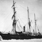
Also referred to as the Arctic pole of inaccessibility, the northern pole of inaccessibility was initially thought to be located 214km (133mi) from the current position and several expeditions have been made to cross it. The first notable attempt was by Sir Hubert Wilkins who tried to fly a plane over it in 1927. He eventually achieved the feat in 1928.
In 1969, Sir Wally Herbert claimed to have reached the northern pole of inaccessibility en route to the North Pole. Herbert was awarded an Arctic bar – added to his previously achieved Polar Medal – and received awards from the Royal Geographical Society as well as other institutions. The problem was he’d gone to the wrong place.
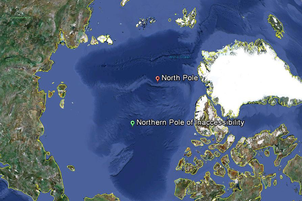
The true location of the northern pole of inaccessibility was confirmed by the National Snow and Ice Data Center and Scott Polar Research Institute when they re-established the position using GPS and satellite technology. The new coordinates were published in 2013.
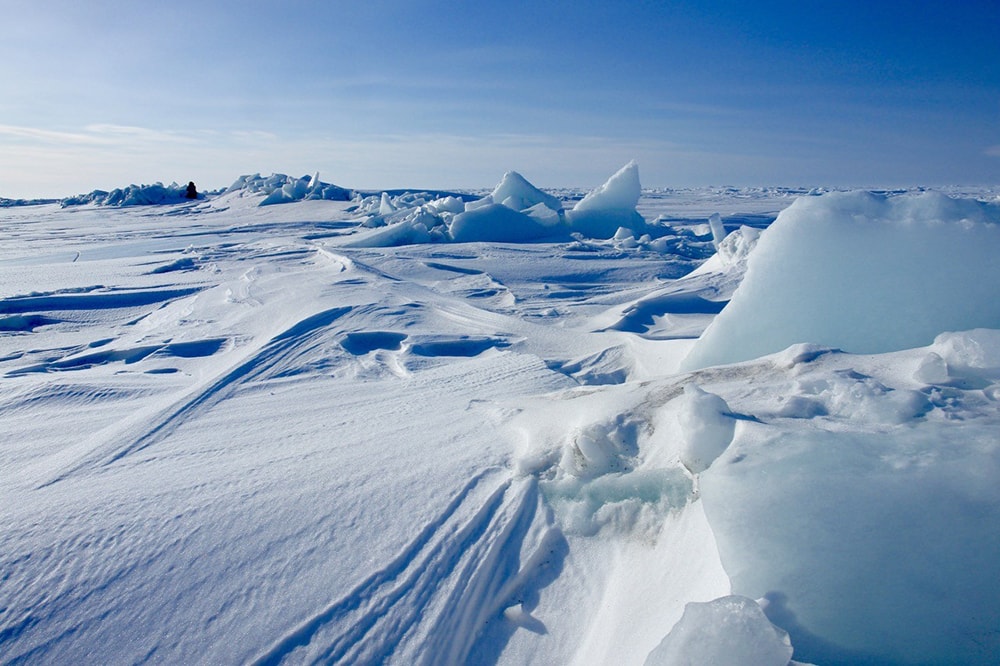
The northern pole of inaccessibility is located in the Arctic Ocean equidistant from the islands of Ellesmere (Canada), Komsomolets (Russia) and Henrietta (Russia). Modern satellite data has confirmed that distance to be 1,008km (626mi). Despite renewed attempts to reach the new location, the current northern pole of inaccessibility remains unconquered.
Southern pole of inaccessibility
Coordinates: 82°53′14″S 55°4′30″E
Location: Antarctica
The southern pole of inaccessibility is the point in Antarctica furthest from the Southern Ocean. Due to the continuously shifting ice shelves that surround the continent, the exact location of the southern pole of inaccessibility is still open to interpretation.
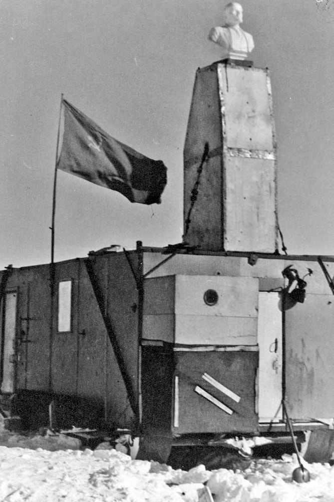
For years, the southern pole of inaccessibility was considered to be located at the site of the Soviet Union research station Polyus Nedostupnosti meaning Pole of Inaccessibility Station. Here, a plastic bust of Vladimir Lenin was placed on the chimney rising from the now-abandoned station facing towards Moscow in 1958.
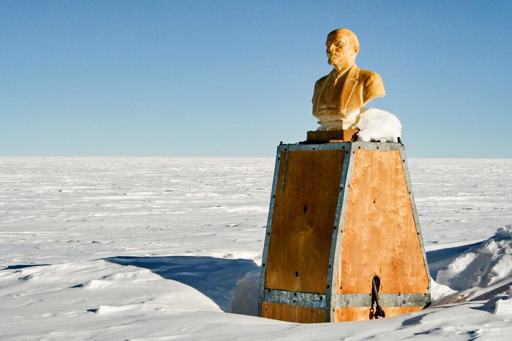
In 2007, this spot was reached by a British team of explorers who found the abandoned station and bust of Lenin. They were the first to reach the location by foot. Previous expeditions had been mechanised while this one was completed using a combination of skis and kites.
That said, the location of the southern pole of inaccessibility is still in debate. Using different criteria, the Scott Polar Research Institute and the British Antarctic Survey (BAS) have identified the southern pole of inaccessibility in different locations (see map below).
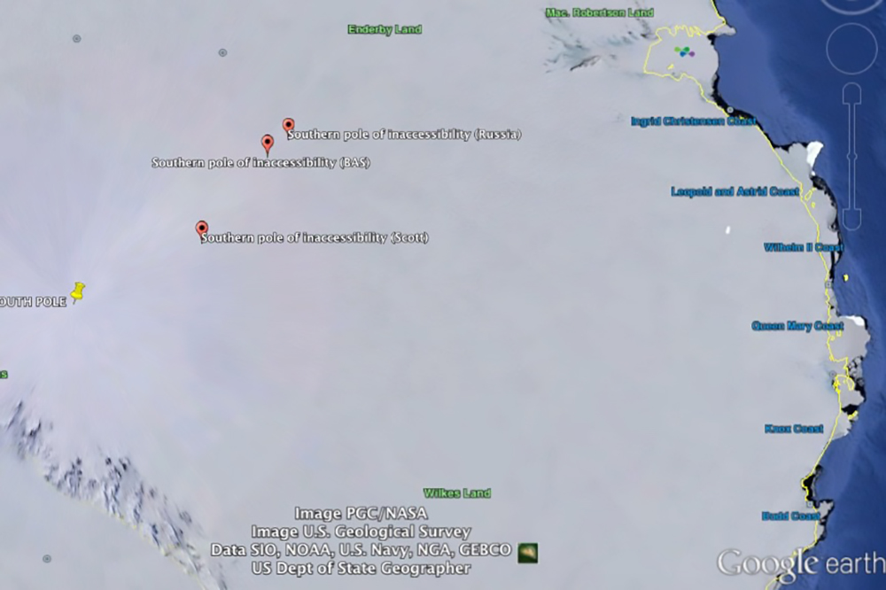
Moreover, BAS suggests that it could be located in two separate locations: one which reflects the furthest distance from the coastline proper; the other which reflects the furthest distance from the outer edges of the ice shelves.
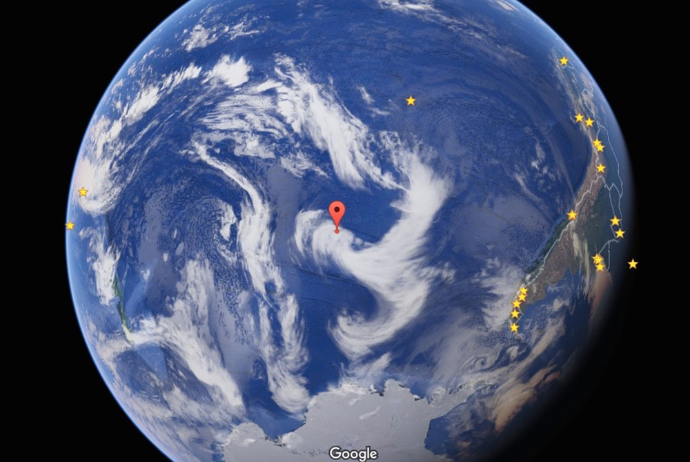
Oceanic pole of inaccessibility
Coordinates: 48°52.6′S 123°23.6′W
Location: Pacific Ocean
The oceanic pole of inaccessibility is also known as ‘Point Nemo’, a reference to Captain Nemo, a character from Jules Verne’s 1869 book Twenty Thousand Leagues Under the Sea. Point Nemo is the point in the Pacific Ocean farthest from land at 2,688km (1,670mi) from Ducie Island, part of the Pitcairn Islands.
The closest landmasses to the oceanic pole of inaccessibility are:
- Ducie Island to the north
- Motu Nui (part of Easter Island) to the northeast
- Maher Island in Antarctica to the south
- Chatham Island in the west
- Southern Chile in the east
Other poles of inaccessibility
There are other poles of inaccessibility, namely locations identified on continental landmasses and the Indian and Atlantic as their respective poles of inaccessibility. For continents, the poles of inaccessibility are the places furthest from the ocean and for the oceans, they are places furthest from land.
Eurasian pole of inaccessibility
Coordinates: 46°17′N 86°40′E, 44.29°N 82.19°E or 45.28°N 88.14°E
Location: China
Like the southern pole of inaccessibility, the Eurasian pole is located at a point on land farthest removed from the ocean. It can be found in northwestern China near the border with Kazakhstan 2,645km (1,644mi) from the sea and 320km (20mi) north of the city of Ürümqi.

However, a 2007 study published in the Scottish Geographical Journal challenged this and suggested two other possible locations. The study argued that the original calculation didn’t take into account the Gulf of Ob in northern Siberia which penetrates 1,000km (600mi) into the landmass.
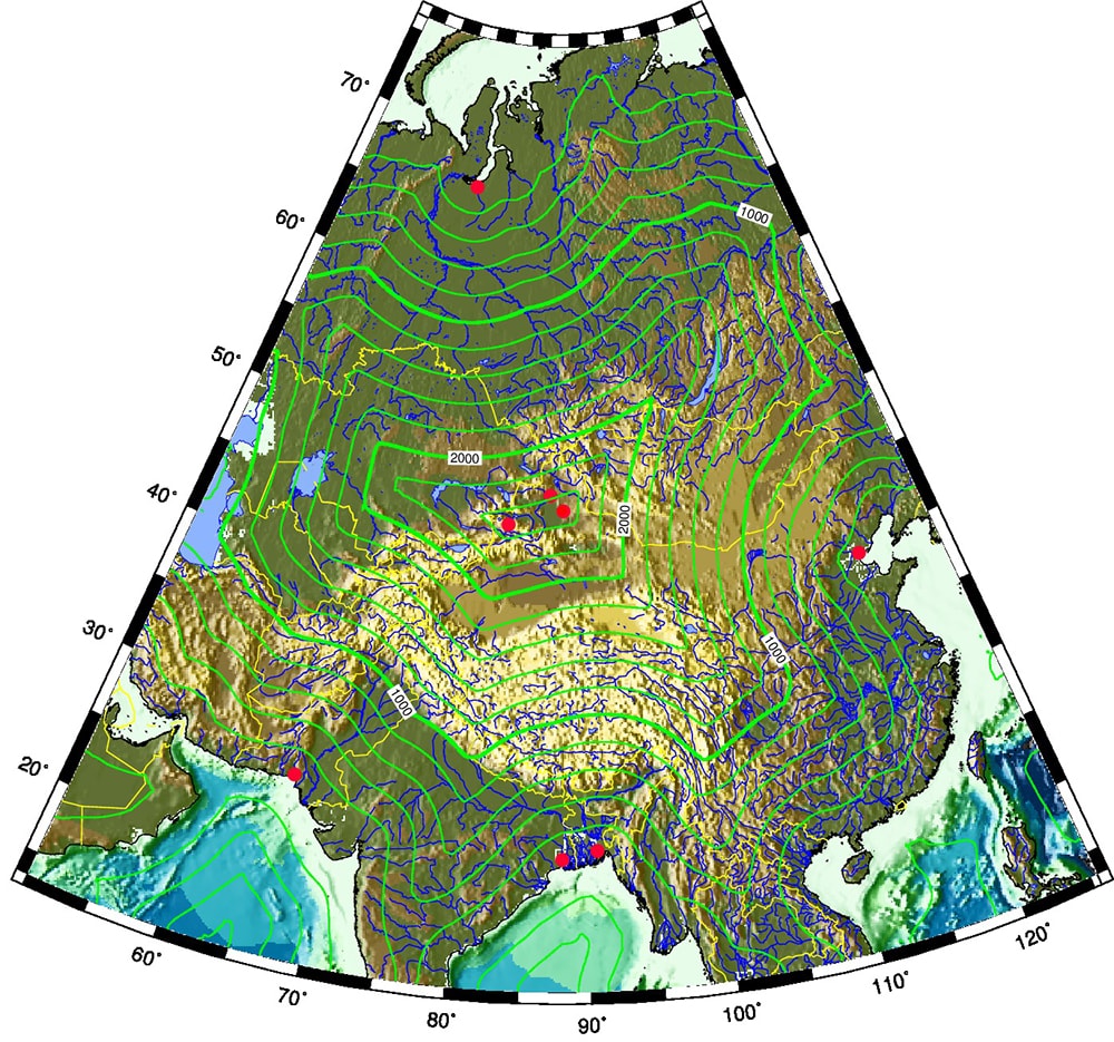
These poles are still located in China in the northwestern province of Xinjiang. The distance to the sea at these locations is 2,510km and 2,514km respectively, about 120km closer than previously thought.
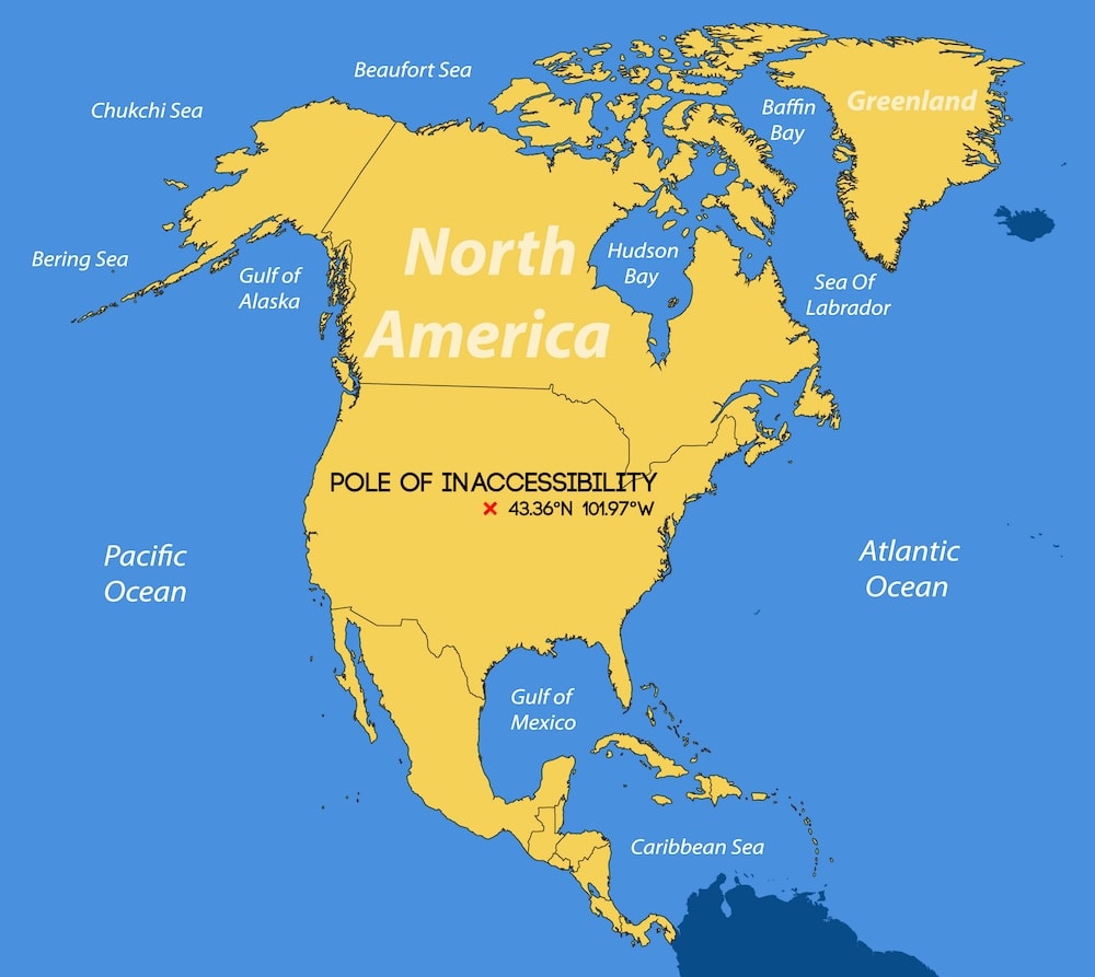
North American pole of inaccessibility
Coordinates: 43.36°N 101.97°W
Location: South Dakota, USA
South Dakota in the USA is home to the North American continental pole of inaccessibility. Located just 11km (7mi) north of the town of Allen, the pole doesn’t hold much in the way of a challenge for the modern-day adventurer. It is 1,650km (1,024mi) from the nearest coastline.
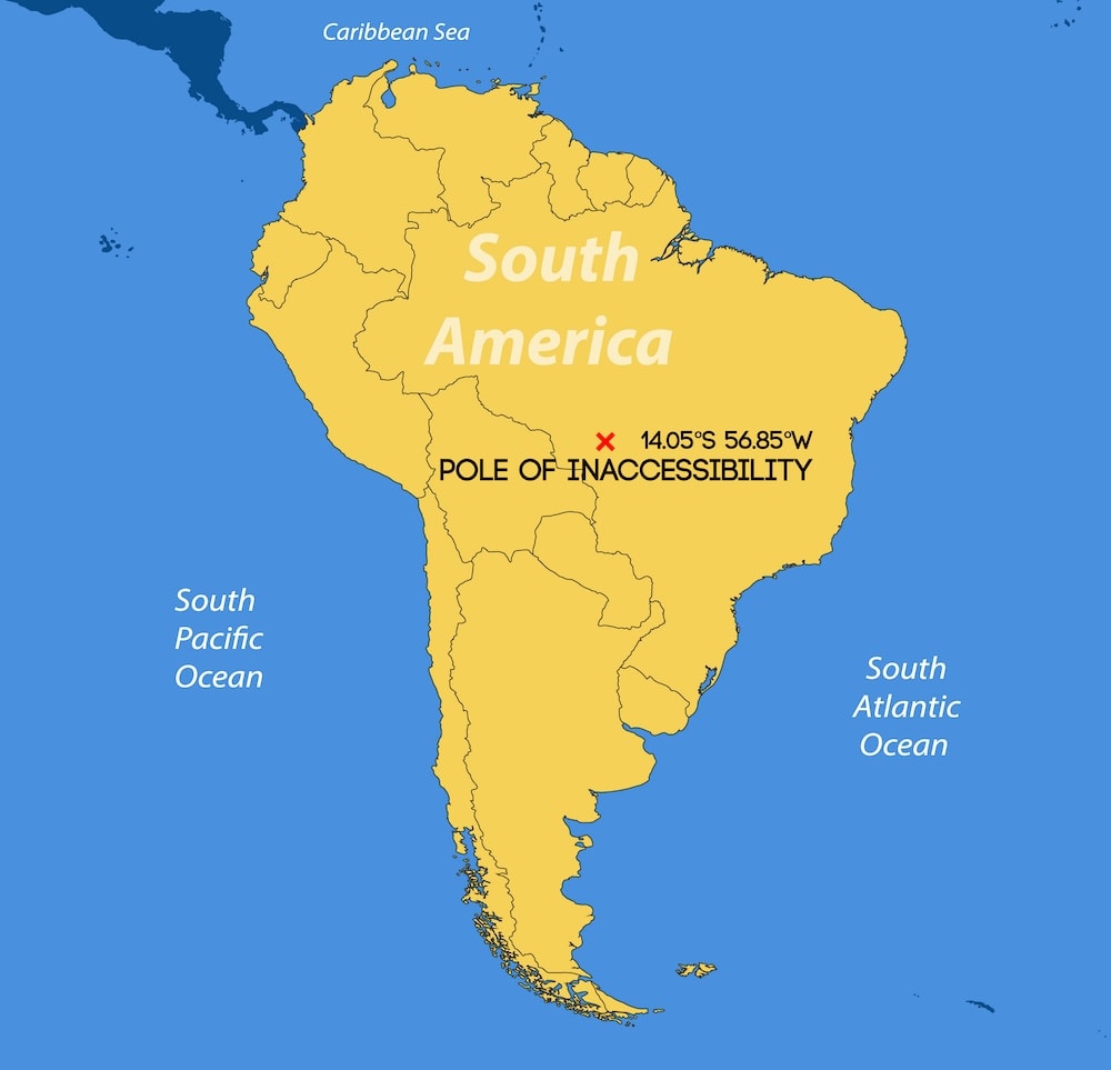
South American pole of inaccessibility
Coordinates: 14.05°S 56.85°W
Location: Brazil
The South American continental pole of inaccessibility is located in Brazil, 44km (27mi) from the nearest town of Arenápolis in the state of Mato Grosso. It is 1,512km (940mi) from the nearest coastline.
WindVector/Shutterstock
Other poles of inaccessibility
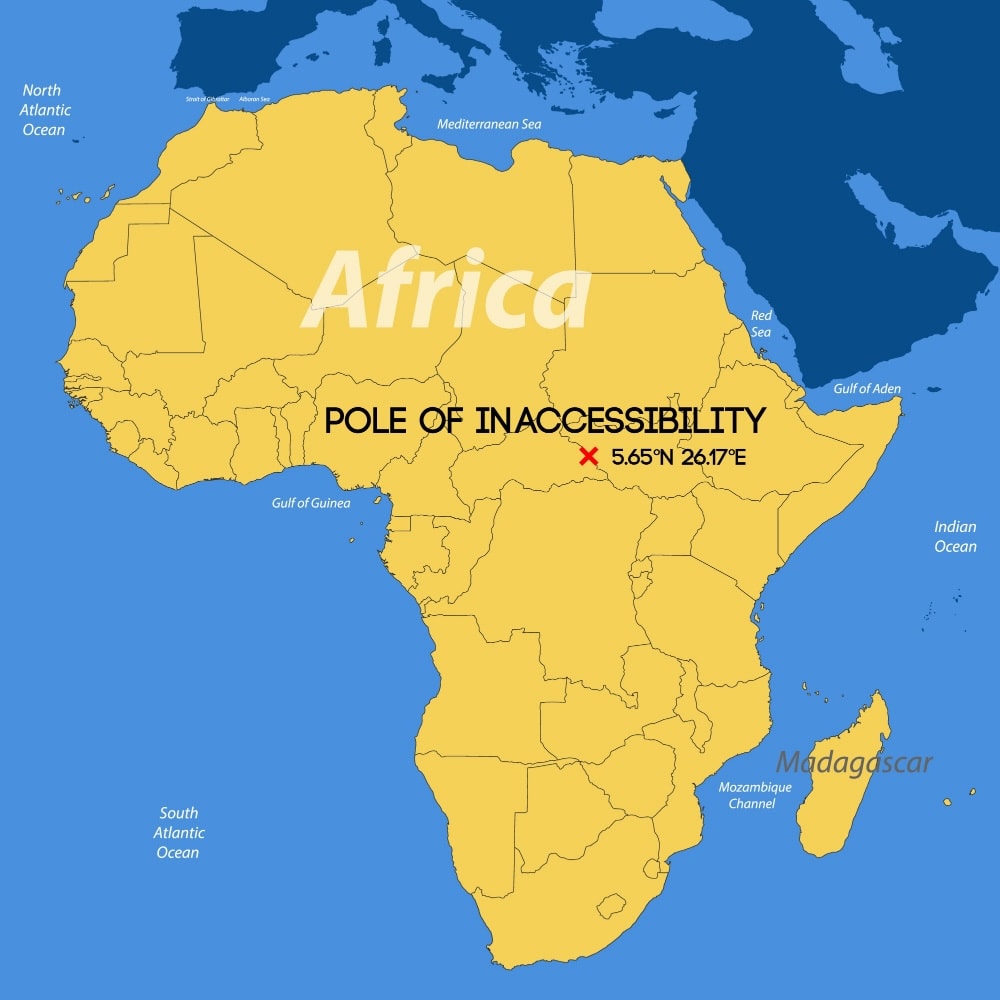
African pole of inaccessibility
Coordinates: 5.65°N 26.17°E
Location: Central African Republic
The African pole of inaccessibility is located 1,814km (1,127mi) from the nearest coastline. It is close to the tri-point border of the Central African Republic, South Sudan and DR Congo. The closest town is Obo in the Central African Republic, 49km (31mi) away.
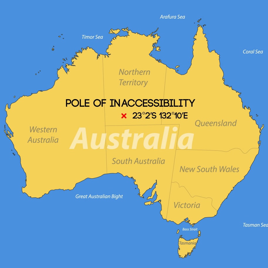
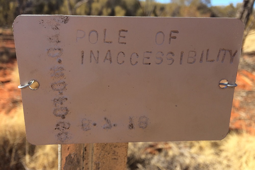
Australian pole of inaccessibility
Coordinates: 23.17°S 132.27°E
Location: Australia
The Australian pole of inaccessibility is around 920km (570mi) from the nearest coastline. The nearest town is Papunya in the Northern Territory, 30km (19mi) to the southwest of the position.
Atlantic Ocean pole of inaccessibility
Coordinates: 24°07’36.1″N 42°12’07.7″W
Location: North Atlantic Ocean
Although no official location has been identified, a 2019 study placed the Atlantic pole of inaccessibility halfway between Bermuda and Cape Verde.
Indian Ocean pole of inaccessibility
Coordinates: 45°42’22.2″S 93°30’03.5″E
Location: Indian Ocean
The same study has also estimated the Indian Ocean pole of inaccessibility to be just short of halfway between the Kerguelen Islands (rather aptly known as the Desolation Islands) and the western coast of Australia.
Enjoyed this post? pin it for later…