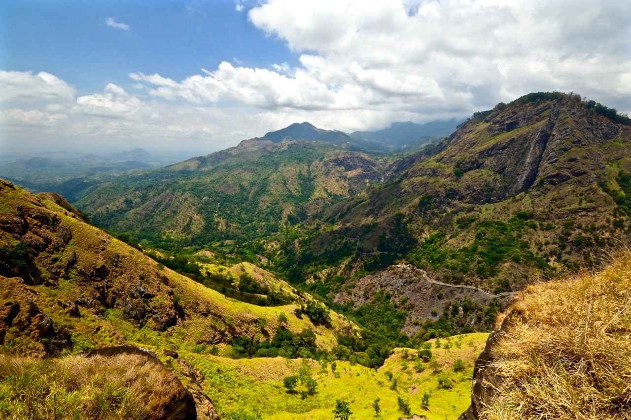
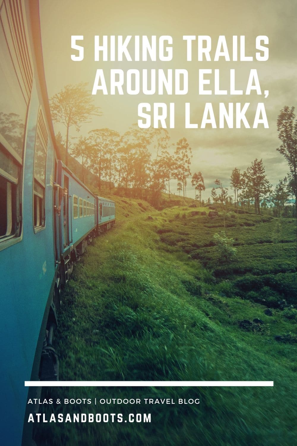
Some of the best scenery in Sri Lanka awaits you on the hiking trails around Ella in the Hill Country
Many people head to Sri Lanka for the beaches – and the country does have some of the finest in the world – but it was Sri Lanka’s Hill Country that really captured our imagination. Carpets of tea plantations and alpine forests emerge from creeping morning mists to reveal some of the most beautiful scenery in the country (if not the world).
When we arrived in Ella, we couldn’t wait to get out onto the trails and explore the highlands. The town itself is a busy and unappealing thoroughfare flanked by charmless hotels and noisy cafes. The surrounding hills, however, really are something else so we spent three days exploring them.
Here, we list our favourite hiking trails around Ella, so eager hikers can follow in our footsteps.
Little Adam’s Peak
Distance: 4.5km (2.8mi)
Duration: 1 hour
Little Adam’s Peak is ideal for a late and leisurely stroll – if you can dodge the almost clockwork afternoon rain showers. Mildly similar in shape (although nowhere near as dramatic) as its big brother, Adam’s Peak, Little Adam’s Peak is a short hike from town and offers some rewarding views for little effort.
Take the Ella-Passara Road from town and turn right at Ella Flower Garden Resort. From here, it is well signposted so just follow the waymarkers. The final 20 minutes are steep but otherwise it’s an easy walk. Part of the path takes you through a local tea estate usually dotted with workers.
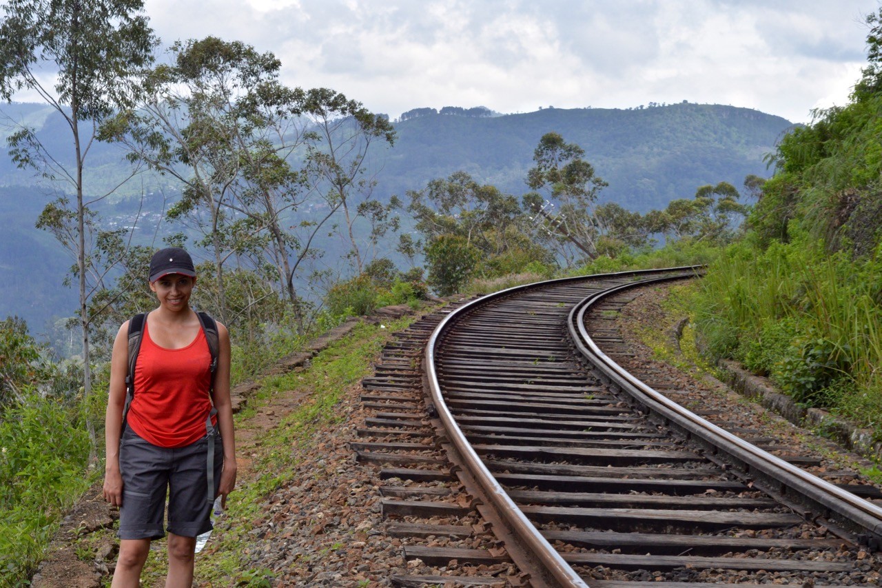
Ella Rock
Distance: 10km (6.2mi)
Duration: 3-4 hours
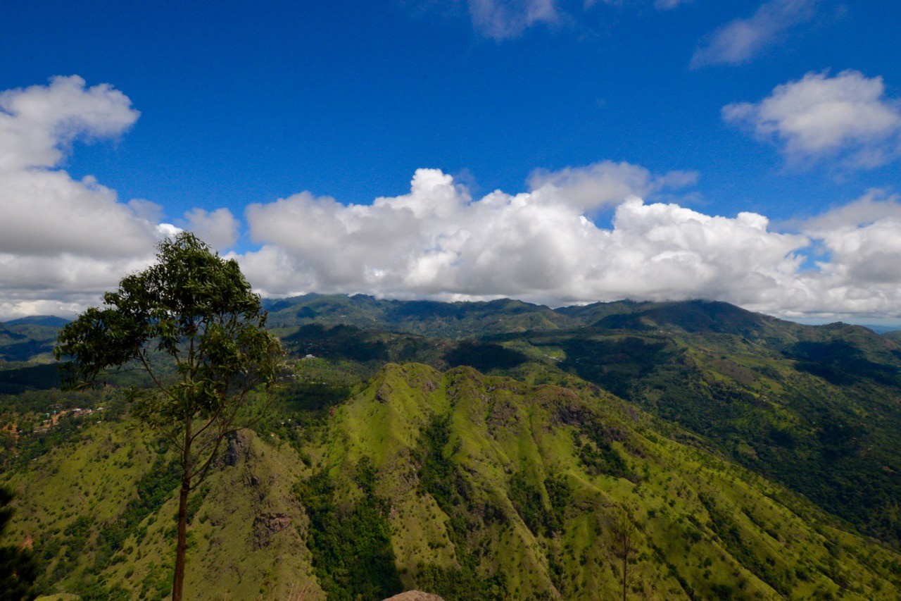
One of the most popular hiking trails around Ella is this moderately challenging half-day hike with exceptionally rewarding views. It’s worth heading off early (no later than 9am) to avoid the heat and afternoon rain showers. This is a slightly more complicated hike with little or no signage along the way. Additionally, local touts attempt to lead hikers astray in order to earn a few rupees for putting them right again!
Follow our guide on how to hike Ella Rock which includes detailed directions, a route map and a list of essential tips. Once at the summit, take your time to enjoy the view – it’s one of the finest in Sri Lanka.
Dambatenne to Lipton’s Seat
Distance: 14km (8.7mi)
Duration: 4-5 hours
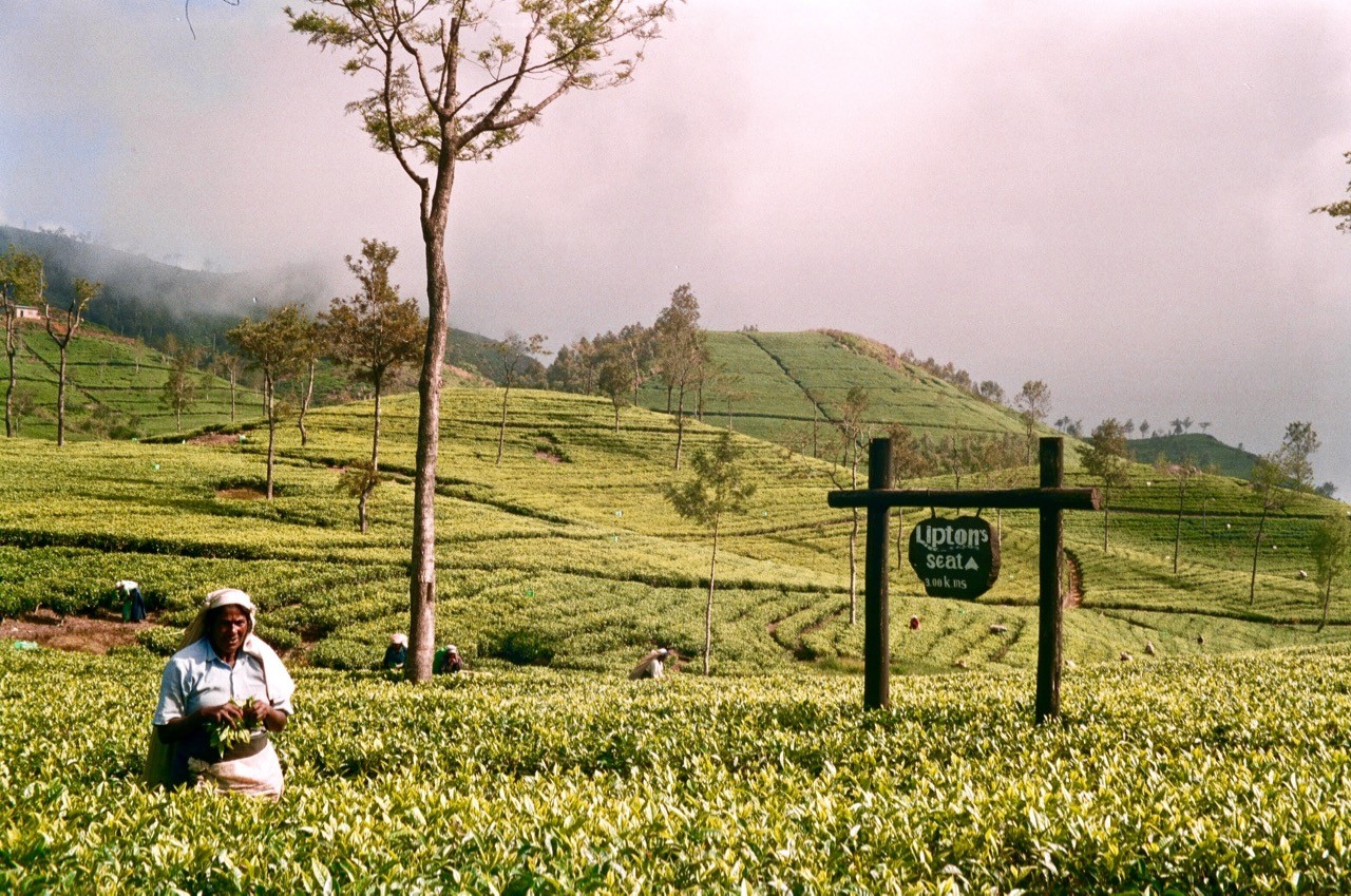
At 1,970m (6,463ft) , Lipton’s Seat lookout above the Dambatenne Tea Factory is another excellent viewpoint. The Scottish tea aristocrat, Sir Thomas Lipton, used to watch over his growing tea empire from here.
The signs from the tea factory are easy to follow. The ascent should take about 2.5 hours and the descent around 1.5 to 2 hours. As with Ella Rock, give yourself plenty of time at the top to take in the view.
It’s a bit of an effort to get to as you’ll need to take a train to Haputale (80/50/25 LKR – 1st/2nd/3rd class) and then either a bus (30 LKR one way) or a tuk-tuk (800-1,000 LKR return journey including waiting time) to the Dambatenne Tea Factory where you start the hike.
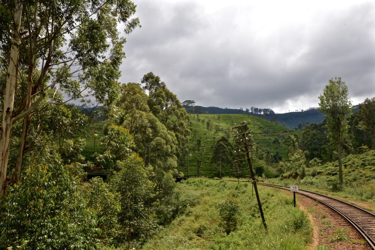
Idalgashinna to Haputale
Distance: 8km (5mi)
Duration: 2 hours
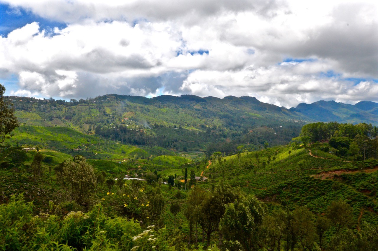
This is one of the least popular hiking trails around Ella, but offers some of the most outstanding views. We suggest buying a comfortable observation class train ticket (1,000 LKR) from Ella Railway station and taking the train to Idalgashinna (1hr 20min). From there, hike back along the tracks back to Haputale. The views across the surrounding hills, tea plantations and local villages are unrivalled.
The terrain falls away dramatically on either side throughout the hike. At one point, you’ll walk along a narrow piece of track with spectacular views sliding away to your right and left. It’s also very quiet; we didn’t see any other hikers along this route and only a handful of locals.
It’s worth noting that this hike doesn’t work so well in reverse. We made the mistake of starting at Haputale and had to rush to get to Idalgashinna to meet the returning train. As such, make sure you stay on the train from Ella until Idalgashinna and walk back to Haputale. Hiking in this direction ensures you have plenty of time to meet the returning (often very busy) trains to Ella.
Pattipola to Haputale
Distance: 14km (8.7mi)
Duration: 4-5 hours
A similar option to the above is to take the same train all the way to Pattipola (160/90/45 LKR – 1st/2nd/3rd class, 2 hours) and walk the longer route back to Haputale. This will be a full day’s hike so take one of the earlier trains from Ella to give yourself enough time. There is the 6.40am which ensures you’ll miss the heat of the day or the 9.24am if you don’t mind the stronger sun.
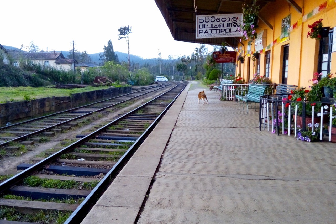
Pattipola is the highest train station in Sri Lanka and with it comes some sweeping views en route. Again, you’re unlikely to meet many fellow hikers along this route.
Be aware that with this longer hike along the tracks you’ll almost certainly meet trains coming from both directions. You’ll usually have plenty of warning but always listen carefully and make short work of the sections without pathways alongside the tracks.
Hiking trails around Ella: the essentials
What: Exploring the hiking trails around Ella in Sri Lanka’s Hill Country.
Where: We booked our stay fairly late so ended up on the main thoroughfare at Ella Dream Cafe. While the rooms were lovely and spacious, they were also ridiculously noisy (a mixture of traffic, tourists and thumping music from the adjacent bar). Instead, we recommend Lonely Planet’s suggestions of Ella Flower Garden Resort or Zion View Ella.
When: The best time for exploring the hiking trails around Ella is between Dec-Mar when the Hill Country is driest. The shoulder season of April and Sep-Nov is a decent time to visit while the Yala monsoon season of May-Aug brings rain to the Hill Country.
How: If you’re planning on doing more hiking around Sri Lanka it’s worth investing in a decent map. Sri Lanka 1:500,000 + city plans waterproof travel map is by far the best map available for hiking in Sri Lanka. On one side of the map is relief shading, spot heights and names of mountain ranges and prominent peaks.
You can reach Ella by rail from Colombo and Kandy (check timetable here; note that ‘Ella’ is spelt ‘Elle’ in the search dropdown).
There are various bus routes available depending on your point of origin. It’s worth noting that we found bus travel to be quite stressful in Sri Lanka so you may wish to take a transfer instead. Your hotel can arrange this but it’s always worth negotiating a discount as these are usually inflated (e.g. if quoted 15,000 LKR, ask for 11,000).
Many tourists opt to hire a driver for the entirety of their trip. This costs around $45 USD per day (including the days you don’t use the driver). We used Ajaa (+94 777 284 178) and Sisi (+94 777 203 083) for shorter transfers and found them to be friendly and reliable.
Most international flights land in Bandaranaike International Airport (CMB). Book via Skyscanner for the best prices.
Enjoyed this post? pin it for later…
Lonely Planet Sri Lanka is a comprehensive guide to Sri Lanka, ideal for those who want to both explore the top sights and take the road less travelled.


