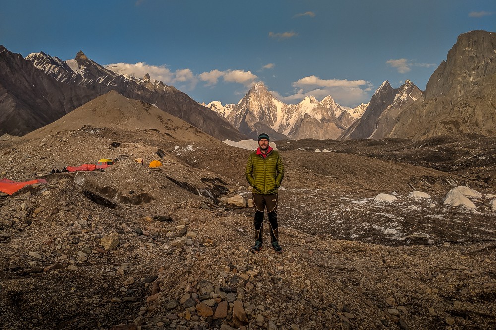
The K2 base camp trek is a stunning journey to the foot of a legendary mountain in the Pakistani Karakoram
The K2 base camp trek through the mighty Karakoram mountains of Pakistan is one of the world’s finest high-altitude treks. Earlier this year an opportunity arose to join Lost Horizon Tours and Treks on a trek to K2 base camp combined with a crossing of the Gondogoro La Pass.
With over 25 years of experience guiding in the mountains of Pakistan, Lost Horizons were a great partner for an expedition of this kind. After completing the Everest base camp trek earlier in the year, I couldn’t resist the chance to trek to this infamous mountain too.
At 8,611m (28,251ft), K2 is the second-highest mountain on Earth, one of just 14 eight-thousanders and a member of the seven second summits. A mere mention of the legendary mountain is enough to make one’s blood run cold. K2 is known as the ‘Savage Mountain’ due to the extremely difficult ascent and one of the highest fatality rates among the eight-thousanders.
K2 is the only eight-thousander that has never been climbed in winter. Unpredictable avalanches mean that one in four summiteers die on its lethal slopes. K2 may be second in stature to Everest, but it demands significantly greater technical climbing skills. Known as the ‘mountaineer’s mountain’, it is often considered the ultimate challenge in high-altitude climbing.
K2 base camp gear list
Tips for trekking to K2 base camp
Best treks in Pakistan: 5 great adventures
Everest vs K2 base camp: which trek is right for you?
Pakistan is open for business
The K2 base camp trek is a journey to the Himalaya less visited. Although technically a separate system, the Karakoram Range adjoins the ranges to the southeast and is loosely grouped into the ‘Greater Himalayas’ of Asia spread across Bhutan, China, India, Pakistan and Nepal.
While the mountains of Nepal continue to attract more and more visitors (over a million in 2018), Pakistan’s trekking industry flatlined during the years following 9/11.
Recently, tourist numbers have started to rise. Imran Khan highlighted tourism as one of his main objectives in his “100 day agenda” following his 2018 election victory. Initiatives have included increasing the availability of tourist visas, developing an online e-visa system, inviting the Royal Family for a state visit and recommencing direct flights to Islamabad – British Airways became the first European airline to do so in June.
The renewed drive has seen an increase, although moderate, in visitor numbers, particularly trekkers. In 2018, just 900 tourists registered to enter the Central Karakoram National Park. When we entered in early September as one of the last trekking parties of the year, that number had risen to 1,300.
Despite the increase, it’s worth remembering that over 30,000 people make the Everest base camp trek in Nepal every year. Pakistan still has a long way to go to catch up with its Himalayan neighbour. With that in mind, now is the time to visit Pakistan.
K2 base camp trek logistics
The below is the itinerary we followed, although it should be noted that all schedules come with a certain degree of flexibility. Some members of our group wanted to ensure we had ample acclimatisation so we built in three rest days.
As we were trekking late in the season we didn’t know for certain that the Gondogoro La Pass would still be traversable. Our guide used the final rest day at Ali camp as a recce day to ensure the pass was still safe to cross.
| Day | From/to | Distance | Duration | Max Alt. |
|---|---|---|---|---|
| 1 | Askole-Jhola | 20km | 6-8 hours | 3,159m |
| 2 | Jhola-Paiju | 21km | 6-8 hours | 3,383m |
| 3 | Paiju rest day | N/A | N/A | 3,383m |
| 4 | Paiju-Khobutse | 13km | 5-7 hours | 3,566m |
| 5 | Khobutse-Urdukas | 6km | 2-4 hours | 4,130m |
| 6 | Urdukas-Goro II | 11km | 5-7 hours | 4,250m |
| 7 | Goro II rest day | N/A | N/A | 4,250m |
| 8 | Goro II- Concordia | 12km | 4-6 hours | 4,600m |
| 9 | Concordia-K2bc-Concordia | 24km | 10-12 hours | 5,150m |
| 10 | Concordia-Ali | 13km | 5-7 hours | 5,000m |
| 11 | Ali rest day | N/A | N/A | 5,000m |
| 12 | Ali-Gondogoro- Khuispan | 12km | 15-17 hours | 5,560m |
| 13 | Khuispan-Saicho | 17km | 6-8 hours | 3,330m |
| 14 | Saicho-Hushe | 10km | 2-3 hours | 3,050m |
It should also be noted that distances and times vary significantly, depending on the condition of the trails and river crossings. The trails over the Baltoro Glacier are constantly changing as the ice shifts and crevasses open up.
It’s also not unusual for rivers to swell to excessive levels or even wash away bridges. We were twice delayed due to swollen rivers. On one occasion, we had to skirt around to another crossing after a bridge had washed away and, on another, we had to ford a tributary further upstream.
Enter the Karakoram
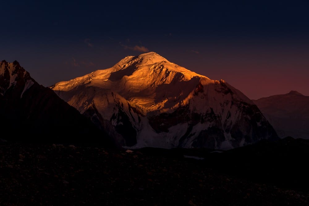
During the short flight from Islamabad to Skardu, I caught my first glimpse of the mighty mountains of Pakistan. The distinctive shape of Nanga Parbat appeared out of the window as we descended. At 8,126m (26,660ft), it is the ninth-highest mountain in the world.
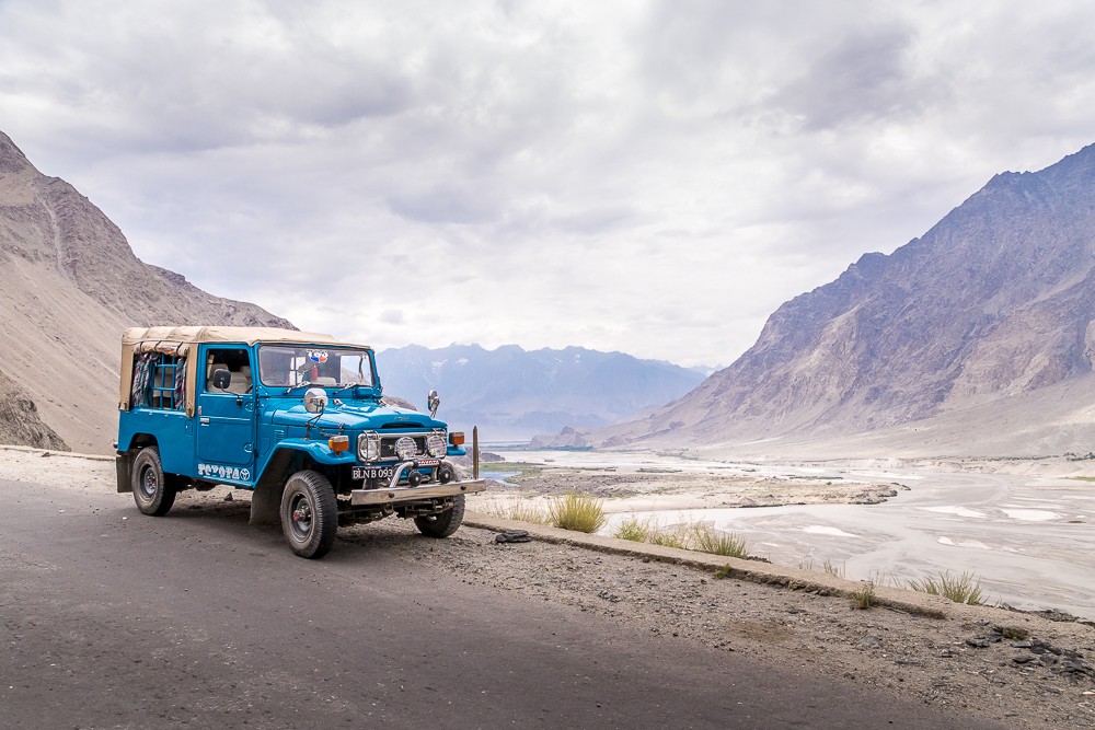
Upon arrival in Skardu, we met our head guide, Waheed, at the airport and transferred to our hotel in Skardu for the night. In the morning we took a 4WD vehicle to the village of Askole, where we would begin our trek the following day. The journey was a bumpy and dusty six-hour 130km drive up the Shigar Valley, then eastwards along the Braldu River to Askole.

Atlas & BOots
Our first days in the Karakoram
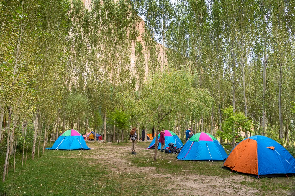
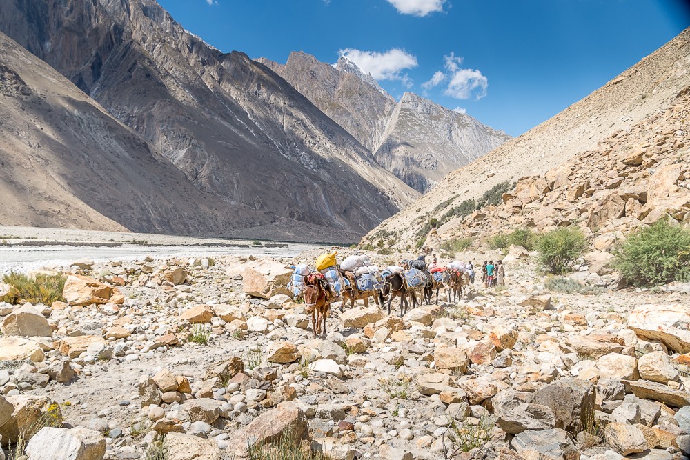
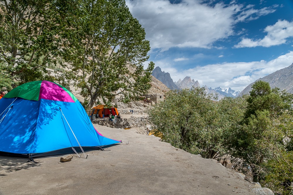
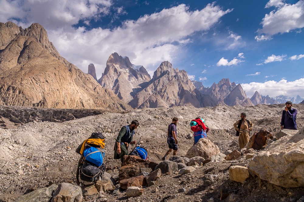
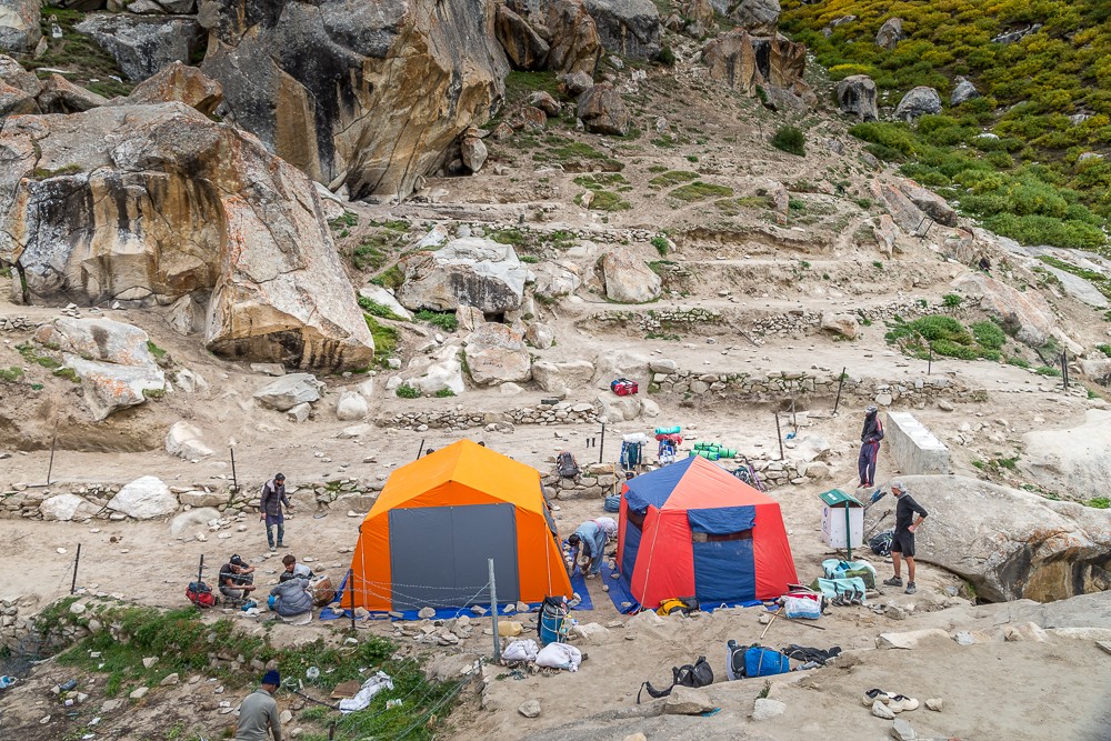
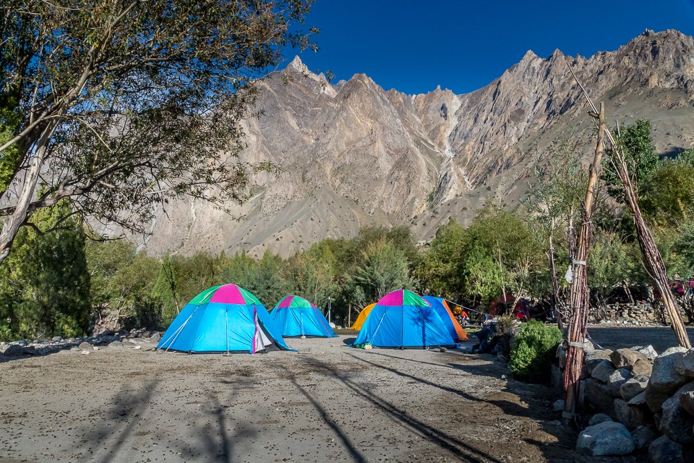
Our first night under canvas was at the serviced campsite at Askole, where we met our cook and assistant guide, Abdullah, along with the rest of our team of porters and mulemen. After our first meal together in camp, we bedded down on soft grass for the last time in nearly two weeks; from now it would be rock, ice or both beneath our camping mats.
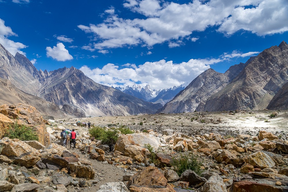
We began our K2 base camp trek in the morning beneath a fiery sun. The trail was hot and dusty once we left the green oasis of Askole. Shortly after departure, we passed through the official entrance to the Central Karakoram National Park. After a brief stop to organise our paperwork, we were on our way into the heart of the Pakistani Karakoram.
Along the Braldu Valley
The Braldu River originates from the Baltoro Glacier and flows 78km along the Braldu Valley. It would be our guiding force over the initial days of the trek as we followed its banks towards the Baltoro Glacier.
Our first day was a baptism of fire as we acclimatised not to the altitude, but to the heat. There was little shade to be found along the trail as we crisscrossed tributaries of the Braldu and Dumordo Rivers. After pausing for lunch at a pretty oasis at Korofon campsite, we pushed on deep into the afternoon to Jhola campsite.
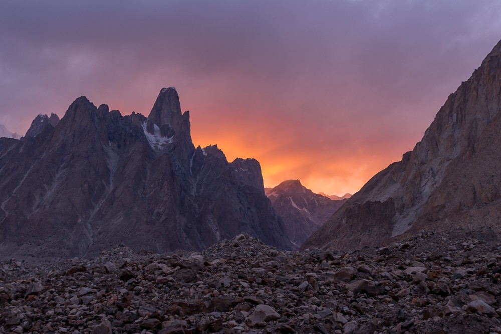
The campground is situated beneath the peculiar peak of Bakhor Das. The 5,810m (19,061ft) summit is known locally as Mango Peak due to its distinctively shaped summit cone. That night, we experienced our first of many magical sunsets in the Karakoram as the summits shimmered in the evening alpenglow.
Atlas & BOots
Moving up the Braldu Valley
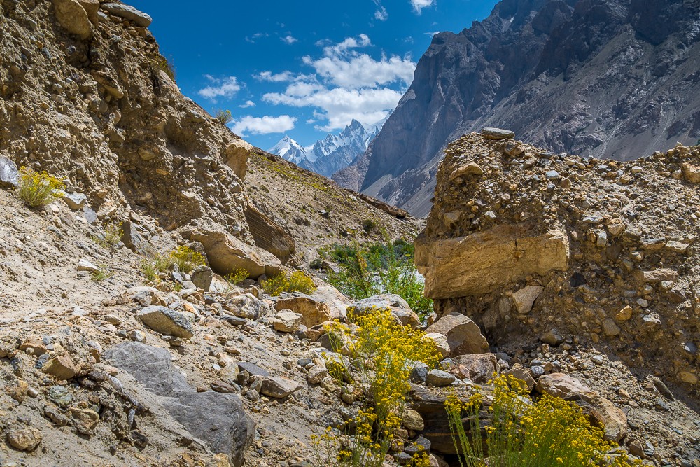
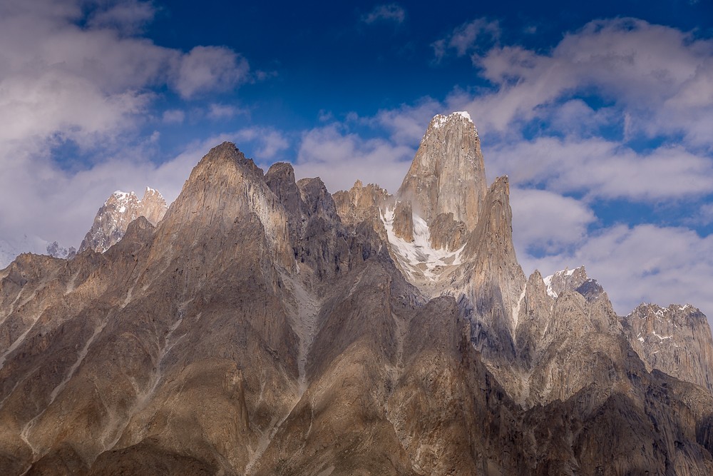
The following day we continued along the Braldu Valley and it wasn’t long before we got our views of the fantastic granite rock spires of Trango Towers and Cathedral. The Trango Towers, at 6,286m (20,623ft), offer some of the world’s most difficult big wall climbing. The east face of Great Trango Tower is the world’s greatest ‘nearly vertical’ drop at 1,340m (4,396ft).
After another long and hot day, I was pleased to arrive at the shaded campsite of Paiju. Here, at 3,383m (11,099ft), we would take our first acclimatisation day of the trek.
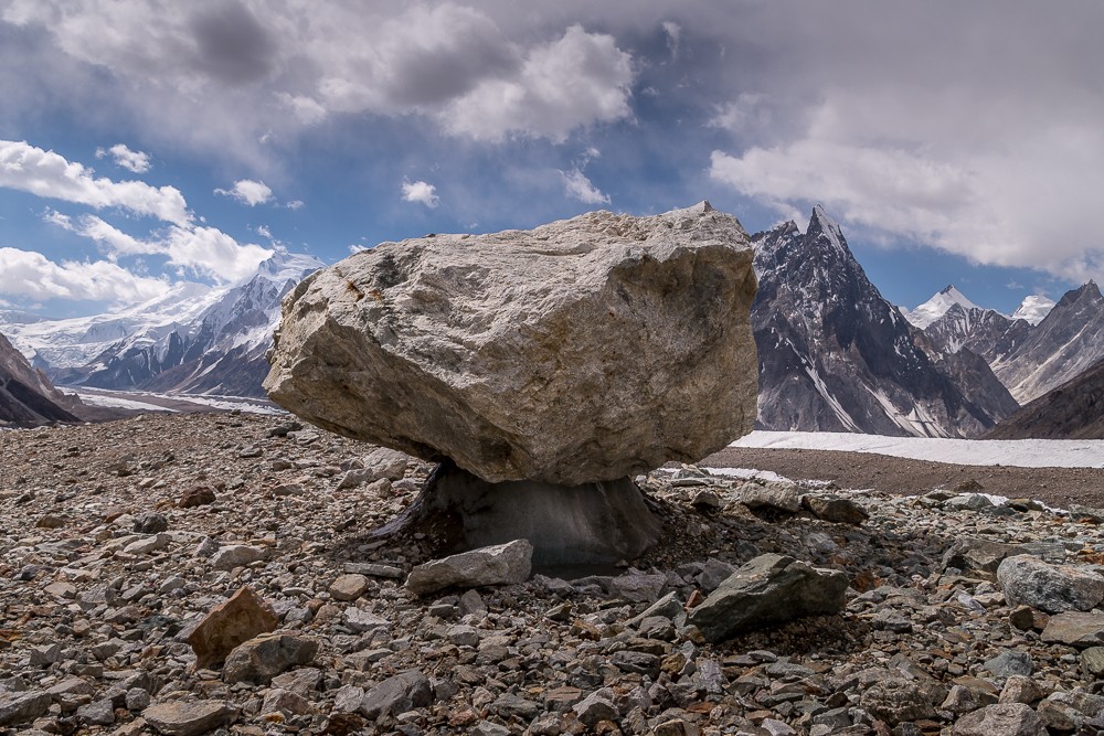
Onto the Baltoro
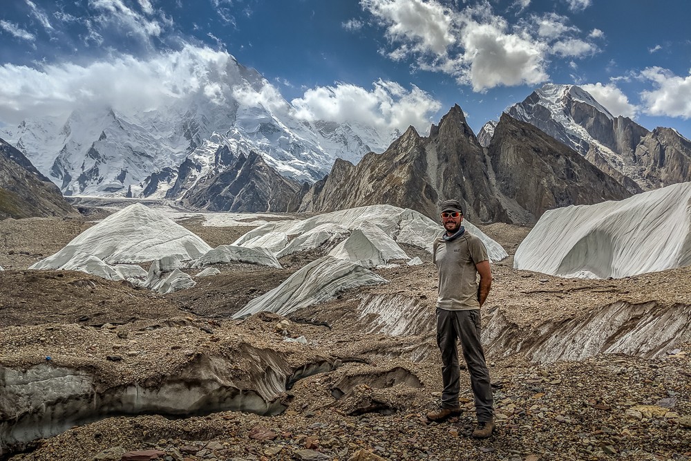
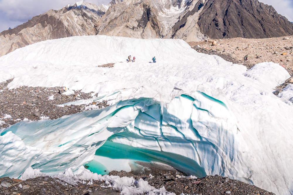
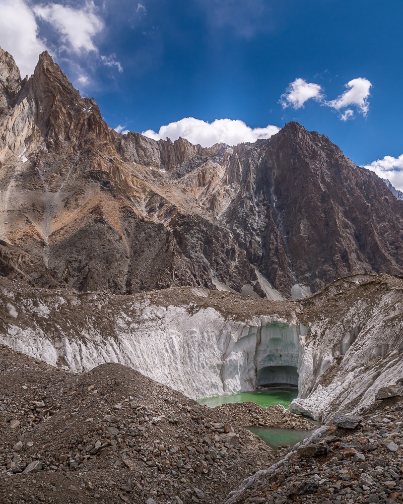
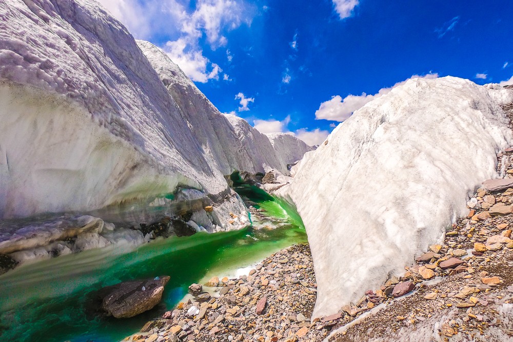
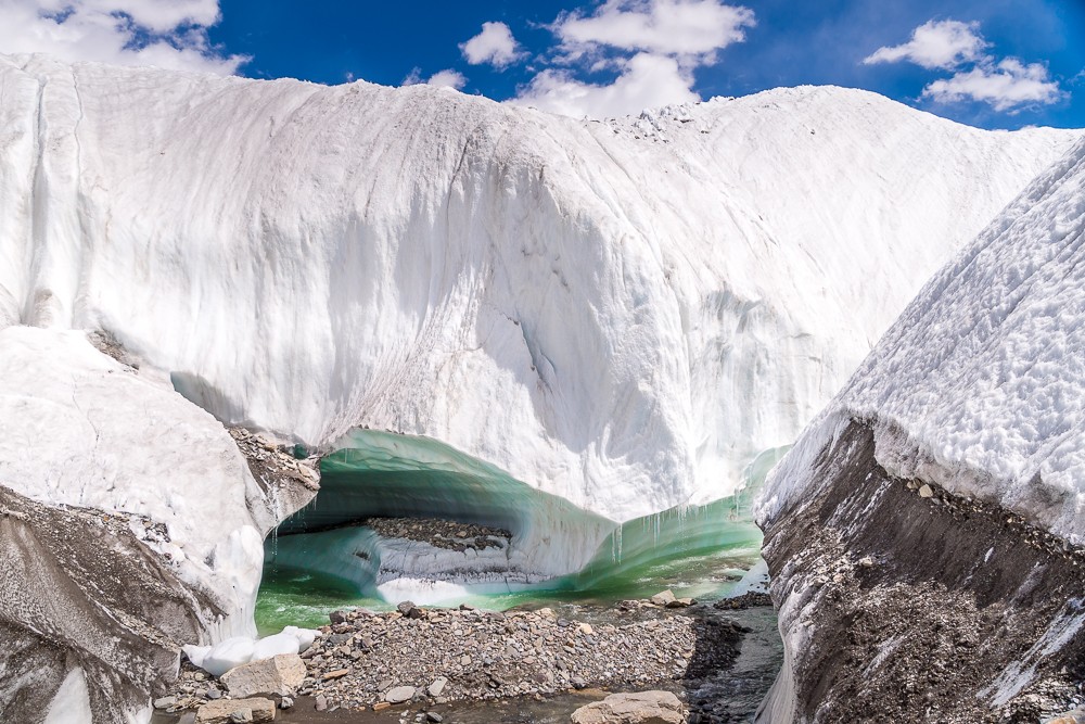
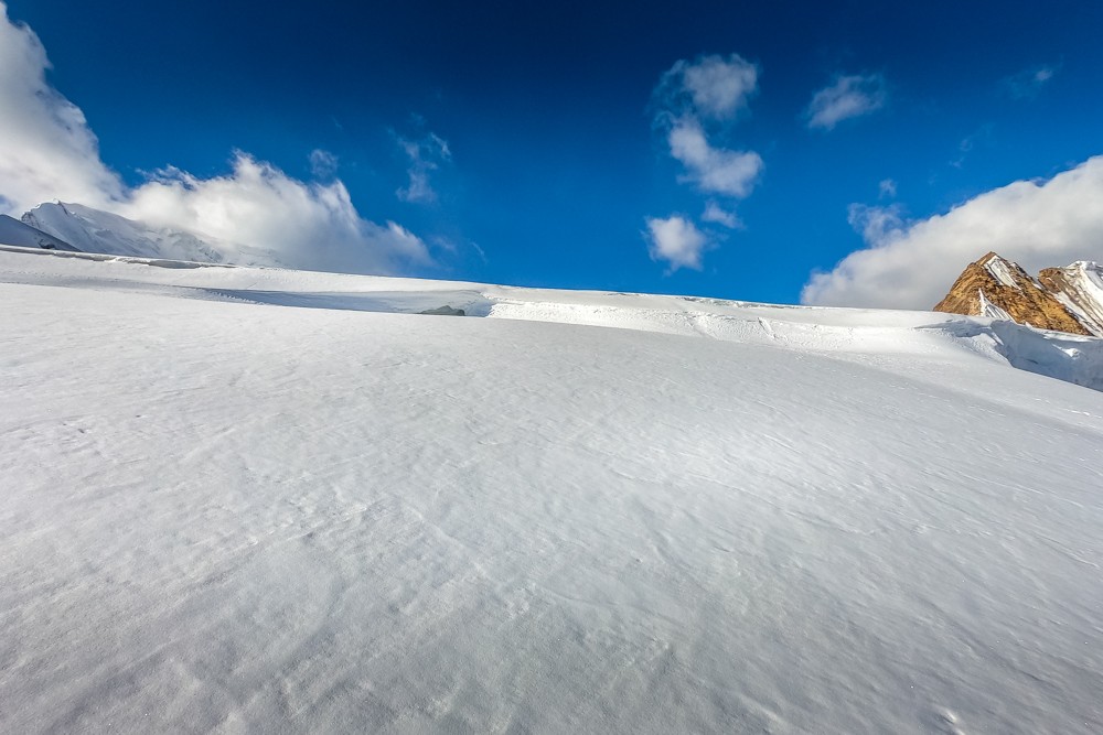
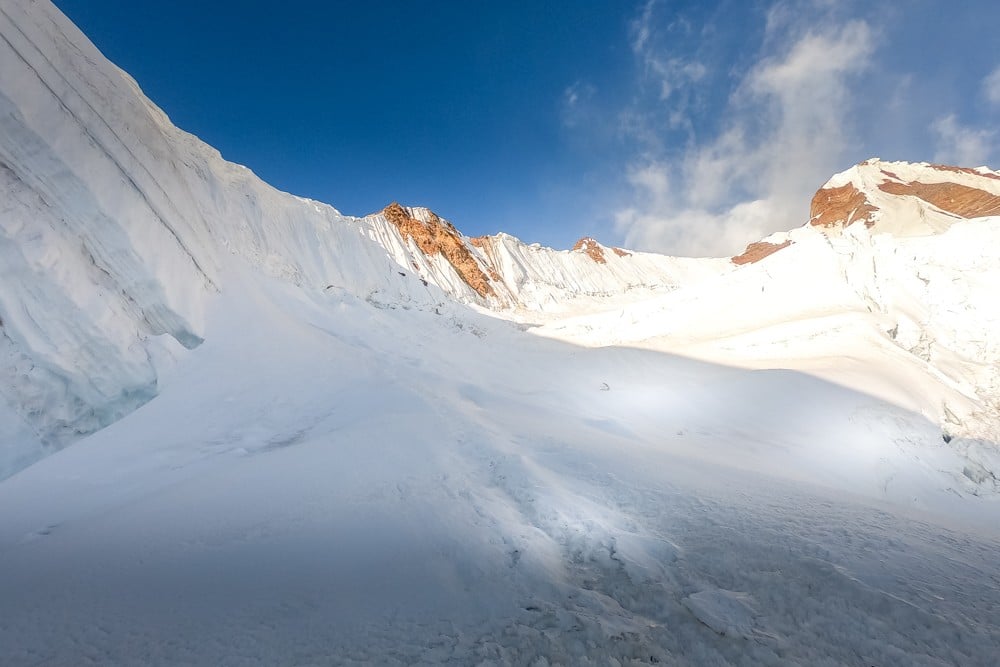
After a day’s rest it was time to move onto the snout of the Baltoro Glacier and with that the temperature changed. The skies were still largely clear and the sun was hot, but moving across a moraine-strewn glacier is a different beast to following a waymarked trail. The day was frustratingly long as we lost time picking a new route over the glacier where a massive ice shift had destroyed the trodden trail used during the season.
Furthermore, at the end of the day we lost more time picking a course across a swollen river. By the time we had all crossed, nearly two hours had been lost and our feet were frozen! Fortunately, it wasn’t long until we’d pitched our camp at Khobutse opposite the striking Trango Towers.
Atlas & BOots
Moving up the trail besides Trango Towers and Cathedral
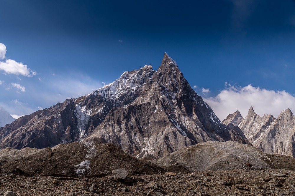
The following day was a much shorter hike along the valley to the final refuge of green at Urdukas. This wonderfully positioned campsite up the slopes of the valley offers beautiful views across the glacier towards Trango Towers and Cathedral.
Moving up the glacier
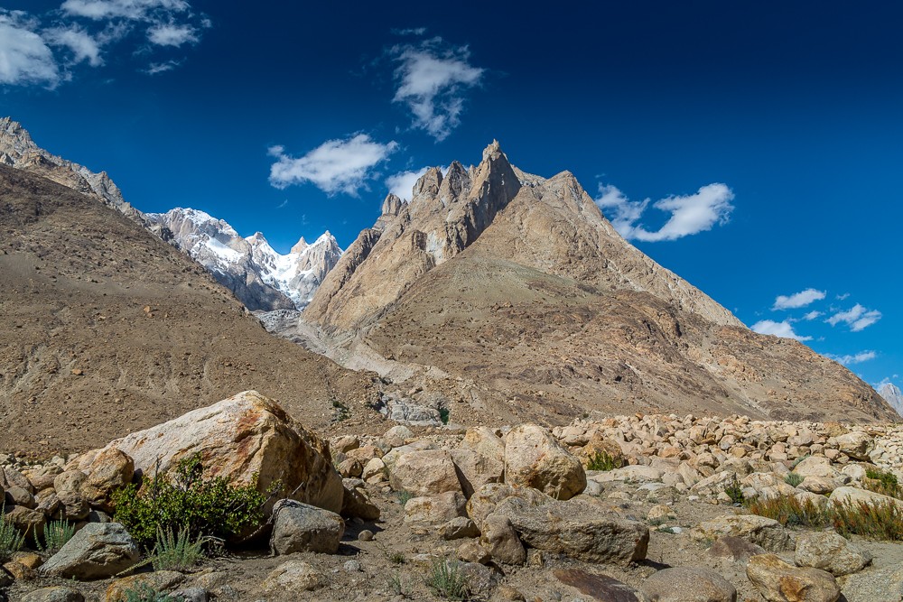
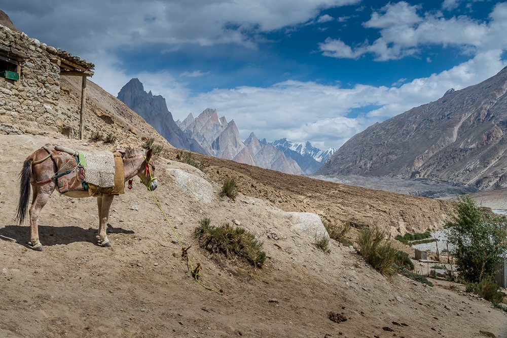
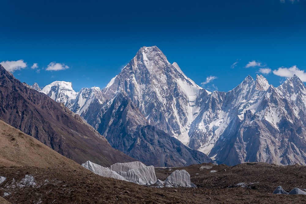
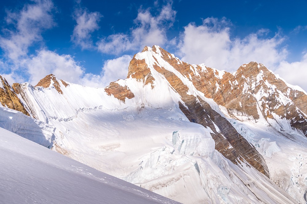
On this day, we caught our first views of a 7,000m peak, quickly followed by our first 8,000m peaks. First up was Masherbrum off to our right. At 7,821m (25,659ft), Masherbrum is the 22nd highest mountain in the world and the ninth highest in Pakistan.
Masherbrum was initially designated K1 when in 1856 Thomas George Montgomerie – a British officer working for the Great Trigonometrical Survey of India – climbed a small mountain in Kashmir and spotted two prominent peaks over 200km away in the Karakoram. He named them K1 and K2, the ‘K’ standing for Karakoram.
Moving up the glacier, our first 8,000m peaks came into view. Directly ahead stood the Gasherbrum Range, a collection of five peaks over 7,000m including two over 8,000m. At 8,035m (26,362ft) and 8,080m (26,444ft), Gasherbrum I and II are the 13th and 11th highest mountains in the world. They were initially designated K4 and K5 in keeping with Montgomerie’s naming system.
Atlas & BOots
Moving up the glacier we saw our first 7,000m and 8,000m mountain
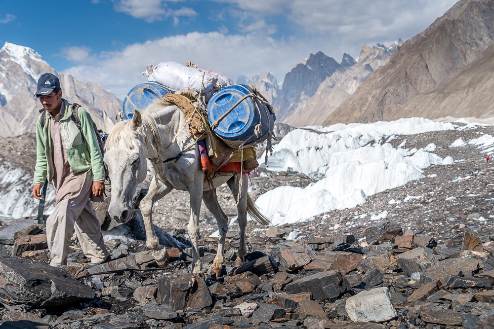
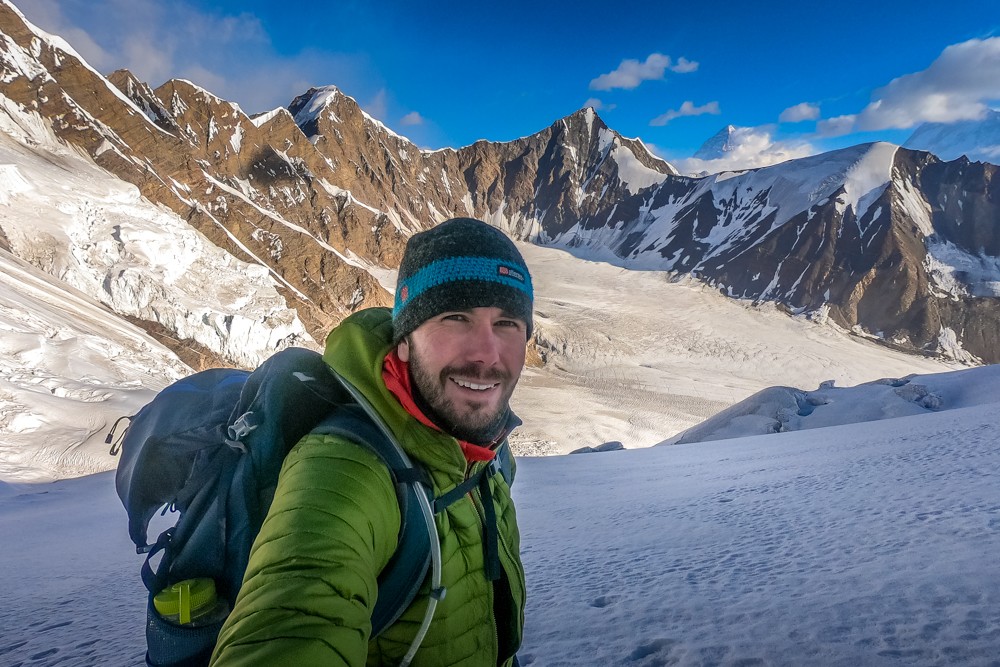
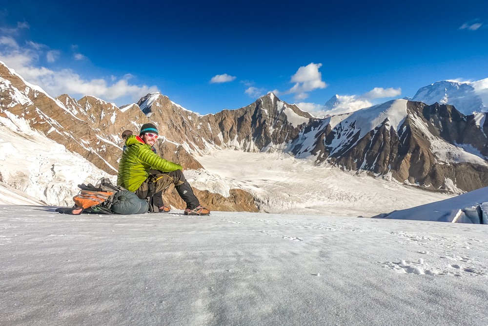
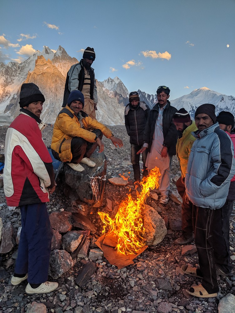
After a breathtaking but challenging day’s walk along the glacier, we arrived at Goro II camp at 4,250m. Here, our porters went to work chipping away at the ice and rock to create flat ground for tents to be pitched – an arduous task at the best of times, let alone at the end of a day’s trekking above 4,000m.
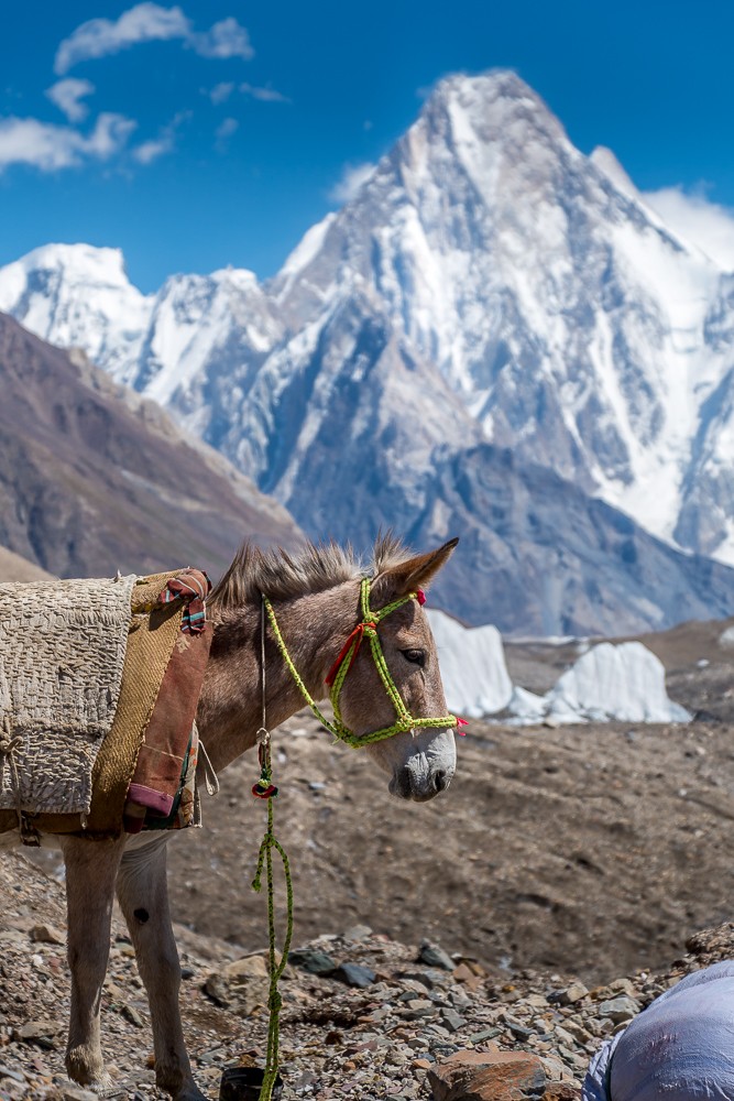
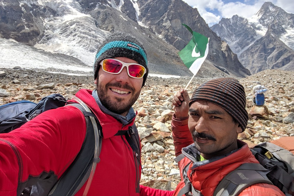
Our guide, cook, porters and mule men all hailed from Hunza, a mountainous valley in the Gilgit-Baltistan region of Pakistan. They carried 20kg plus of supplies every day. Needless to say, I can’t emphasise enough how much harder – make that impossible – this expedition would have been without the support of our team.
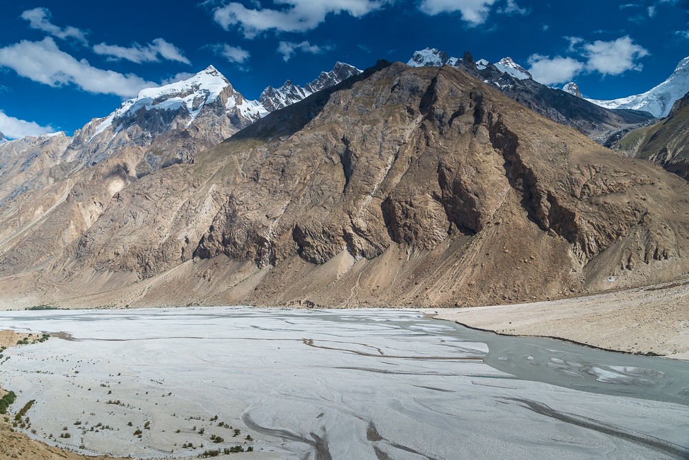
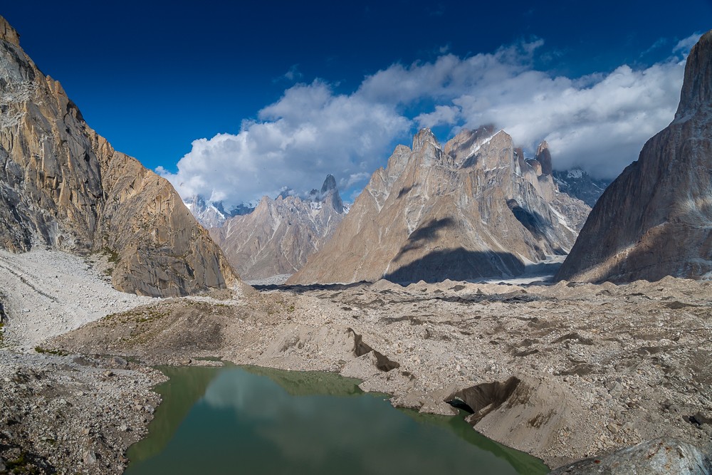
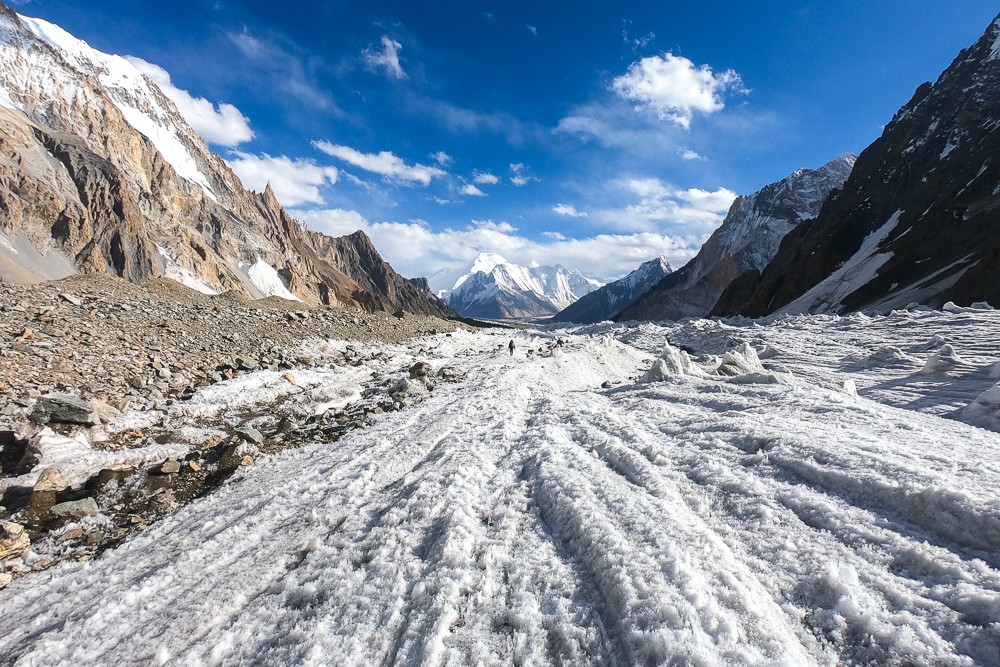
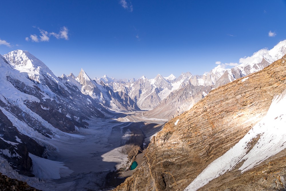
Where glaciers converge
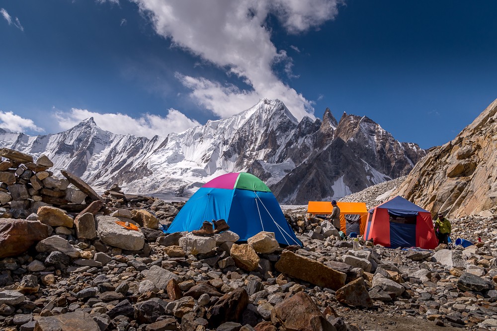
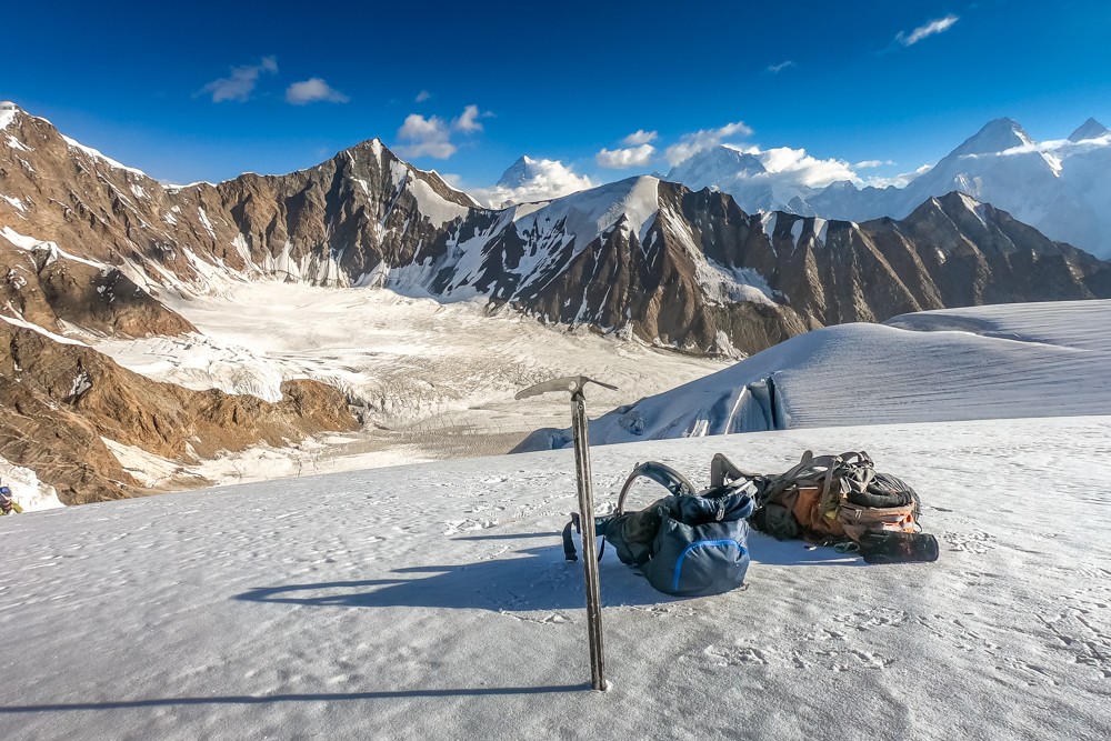
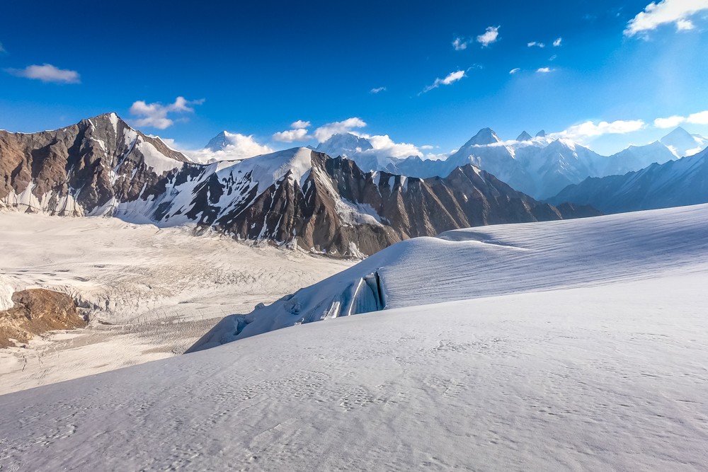
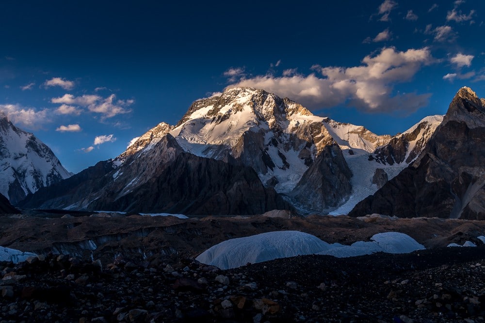
After taking our second rest day of the trek at Goro II camp, we continued along the wide corridor of ice and moraine leading to the magnificent mountain amphitheatre that is Concordia.
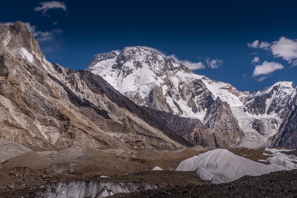
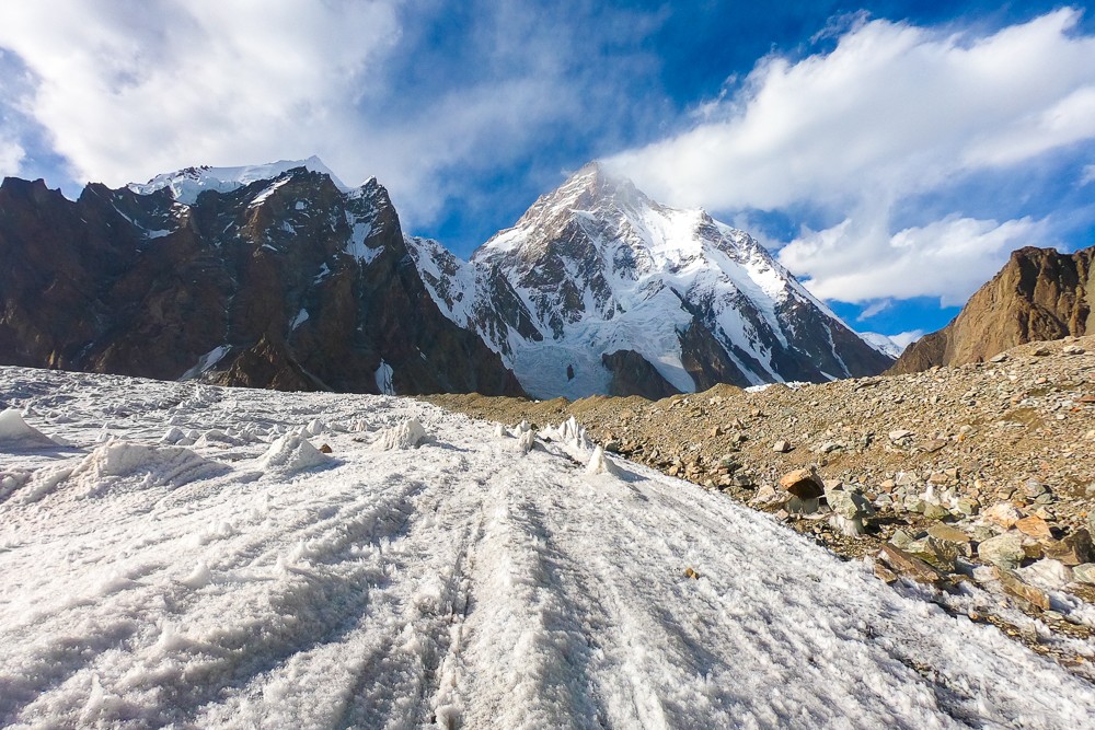
Early in the day, the 1.5km summit ridge of Broad Peak breached the horizon. Part of the same massif as the Gasherbrums, Broad Peak at 8,051m (26,414ft) is the 12th highest mountain in the world.
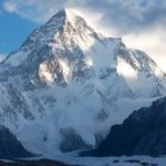
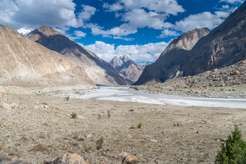
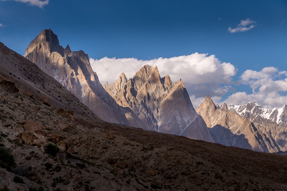
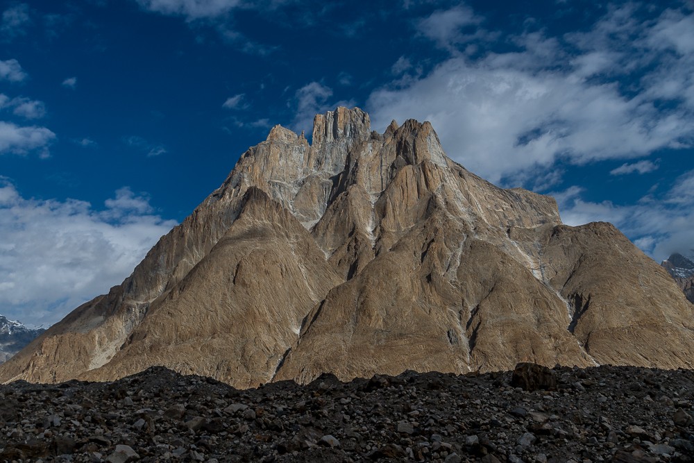
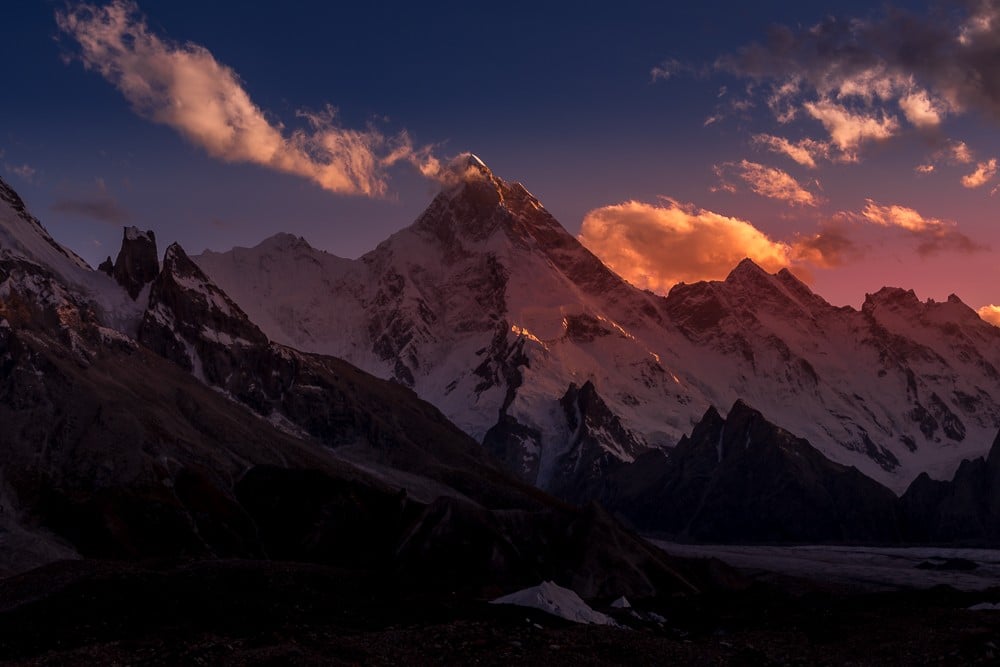
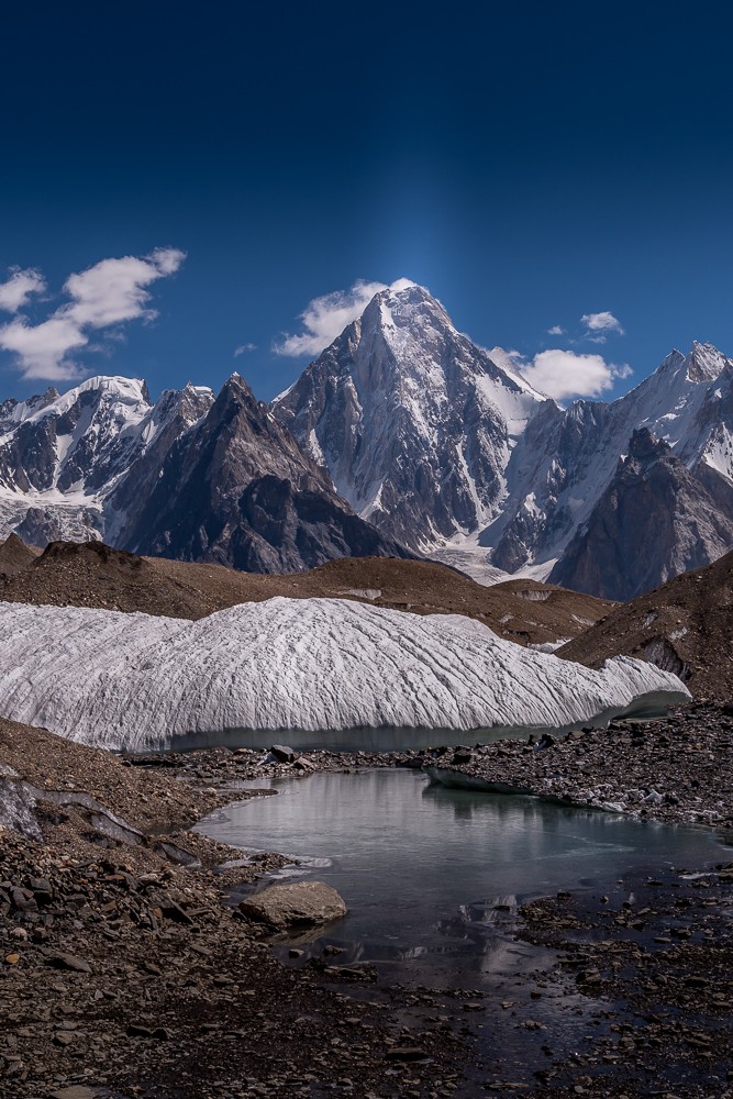
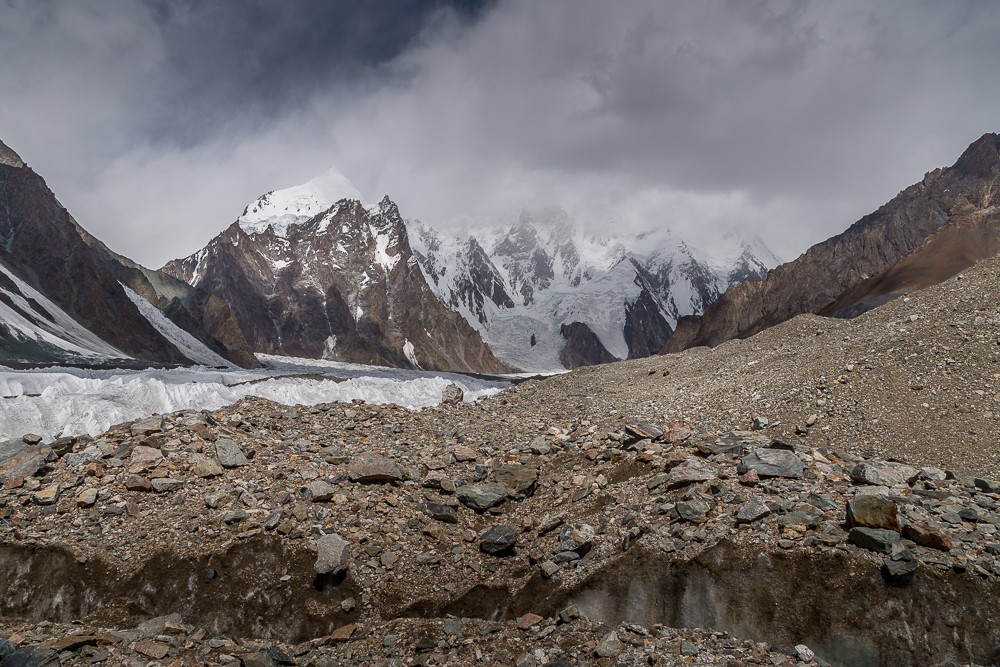
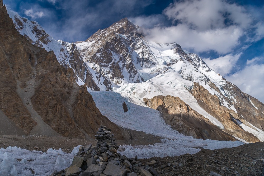
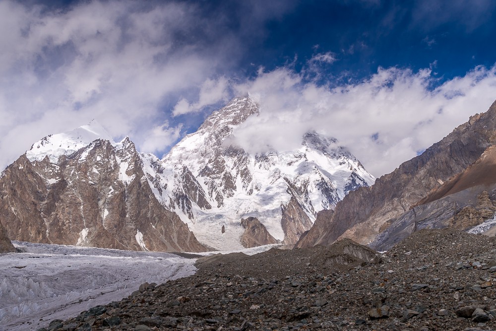
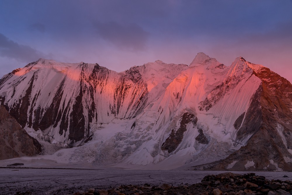
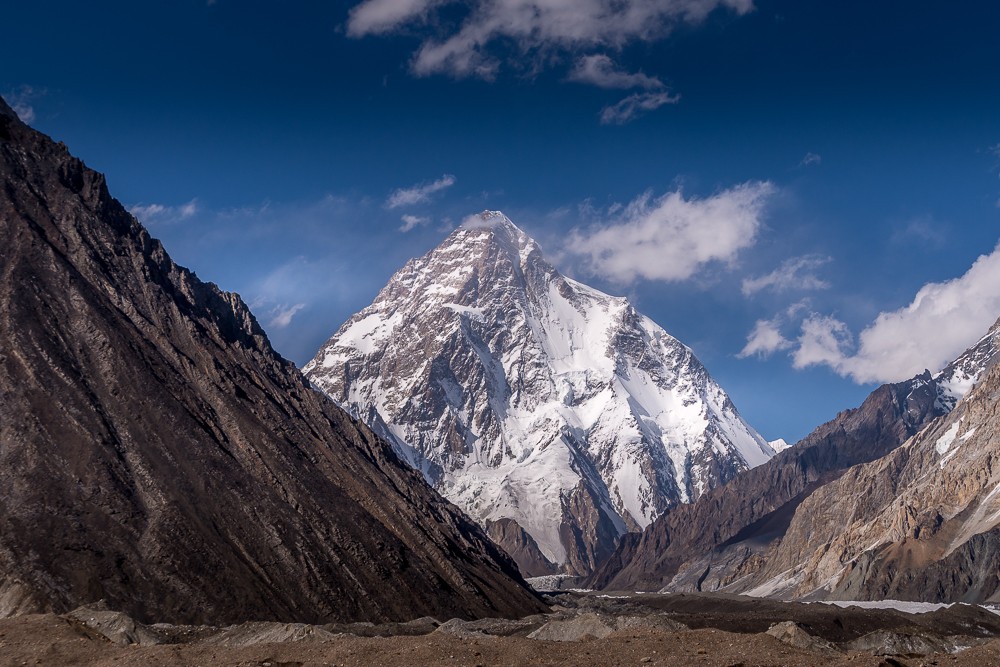
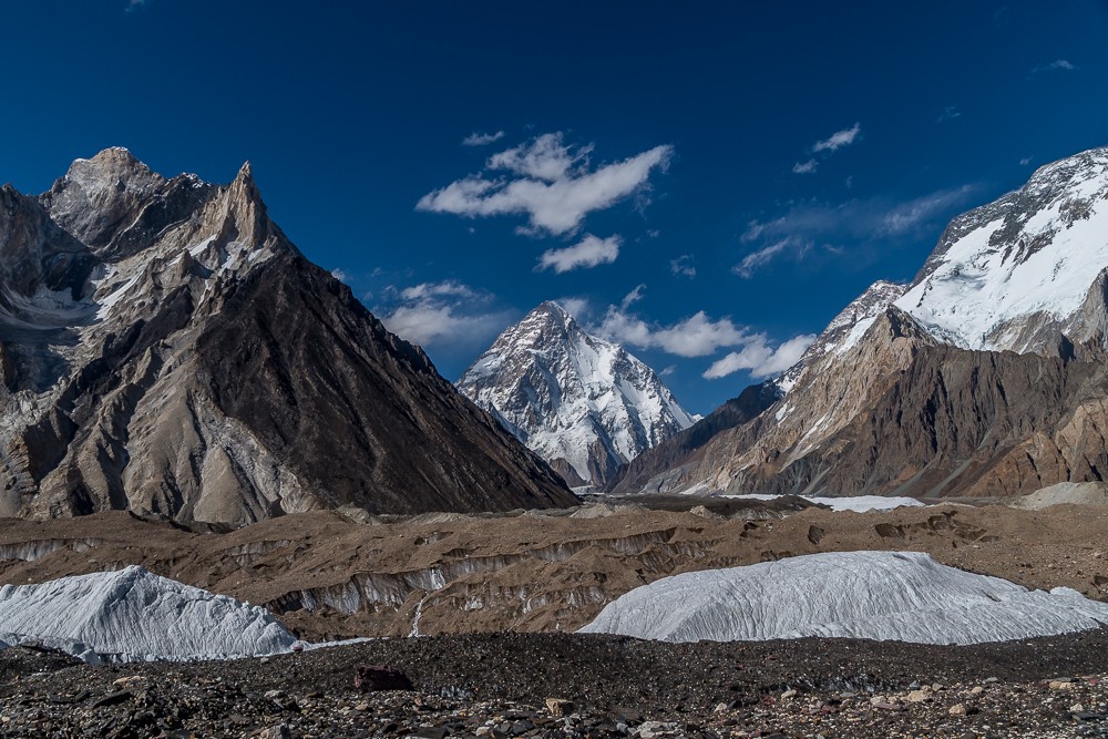
Shortly afterwards, the mountain we’d all come to see emerged into sight. After eight days of trekking, we finally got our first view of the ‘Savage Mountain’. Still over 12km away, K2 rises above the surrounding mountains, its towering presence utterly overwhelming. It has a grace and symmetry that in my mind, makes it the most striking of the 14 eight-thousanders.
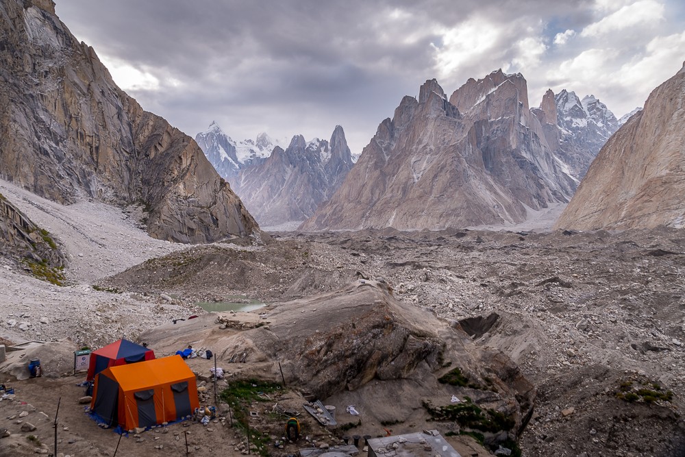
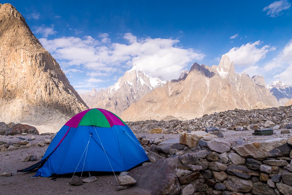
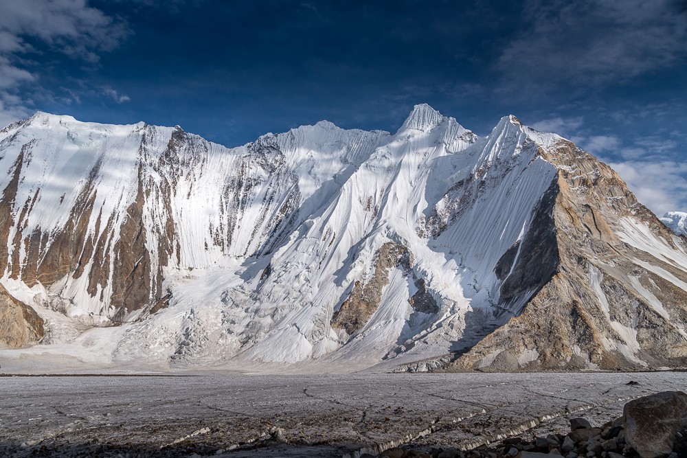
By mid-afternoon we arrived at Concordia beneath cobalt skies and the glinting goliaths of the mountaineering world. Located at the confluence of the Baltoro and Godwin-Austen glaciers at around 4,600m (15,091ft), Concordia is one of the few places in the world where you can see four 8,000m peaks: K2, Broad Peak, Gasherbrum I and Gasherbrum II.
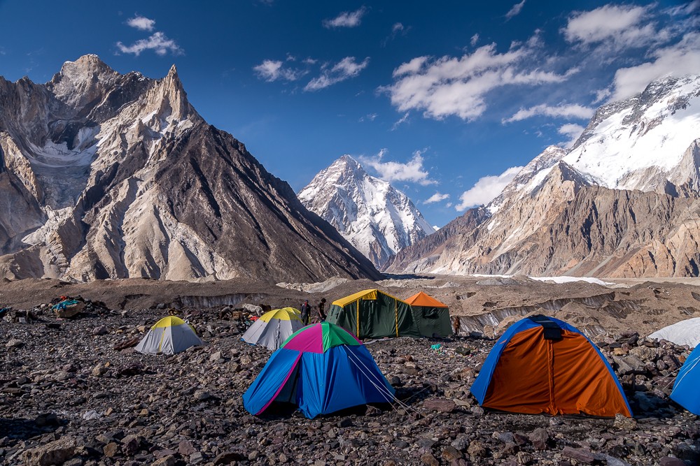
The huge rocky arena, where the colossal pyramidal peak of K2 stands sentry, makes Europe’s ranges look Lilliputian in comparison. K2 is flanked by five of the 17 highest mountains in the world. In fact, the massif is home to the world’s densest constellation of sky-scraping mountains – even more than the Everest massif in Nepal.
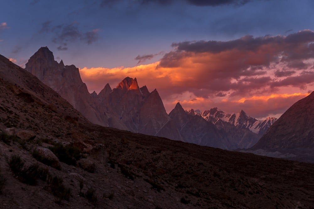
That evening, the surrounding mountains glowed warm in the evening light. Whether guide, porter or client, and despite the crisp chill in the mountain air, everyone in our group stood outside for hours that evening, soaking up the spectacle. We were all aware we stood in the presence of one of nature’s most glorious wonders.
K2 base camp
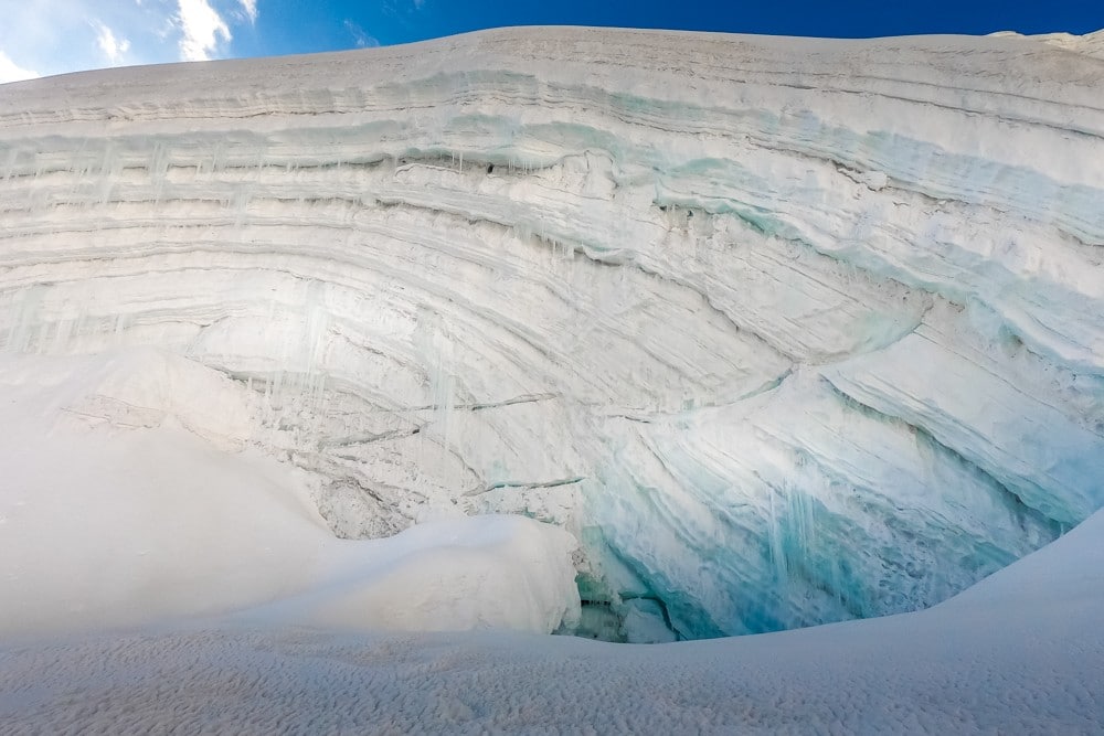
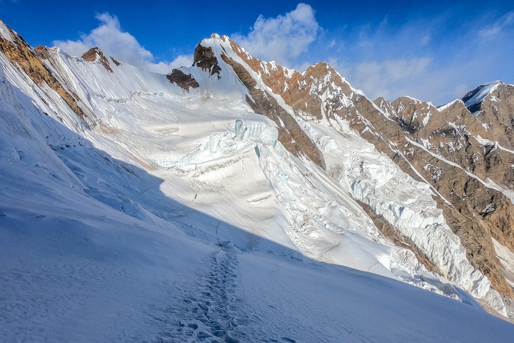
Back to the task at hand we were up early on day nine with a long footslog before us – K2 base camp was a challenging 12km hike up the Godwin-Austen Glacier. The first part of the morning was spent negotiating the ice field directly beside our camp. Numerous crevasses and glacial streams had to be crossed before we could get into our stride.
Some groups choose to camp overnight at either K2 base camp or Broad Peak base camp, which is also en route. We were keen to move on the following day towards the Gondgoro La pass so decided to complete the round trip in a single day.
The morning was overcast with K2 shrouded in thick cloud. As we moved up the glacier, the skies around us began to clear, but K2 remained stubbornly obscured. I was out ahead with another member of my team when we paused at Broad Peak base camp to speak to another group. I was surprised to hear that we were still over two hours from K2.
The mountain looms large above its surroundings, making distances deceiving. We’d been hiking for hours, but when looking ahead to K2 I could hardly tell if I was any closer. It was a disheartening feeling, but at least the clouds were beginning to clear.
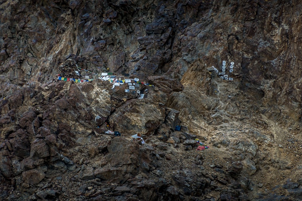
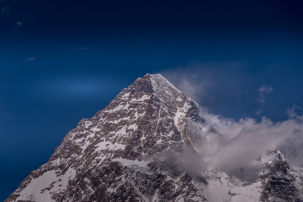
Finally, after nearly five hours of hiking, I arrived at the rock pile identifying the site of K2 base camp. Unlike at Everest base camp, there were no greeting signs and no sea of tents. It was late in the season and no one climbs this mountain in September.
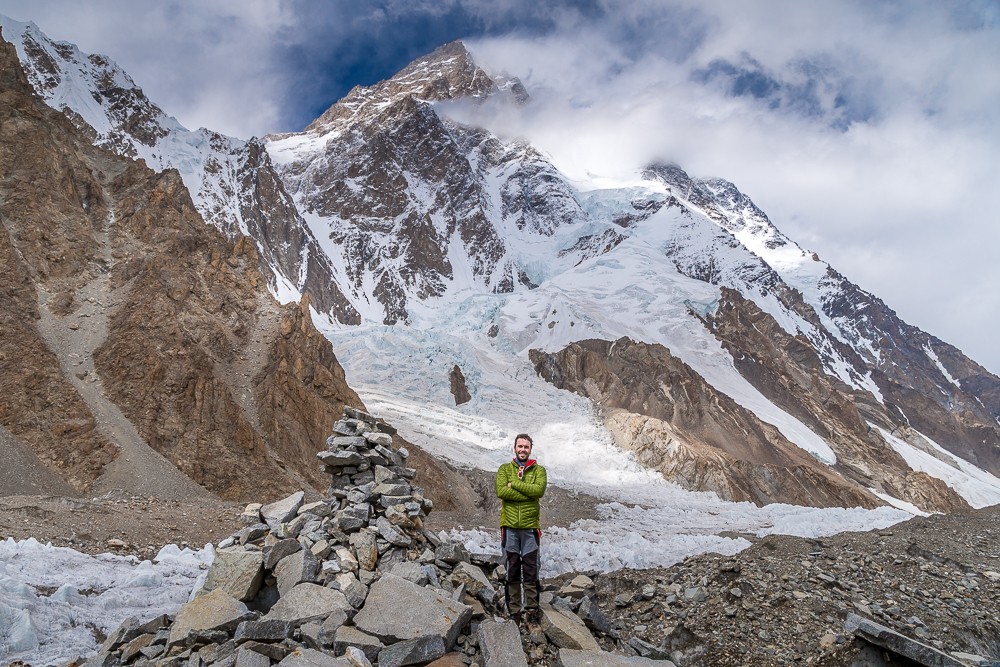
Legendary mountaineer Reinhold Messner described K2 as “the mountain of mountains” after completing the fourth ascent of the peak in 1979. “It is the most beautiful of all the high peaks,” he continued. “An artist has made this mountain.”
I can’t think of a more befitting description. The skies cleared enough to allow unobstructed views of the mountain between billows of white cloud. Above me rose the huge mass of K2, over two vertical miles of sinister rock and ice. I stood there gaping, as if paralysed, humbled before the mountain.
It was late in the afternoon and time to get back to Concordia. Descending along the same route, crunching down the glacier, took a third of the time it had taken earlier. Despite the faster descent, it was twilight by the time I made it back into camp, exhausted, but buoyed by an astonishing day’s hiking.
Atlas & BOots
More scenes from the long hike from Concordia to K2 and back again
Over the Gondogoro La Pass
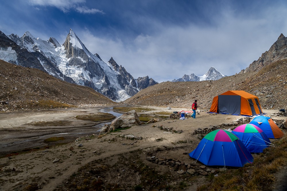
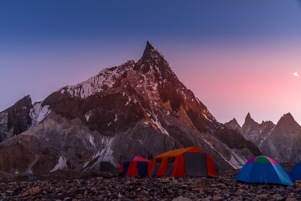
The following morning we had a late breakfast before pushing on to Ali camp, located along the Vigne Glacier to the south of K2. The hike was longer than expected, particularly as we were all tired from the previous day’s exertions.
We made it into camp late afternoon and were pleased to discover we would no longer be sleeping on the glacier. Instead, we moved off the ice onto the rocks at the edge of the glacier. Here, we enjoyed our third and final rest day in preparation for crossing the Gondogoro La Pass.
Atlas & BOots
Moving from Concordia to Ali camp
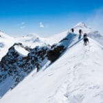
We were up at 10pm that night and headed off using our head torches to light the way to the base of the Gondogoro La Pass. Here, we strapped on crampons and grabbed our ice axes. Our guide had used the previous day for a recce and had fixed the initial ropes for us to use.
Once we had moved up the first set of ropes, I helped Abdullah fix the next set as the terrain began to steepen. As the only member of our group with some mountaineering experience, I was only too happy to lead some sections and help with the rope fixing.
Atlas & BOots
In the throne room of the mountain gods: crossing the Gondogoro La Pass
By around 5am, the sun was coming up and the surrounding peaks were bathed in light. As I was leading, I often found myself alone near the top of the pass. At times, I felt like the only man on the mountain.
To the northeast, all the eight-thousanders could be seen as well as innumerable other peaks and ridges. It was the most breathtaking mountain scenery I’ve seen. It was here that photographer and climber Galen Rowell found the title for his book and classic of mountaineering literature In the Throne Room of the Mountain Gods.
Finally, in early morning, we reached the zenith of the Gondogoro La Pass and looked out to the northeast along the striking Hushe Valley. The steep descent into Hushe Valley was a challenge to say the least! Ropes were available in places to help, but the terrain was often loose scree, which made it laboriously slow going.
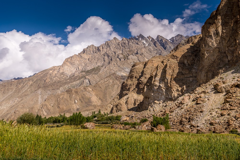
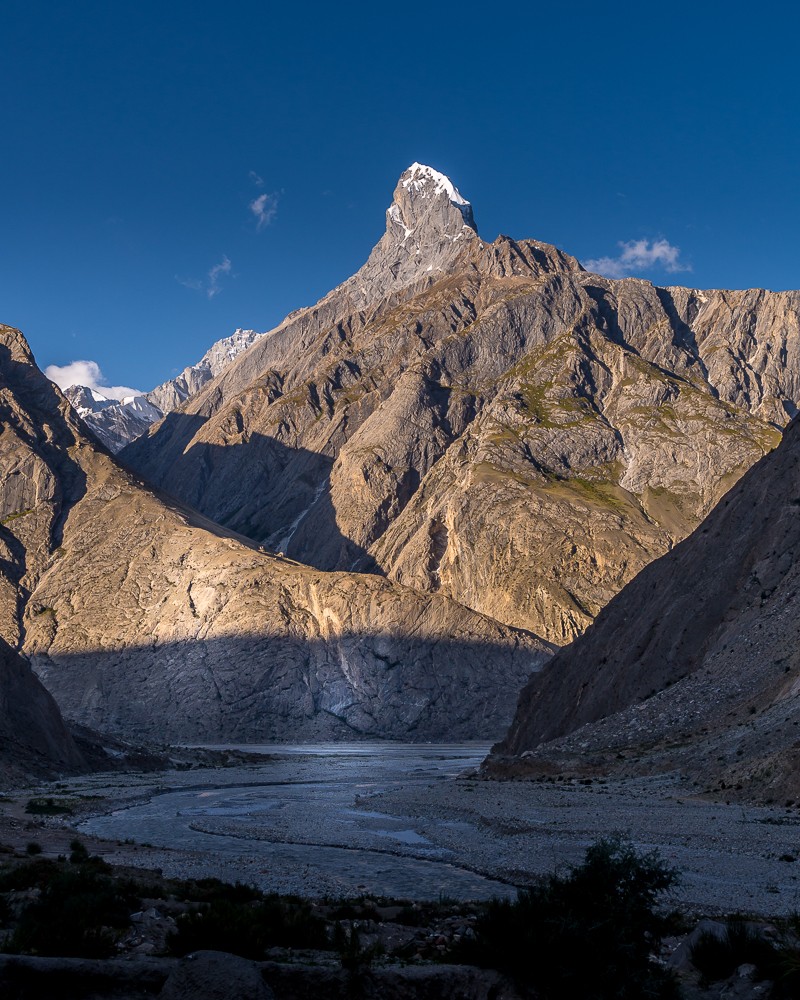
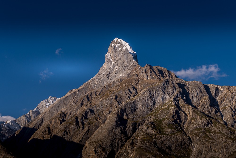
Finally, after 15 hours of hiking I arrived in Khuispan camp, located beneath the needlepoint summit of Laila Peak. At 6,096m (20,000ft), Laila Peak is one of the most beautiful mountains in the world. That night, we slept soundly upon soft ground and surrounded by the first greenery we’d seen in over a week.
The final two days of our trek were largely uneventful. After a short jaunt across the snout of a glacier, we joined a trail again and followed a route beside the Gondogoro Glacier southwards. As we were now off the glacier and rapidly dropping altitude, we quickly warmed up and were once again in shirtsleeves and light trousers.
Saicho campsite was our final stop of the trek where we camped within a small copse with a stream running through it. Our last day was a short and sweet march to the village of Hushe where we met a pair of 4WD vehicles for another bumpy ride back to Skardu.
Why the K2 base camp trek is so special
The K2 base camp trek is incomparable to trekking in Nepal. It is a tough slog to one of the most remote regions of the Greater Himalayas. Gone are the crowds and comforts of Nepal. Gone are the villages, teahouses and monasteries – even the trails are missing in sections.
Instead, the Karakoram mountains of Pakistan offer an alternative view of the highest peaks on Earth. Trekkers will find they have large amounts of time, and trail, entirely to themselves.
The K2 base camp trek, combined with the crossing of Gondogoro La Pass, traverses some of the most stunning scenery on the planet, the most humbling of which is located at Concordia where the world’s most majestic coliseum of high peaks is guarded by the crown of the Karakoram: K2.
Atlas & BOots
One of those sights which impress a man forever
I’ve read reams of literature on K2 over the years, but one quote from the splendidly named British explorer Francis Younghusband stands out. When Younghusband first laid eyes upon K2, he marvelled:
“It was one of those sights which impress a man forever, and produce a permanent effect upon the mind – a lasting sense of the greatness and grandeur of nature’s works – which he can never lose or forget.”
K2 is indeed one of those sights. My K2 base camp trek was filled with many of those sights. Sights that impress forever and will never be forgotten.
K2 base camp trek: the essentials
What: K2 base camp trek and crossing the Gondogoro La Pass in the Karakoram mountains, Pakistan.
Where: Before the trek I had a night in Rawalpindi where I stayed at the Grace Crown Hotel. In Skardu, our group stayed at Indus Motel. A night in Rawalpindi and a night either end of the trek in Skardu are included as part of the itinerary.
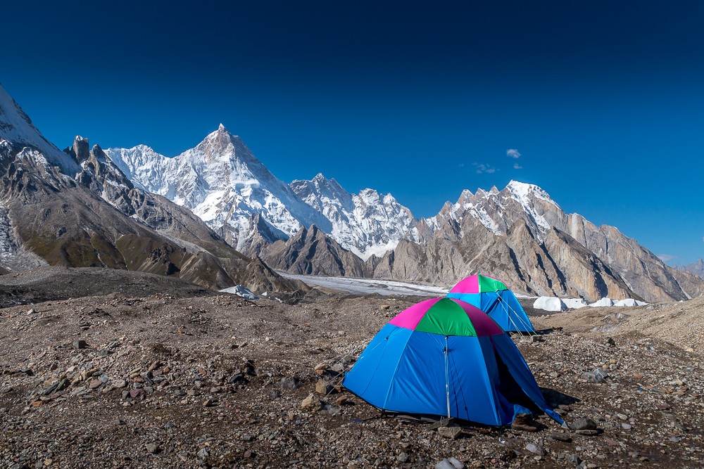
During the trek, all 14 nights are camping in two-man tents provided by Lost Horizon. Campsites are usually on rocky ground, but once onto the Baltoro Glacier you’ll likely be camping on ice until Ali camp, so make sure you pack a thick, warm camping mat or mattress.
Atlas & BOots
Our team of porters, cooks and guides was outstanding
Some of the campsites have simple drop-toilet facilities, but trekkers should plan for doing their business in the wild most of the time. Please do your utmost to leave no trace in the process. Urdukas is the only campsite with running water, albeit cold.
Upon return to Islamabad, I checked into the Ramada Islamabad for a touch of post-trek comfort. If you really fancy being looked after, then the Islamabad Marriott is an excellent choice surpassed only by the extravagant Serena.
When: The best time for the K2 base camp trek is from mid-June to mid-September with July and August being the optimum months. Before then, trekking is still possible, but until mid-June, excessive snow remains on passes and north-facing slopes, keeping any passes higher than 3,000m closed.
Most passes, including the Gondogoro La, are closed by the end of September when heavy snow returns. The mountain rescue support team near Gondogoro La depart in early September, so trekkers (as we did) will have to cross the pass unsupported after this time.
How: I joined Lost Horizon Treks and Tours on a Gondogoro La and K2 base camp trek. Lost Horizons is co-owned by Gilgit local Abdul Bari and Canadian Justin Stirrett. They have over 25 years of experience guiding in the region and offer a number of different trekking options. Head guide and Abdul Bari’s brother, Waheed, was our guide for the trek.
Prices start from around $2,000 USD, depending on dates and itinerary, for a round trip from Islamabad. The price includes all accommodation, all meals on the trek, an English-speaking local guide and assistants throughout the trek, porters to carry equipment between camps, the entrance fee to Central Karakoram National Park and all transport between destinations. Allow an extra $200 USD per person for tips.
Travelling from Islamabad to Skardu can be done via an overnight drive (included) or by a short flight which saves a day of driving on either side of the trek. If trekkers choose the flight option then budget an additional $150 USD each way.
Trekkers do not necessarily need mountaineering skills to cross the Gondogoro La, but experience using crampons and an ice axe will be of great help.
For more information or to book, contact Lost Horizons on +92 5811 455017 or +92 5811 457974. Alternatively, email on info@losthorizontreks.com.
Another option is to join a 21-day trek with Epic Expeditions. I joined them in Tajikistan and would recommend their approach to trekking in the remote regions of Central and South Asia.
I flew to Islamabad in Pakistan directly from the UK with British Airways. Book via Skyscanner for the best prices.
Enjoyed this post? pin it for later…
Currently, there are very few up-to-date Pakistan guidebooks available. Therefore, we recommend the waterproof 1:175,000 Karakoram Trekking Map by TerraQuest for the K2 base camp trek.