Hiking Great Shunner Fell was my first of the Dales 30, the highest peaks in the Yorkshire Dales. One down, 29 to go…
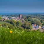
As many of you will know, Kia and I recently moved to the country. It’s taken me eight years, but I’ve finally convinced Kia that life is better away from the busy south. As such, we’ve moved to the small and charming market town of Richmond on the edge of Yorkshire Dales National Park.
As well as enjoying the delights of Richmond, the best thing for me about our move is having easy access to the countryside, right on our doorstop. It takes five minutes to drive into the national park, one of Britain’s 15 breathing spaces, while at the end of our street is a walking trail along the River Swale that gets us into the park in just 15 minutes.
After a few weeks of settling in and sampling the town’s numerous tearooms, it was time to do get stuck into some proper hiking in the Dales.
Introducing the Dales 30
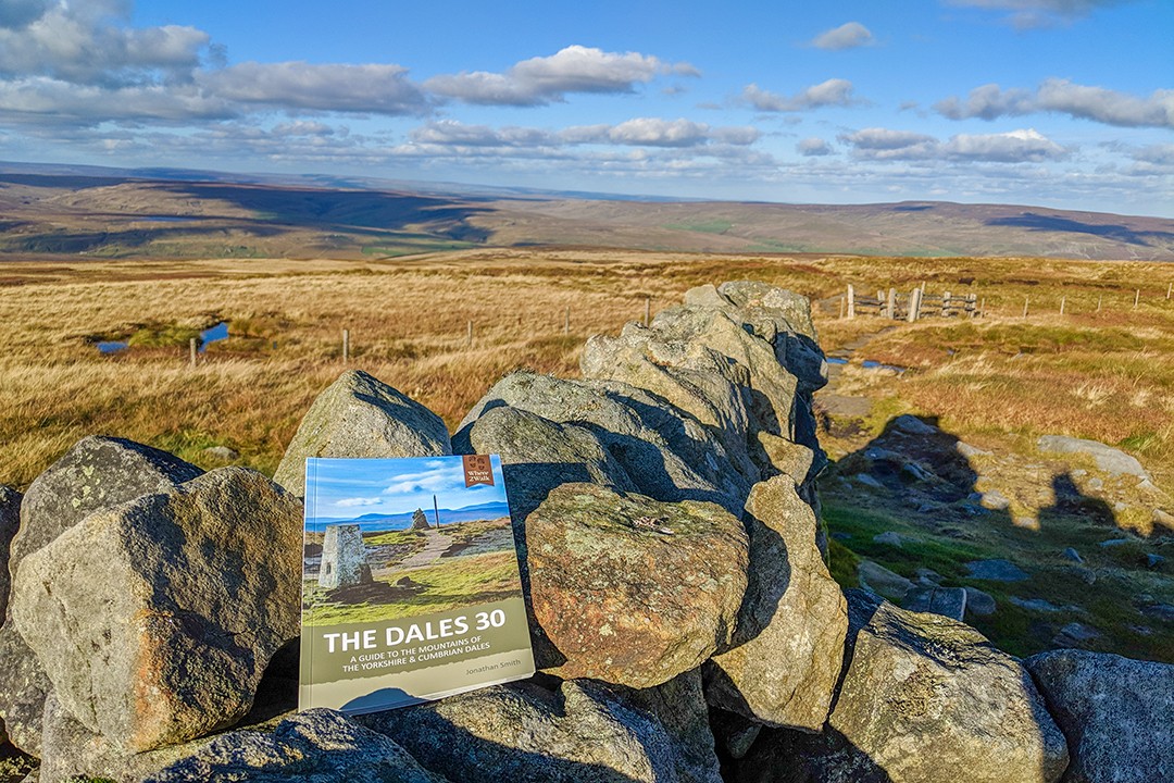
With all this countryside waiting to be explored, I didn’t know where to start. Fortunately, we attended an evening at the Richmond Walking & Book Festival where local hiking guide Jonathan Smith from Where2walk was discussing his book, The Dales 30.
The Dales 30 are the 30 summits in the Yorkshire Dales over 610m (2,000ft) – considered the general classification of a mountain in the British Isles – and also have a drop of at least 30m (98.4ft) on all sides. Jonathan has written a detailed Dales 30 companion guidebook filled with recommended routes, maps, facts and anecdotes.
They may not be as dramatic as the Munros of Scotland or as popular as the Lake District Wainwrights, but the Dales 30 account for a fine segment of the highest mountain range in England, the Pennines.
The mountains and their summit trails also showcase some of the most remote and picturesque scenery England has to offer. The Dales 30 in particular present the perfect opportunity for me to get to grips with the wilds of my new home.
| Rank | Mountain | Height (m) | Height (ft) |
|---|---|---|---|
| 1 | Whernside | 736 | 2,415 |
| 2 | Ingleborough | 724 | 2,375 |
| 3 | Great Shunner Fell | 716 | 2,349 |
| 4 | High Seat | 709 | 2,326 |
| 5 | Wild Boar Fell | 708 | 2,323 |
| 6 | Great Whernside | 704 | 2,310 |
| 7 | Buckden Pike | 702 | 2,303 |
| 8 | Pen-y-Ghent | 694 | 2,277 |
| 9 | Great Coum | 687 | 2,254 |
| 10 | Swarth Fell | 681 | 2,234 |
| 11 | Plover Fell | 680 | 2,231 |
| 12 | Baugh Fell, Tarn Rigg | 678 | 2,224 |
| 13 | The Calf | 676 | 2,218 |
| 14 | Lovely Seat | 675 | 2,215 |
| 15 | Calders | 674 | 2,212 |
| 16 | Great Knoutberry Hill | 672 | 2,205 |
| 17 | Rogan’s Seat | 672 | 2,205 |
| 18 | Dodd Fell Hill | 668 | 2,192 |
| 19 | Fountain’s Fell | 668 | 2,192 |
| 20 | Little Fell | 667 | 2,188 |
| 21 | Simon’s Fell, Ingleborough | 656 | 2,133 |
| 22 | Yockenthwaite Moor | 643 | 2,110 |
| 23 | Fell Head | 640 | 2,100 |
| 24 | Yarlside | 639 | 2,096 |
| 25 | Gragareth | 628 | 2,060 |
| 26 | Darnbrook Fell | 624 | 2,047 |
| 27 | Randy Gill Top | 624 | 2,047 |
| 28 | Drumaldrace, Wether Fell | 614 | 2,014 |
| 29 | Birks Fell | 610 | 2,001 |
| 30 | Calf Top | 610 | 2,000 |
Great Shunner Fell
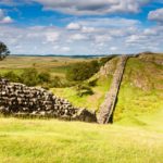
I decided to kick things off by hiking Great Shunner Fell located in the Northern Dales, between Wensleydale and Swaledale. Great Shunner Fell, at 716m (2,340ft) is the third highest peak on the Dales 30 list.
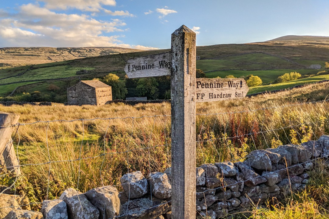
Great Shunner Fell is conveniently located on the Pennine Way, a 429km national trail running from the Peak District and crossing the Yorkshire Dales on its way up to the Scottish border. This means that much of the hiking route is along a clearly defined and well-trodden trail with little opportunity for error.
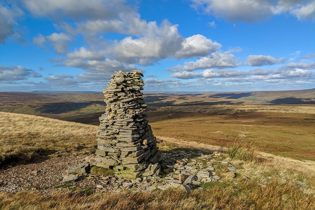
The reasonably gentle yet constant ascent winds its way up a rocky trail along dry stonewalls to begin with before opening out onto more marshy outcrops and moorland. The trail is easy to follow throughout and is regularly marked by cairns particularly as you near the summit.
At the summit is a large cross-shaped windbreak and triangulation pillar. Here, it’s possible to shelter from the wind no matter what direction it’s blowing and enjoy sweeping views stretching across the surrounding moorland.
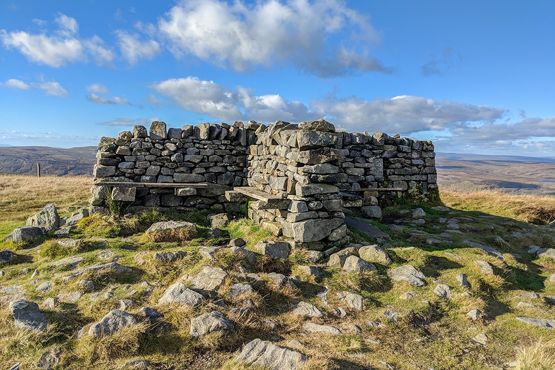
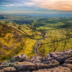
To the west you can see the Howgill Fells in the foreground with the fringes of the Lake District fells further on. It’s also possible to see the cairns of Nine Standards Rigg to the north along with the road up to the Tan Hill Inn, Britain’s highest pub.
To the south are views across Swaledale (our home dale), Lovely Seat, Buckden Pike and the summits of Pen-y-ghent, Ingleborough and Whernside that make up the Yorkshire Three Peaks.
Hiking Great Shunner Fell from Thwaite
Height: 716m (2,340ft)
Distance: 11km
Duration: 2-3 hours
There are several route options available for hiking Great Shunner Fell, the most popular of which are from the villages of Hawes, Hardraw and Thwaite. I began and finished at Thwaite, a simple straight-up-and-down along the Pennine Way which crosses the village.
A popular option is to combine hiking Great Shunner Fell with Lovely Seat, another Dales 30 peak located nearby.
Hiking Great Shunner Fell: the essentials
What: Hiking Great Shunner Fell from Thwaite in Yorkshire Dales National Park, England.
Where: We live in the nearby market town of Richmond, located on the eastern edge of Yorkshire Dales National Park. There are numerous accommodation options, from campsites to luxury hotels throughout the national park as well as in the surrounding gateway towns and villages.
The best way to find accommodation is to use the interactive map section on the Yorkshire Dales website or similarly through Booking.com.
When: Alas, you’re rarely guaranteed a completely dry period in England, but the best time for hiking Great Shunner Fell and in the Yorkshire Dales is from June to August. It is without doubt the driest and warmest time of the year.
However, it’s also peak season and availability could be an issue, particularly during the school holidays from the end of July through August. The shoulder seasons (Apr-May and Sep-Oct) are also a good time to visit although the weather will invariably be colder and wetter.
How: There are many ways to explore the Yorkshire Dales. The national park is small enough to explore by foot or bicycle if you’re not in a rush to get from one place to another. With plenty of car parks throughout, many prefer to travel around the park with a car, stopping at villages and trailheads.
There are local transport options available including train, bus and coach. For the latest up-to-date information on accessing the Yorkshire Dales, see the transport section of their website.