We share the best hiking apps to download this year, from navigation and route planning to first aid and stargazing
Occasionally, when Kia and I are driving somewhere remote – the Kalahari in Namibia, say, or the Australian Outback – she will remark on the fact that travellers used to do this with only paper maps. Unlike me, Kia grew up in inner city London and had little opportunity to venture into the outdoors. As such, she never learnt how to use a compass and map or how to build a campfire, or any number of the skills a frequent hiker should have.
Thankfully, a host of hiking apps has made the outdoors less daunting for novice and experienced hikers alike. While it’s still important to master basic skills, these apps have made it easier than ever before to venture into nature. To help you get started, we have gathered the best hiking apps to download in 2026.
Best hiking apps to download in 2026
Below, we take a look at the best hiking apps, based on user ratings in the App Store and our own experiences on a host of treks including the Arctic Circle Trail, Aconcagua, Everest Base Camp trek and K2 Base Camp trek.
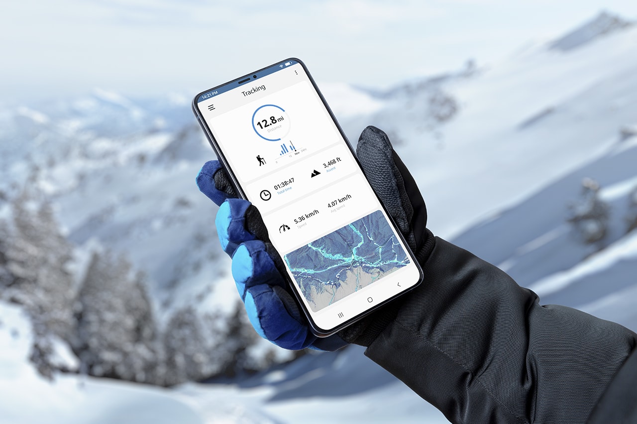
1. AllTrails
Platforms: iOS, Android
Price: Basic Free; Pro from $35.99 per year
Great for: Connecting with a global community of hikers

Covering over 500,000 trails and with 3.5 million downloads, AllTrails is one of the most popular hike-planning apps available.
The free version allows you to create your own trails with GPS tracking, photos and text, and save or share them with others. The paid membership allows you to save routes offline and design and print custom maps.
AllTrails has a global community of users and offers detailed reviews and inspiration from tried-and-tested trails. It allows you to easily share your adventures and grow your own community of fellow hikers.
2. Gaia GPS
Platforms: iOS, Android
Price: Basic Free; Premium $59.90
Great for: Navigation

Gaia GPS is an outdoor navigation app providing access to a rich catalogue of maps including topographical, satellite, road and the NatGeo Trails Illustrated map series.
As well as tracking hikes while measuring pace, distance and elevation as standard, it is also possible to download a range of offline maps for off-grid access. The app and accompanying web-based version allow for printing too.
The interface is intuitive and users can import and synchronise data points and trails from other digital sources. The app is free, but the best of its features are accessed via the paid version.
3. MapMyWalk
Platforms: iOS, Android
Price: Basic Free; Pro $10.99 per month, $37.99 per year
Great for: Fitness

This is a great community-based walking and fitness app that allows you to record your activity and log your food intake to track calories and nutritional content. You can also sync the app to a wearable device and connect with friends and other walkers to stay motivated.
The app’s premium level unlocks advanced fitness features such as heart rate analysis and personal training plans. It is best for urban walks rather than backcountry hiking but is a worthy addition to your bank of apps.
4. FarOut
Platforms: iOS, Android
Price: Basic Free; individual hikes from $13.99
Great for: Thru-hiking

FarOut is one of the best hiking apps for thru-hikers. With detailed maps covering thousands of miles of trail routes and over 10,000 waypoint details, it is the app of choice for hikers on the Appalachian Trail, Pacific Crest Trail and Continental Divide Trail.
Waypoints include water sources, shelters, campsites, road crossings, trailheads, junctions, viewpoints, peaks, parking and many others while town guides include accommodation, restaurants, resupply, laundry, post offices, shops, historical sites and more.
Hikers can create custom routes with the app’s route builder tool and stay up to date with photos and comments shared by other hikers.
5. PeakVisor
Platforms: iOS, Android
Price: Basic Free; Pro $9.99 per month for Hiking & Skiing, $39.99 per year for Hiking & Skiing, $159 per year for 3D Maps and AR Peak Finder
Great for: Identifying mountains

PeakVisor is the best app for mountain walking as it instantly recognises the name of any mountain peak that comes into view using a combination of your phone’s camera, location tracking and a high-precision 3D mountain panorama.
It provides a detailed profile for each peak including altitude, topographic prominence, mountain range and the national parks or reserves it may belong to, as well as photos and relevant entries on Wikipedia.
PeakVisor includes detailed 3D maps, allowing you to preview trails, summits, passes, viewpoints and parking before setting foot on the trail.
6. Spyglass
Platforms: iOS, Android
Price: $3.99 per month, $29.99 per year
Great for: Stargazing

One of the coolest outdoor apps available, Spyglass is also by far the most visually impressive. A complete GPS toolkit is available with the usual tracking features but combined with a stunning augmented reality view.
The app also incorporates a heads-up display, a high-quality compass with map overlays, a gyrocompass, a speedometer, an altimeter, an astronomical object finder, a sextant, an inclinometer, an angular calculator and more.
7. OS Maps
Platforms: iOS, Android
Price: Basic Free; Pro $6.99 per month, $34.99 per year
Great for: Hiking in the UK

If you live in the UK then you will probably know that Ordnance Survey is the home of British mapping and has been for centuries. Whether you’re hiking or cycling, Ordnance Survey produces the UK’s most detailed leisure maps.
Their accompanying apps are simple to use, feature-rich and an excellent addition to paper maps.
The route-plotting feature is a bit clunky and needs some improvement, but for navigation purposes (i.e locating your position on the UK’s most detailed maps) the app is excellent.
Its augmented reality feature allows users to pan the landscape to see what’s nearby, including hills and mountains, forest and woodland, transport, settlements, coast and water.
8. Geocaching
Platforms: iOS, Android
Price: Basic Free; Pro $5.99 per month, $29.99 per year
Great for: Geocaching

This is the app of choice for geocachers across the world. Whether you’re off to find your first geocache or your thousandth, this app will aid you through the adventure.
Access details of geocaches near you, complete with a description of attributes and all recent activity. Navigate to the cache using a map, compass or driving directions and learn about trackables: geocaching game pieces that travel from cache to cache.
Pro users can filter geocaches by size, type, difficulty, terrain, and found/owned, and sort by name, distance or favourite points.
9. iNaturalist
Platforms: iOS, Android
Price: Free
Great for: Nature walks

Developed by the National Geographic Society and California Academy of Sciences, iNaturalist encourages hikers to contribute to biodiversity science.
Hikers are invited to record observations and encounters such as an unusual butterfly or unknown plant species through the app. Users’ findings are then shared with scientific data repositories like the Global Biodiversity Information Facility to help scientists find and use the data.
The end result is that hikers become ‘citizen scientists’ and help really smart people with their important work of protecting animals and conserving nature.
10. Knots 3D
Platforms: iOS, Android
Price: $5.99
Great for: Learning knots

Featuring over 135 knots, Knots 3D is the go-to reference for climbers, arborists, fishermen and firefighters all across the globe.
Users can watch a knot draw itself or use a finger to tie and untie the knot to see where the virtual rope goes in and out and around.
The 3D knots are arranged by category (climbing, boating, fishing etc) and type (bend, loop, stopper), and are listed with detailed reference information including tying pointers, strength and reliability, structural information and Ashley reference numbers (ABoK).
11. Weather & Radar
Platforms: iOS, Android
Price: Basic Free; Pro from $9.99 per year
Great for: Weather planning

Weather & Radar offers specifics on temperature, rain, probability of precipitation, snow, wind, sunshine hours, sunrise and sunset as well as detailed displays of air pressure, humidity and UV-Index.
It includes hourly and daily weather forecasts, a 14-day weather outlook, a worldwide live weather map and personalised notifications for your area.
Users can trace the movement of cloud formations and active storms to see if they will hit or bypass specific locations. Users can also track the wind, including wind direction and peak gusts, allowing them to hike in peace.
12. Cairn
Platforms: iOS, Android
Price: Basic Free; Pro $4.99 per month, $26.99 per year
Great for: Safety

Cairn has been called ‘the ultimate hiking safety app’ and is an essential part of our safety kit, especially when hiking solo.
Cairn crowdsources cell coverage spots and shows you where others have found coverage on the trail, broken down by carrier. This is useful if you need to update your loved ones or indeed make an emergency call.
You can configure the app to send updates to named contacts at the start and end of each trip as well as an ‘overdue’ notification if you don’t check-in. Cairn also allows you to download topo maps offline and navigate the trail with stats, making the premium version one of the best hiking apps for hiking solo.
13. First Aid by British Red Cross
Platforms: iOS, Android
Price: Free
Great for: Medical emergencies

The British Red Cross First Aid app provides pre-loaded content offering instant access to safety information and expert advice for everyday emergencies.
There are videos, diagrams, interactive quizzes and simple step-by-step advice to help users deal with and prepare for a range of emergencies.
14. Recreation.gov
Platforms: iOS, Android
Price: Free
Great for: US national parks

Recreation.gov is the perfect companion to the official NPS app, although it isn’t just limited to national parks as it covers all outdoor recreational areas across the US.
The app helps users find and reserve campsites, buy passes, review location details for upcoming trips, access information about reservations and even enter lotteries for in-demand experiences.
It also has an incredibly useful ‘scan & pay’ feature for participating campgrounds to streamline the check-in process so users can arrive out of hours, bypass waiting in line or avoid carrying cash.
The app has over 100,000 individual locations and is continuously adding new campsites, tours, passes and other activities at federal recreation sites across the US.
15. Hipcamp
Platforms: iOS, Android
Price: Free
Great for: Finding and booking campsites

Hipcamp works with private landowners, campgrounds and RV sites in the UK, US, Canada and Australia to help users find a spot everywhere from national parks to blueberry farms.
Users can browse an interactive map to find ‘Hipcamps’ along their route, view real-time availability, check community photos and reviews, and plan last minute with bookings right up until the hour of their trip.
Enjoyed this post? pin it for later…