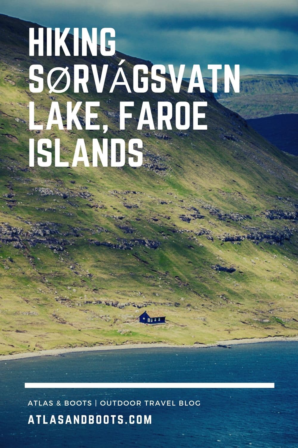
Blessed with a spell of good weather, we set off to Sørvágsvatn where the largest lake in the Faroe Islands stretches into the ocean
Sometimes, in the dead of British winter, I’ll console myself with the fact that at least I’m not on Cotopaxi. At least I’m not on Cotopaxi. Our 2015 glacier hike on Cotopaxi Volcano was probably the coldest I’ve ever been. My fingers were rendered immobile and my feet were hunks of ice and still we trudged on through rain, sleet and snow.
Haunted by the memory of that testing trip, I pulled on a base layer, a mid-layer, a light fleece, a thick fleece and a waterproof jacket ahead of our hike to Sørvágsvatn Lake. After all, we were in the Faroe Islands, hardly known for summer sun.
This remote clutch of 18 islands lies in the Atlantic Ocean roughly halfway between Iceland and Norway. Its untamed beauty promises many things – adventure, seclusion, mystery and drama – but sun is not one of them.
Luckily, we arrived in a spell of good weather, perfect for hiking Sørvágsvatn Lake. We drove 40km from the capital of Tórshavn to Sørvágsvatn on the neighbouring island of Vágar. Ensconced in all my layers, I stepped out of the car, pretty sure I’d keep all my fingers.
We entered through a gate marking the trailhead and were greeted by a local. We had read that the Faroese were a stoic lot and preferred actions to words and silence to small talk. As such, we nodded hello.
It turned out he wasn’t greeting us for the sake of it; there was now an entrance fee and he was there to collect it.

We learned that hiking Sørvágsvatn Lake would cost us DKK200 per person – a rather painful $30 USD each – making it the most expensive day hike we’ve ever attempted. The path cuts through private land and is one of several in the Faroes with hiking restrictions and mandatory fees. No matter. We were in the Faroes which don’t come for free.
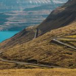
We set out along the path, an easy 45-minute walk along the lip of the lake. At more than 6km in length, Sørvágsvatn is the biggest lake in the Faroe Islands. Its prominence may explain why it’s also a source of contention. Locals in the area disagree over the name of the lake.
The residents of Sørvágur to the west prefer Sørvágsvatn, which means “the lake by Sørvágur” while the residents to the east prefer Leitisvatn, which means “the lake by Leiti”. The tourist board tactfully uses both.

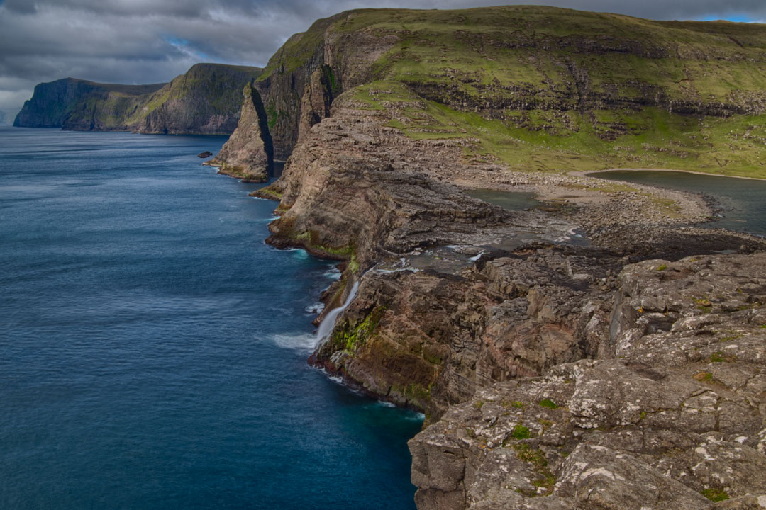
We walked through picturesque peat meadows towards Trælanípa (Slave Cliff), a perpendicular rock wall that juts 142m upward from the sea. Trælanípa is said to have earned its name in the Viking Age when unwanted slaves were pushed off the wall and abandoned to the sea.
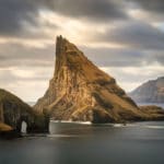
The promontory at Trælanípa is famous for its view of “the lake over the ocean”. Photographed a certain way, it looks like Sørvágsvatn Lake looms on the cliffs high above the ocean. In truth, it lies behind the cliff, only 30-40m higher than the sea.
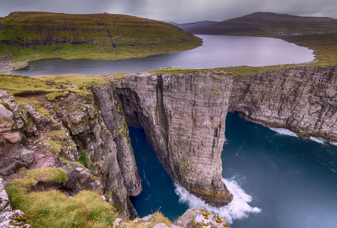
The high cliffs around Sørvágsvatn Lake keep it from emptying into the North Atlantic except through Bøsdalafossur waterfall. Here is the literal meeting place of a lake and an ocean.
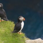
Save the charming puffins in Mykines, hiking to Sørvágsvatn Lake was the highlight of our trip, which slightly eased the sting of the fee.
Having walked the length of the lake, Peter was now keen to walk the width (as is in his nature). Jagged rocks and hulking boulders formed a natural causeway and so we set off for the other side.
“Are you sure we’re allowed to do this?” I asked, picking a careful path across.
“Of course,” said Peter, cavalier as ever. “It was on the map,” he declared confidently.
On the far side, I crouched in a hollow between two rocks, taking shelter from the wind while Peter took more photos. At one point, he came precariously close to losing his tripod over the edge of the cliff.


Atlas & BOots
Before long, we retraced our route across the causeway and rejoined the official path. It grew sunnier and I started to shed my layers. In the Faroes, adding and shedding layers must constitute a national pastime given the constantly changing weather. This can get a little tiring, but the Faroes are worth the extra effort.
These wild isles exceed the hype, and thrum with the legend of Viking blood. Deep valleys absent of trees, wave-lashed headlands and plunging cliffs all evoke lore and myth. We don’t know if we’ll be back, but we’ll certainly try with all our might.
Hiking Sørvágsvatn Lake: tips
- Weather can change abruptly so make sure you pack layers
- Bear in mind that the hike costs DKK200 ($30 USD) per person
- Pause at the promontory at Trælanípa for the famous view of “the lake over the ocean”
- Be careful near the edges as it can grow suddenly windy
- Visit the nearby Trollkunfinger after hiking Sørvágsvatn Lake
Hiking Sørvágsvatn Lake: the essentials
What: Hiking Sørvágsvatn Lake in the Faroe Islands.
Where: We stayed at The Old Millar House, a charming cottage 1km from the centre of town. The cottage is warm and cosy with a traditional turf roof and access to a grotto-like garden.
There is a beach meters away (though it might be too chilly for swimming!) and the Sandá river runs practically past the doorstep. If you’re keen to sample the Faroese nightlife, you may wish to stay closer to the centre, but for those happy to retreat to cosy evenings, the Old Millar House is an excellent option.
Click here to get a discount on your first stay with Airbnb or find alternative accommodation via Booking.com.
Booking.comWhen: The best time to visit the Faroe Islands is from May to September. Late spring brings longer days (perfect for hiking), wildflowers and, of course, puffins. From mid-June to mid-August is when the puffins flock to land to nest. For two weeks on either side, you are still likely see some.
How: Hiking Sørvágsvatn Lake costs DKK200 ($30 USD) per person. Hikers can pay the fee with card or cash on arrival. The price includes a tea or coffee in the portacabin at the trailhead. There are also toilets onsite.
We hired a car from 62°N Car Rental and navigated our way to the trailhead using ‘Sørvágsvatn’ in Google Maps. Driving in the Faroe Islands is straightforward with the roads in good condition, easy to navigate and rarely busy. There is free parking at all the major sights. The parking lot at Sørvágsvatn is reached via a short section of gravel road. Read our guide to driving in the Faroe Islands for more information.
We flew to the Faroe Islands with Atlantic Airways. Book flights via Skyscanner.
Enjoyed this post? pin it for later…