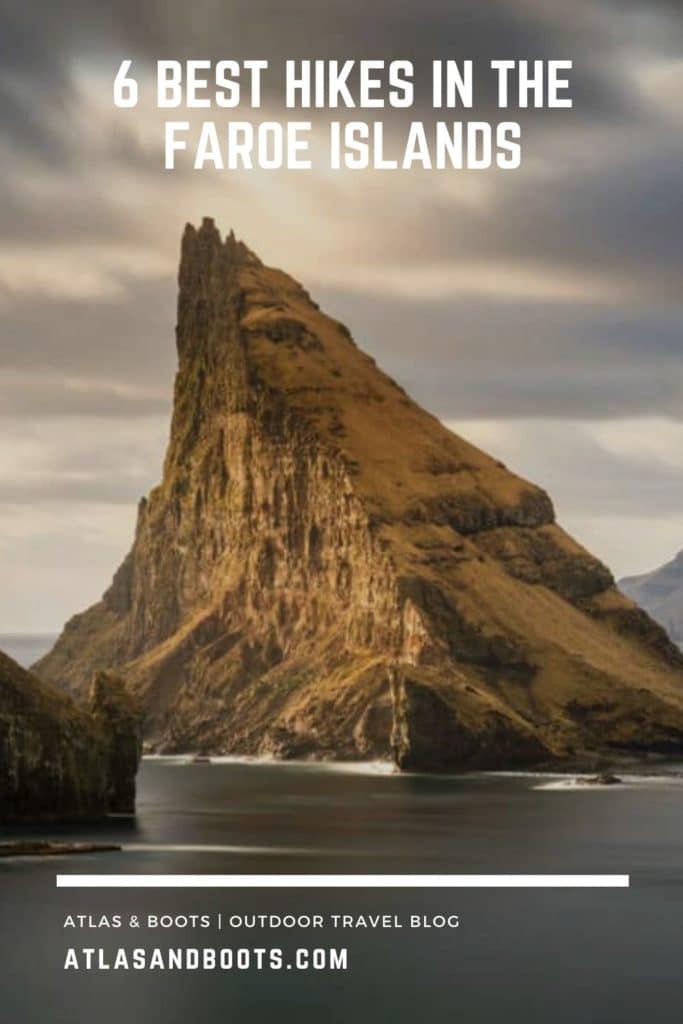
Deep in the North Atlantic, there is a volcanic archipelago protruding from the untamed waters between Iceland and Norway. This remote clasp of 18 basalt rocks make up the Faroe Islands and are home to stirring fjords, dramatic cliffs and sweeping glaciated valleys.
These islands are repeatedly and relentlessly buffeted by the swells and squalls of the tempestuous Atlantic Ocean. As such, the Faroes feature some seriously exciting hiking trails with equally extraordinary scenery.
In the Faroe Islands, you are never more than 5km from the sea so steep coastal cliffs, barbed sea stacks and foaming ocean spray is par-for-course when hiking. Add turf-roof villages, cascading waterfalls and a wealth of charming birdlife, and the Faroes make for an outstanding hiking destination.
We didn’t miss the opportunity to hit the trail on our visit and found some real hiking gems. Below, we take a look at the best hikes in the Faroe Islands.
Best hikes in the Faroe Islands map
The map below shows the best hikes in the Faroe Islands plotted on a downloadable Google Map.
1. Gjógv
Distance: 9km
Duration: 2-3 hours
Difficulty: Moderate
The northernmost village on the island of Eysturoy, Gjógv is named after a 200m gorge that runs from the village into the ocean. There are several trails in the area leading to viewpoints, but the finest by far is the steep trail leading along the clifftop into the Ambadalur Valley.
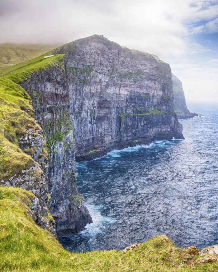
Atlas & BOots
With the foaming North Atlantic never far away, the dramatic escarpment towers above the village, offering striking views in all directions. Once you turn away from the coast and cross the valley, the giant sea stack of Búgvin appears, before the trail loops around back towards the village.
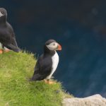
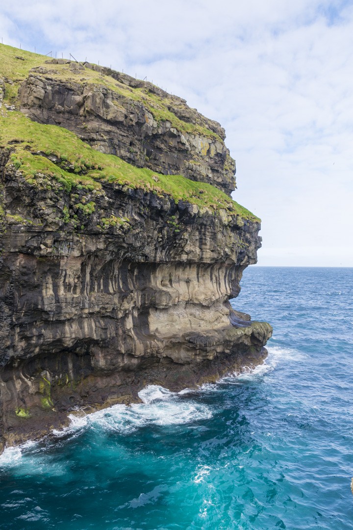
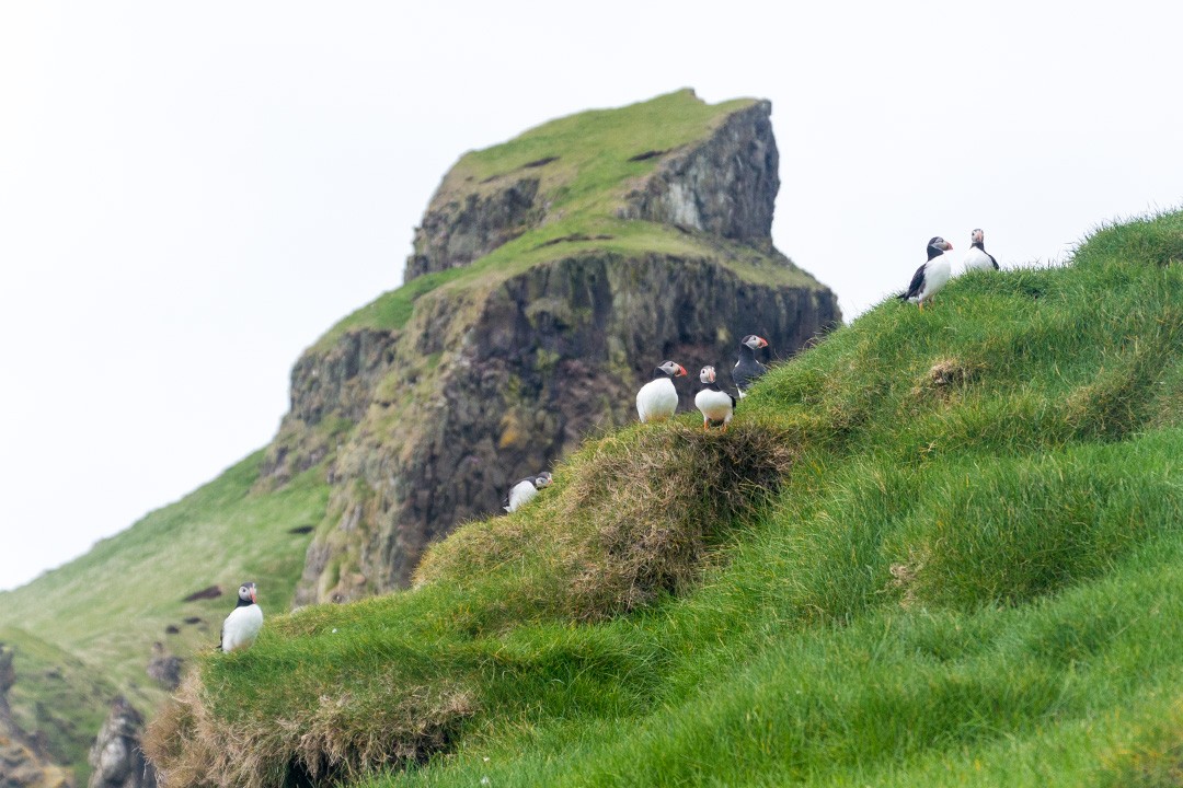
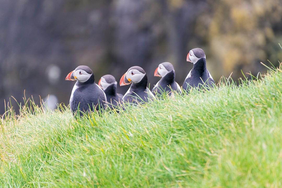
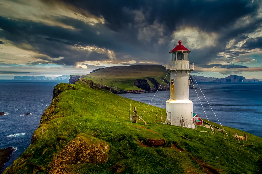
2. Mykines
Distance: 7km
Duration: 2-3 hours
Difficulty: Easy
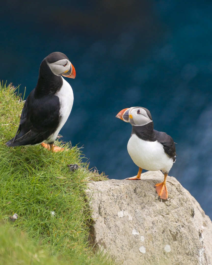
Mykines is the westernmost island of the Faroes and home to a large colony of Faroese or Atlantic puffins. The carless island with its colourful dwellings, wave-battered cliffs, frothing ocean views and distinctive lighthouse is thoroughly beguiling in its own right. However, it is the charming puffins nestled on the clifftops that really steal the show.
Atlas & BOots
We were slightly too early for the height of nesting season which runs from mid-June to August, so most of the puffins were still at sea. That said, we were thoroughly enchanted by the dozens of puffins we did happen to encounter.
Mykines is the most fragile of the Faroe Islands and visitors are therefore required to follow strict guidelines while hiking. Would-be hikers must pay a DKK100 ($15 USD) fee for using the trail. Read our post on Mykines to learn more about one of the best hikes in the Faroe Islands.
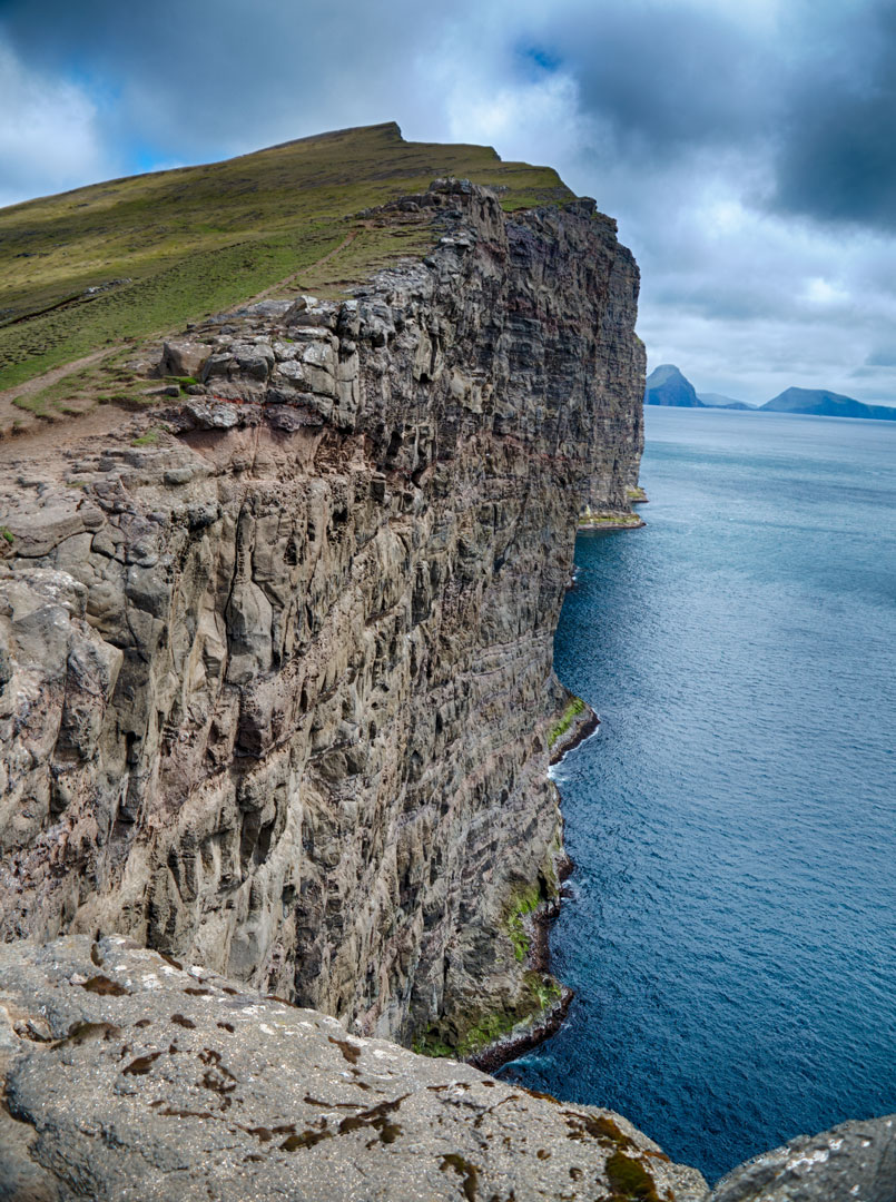
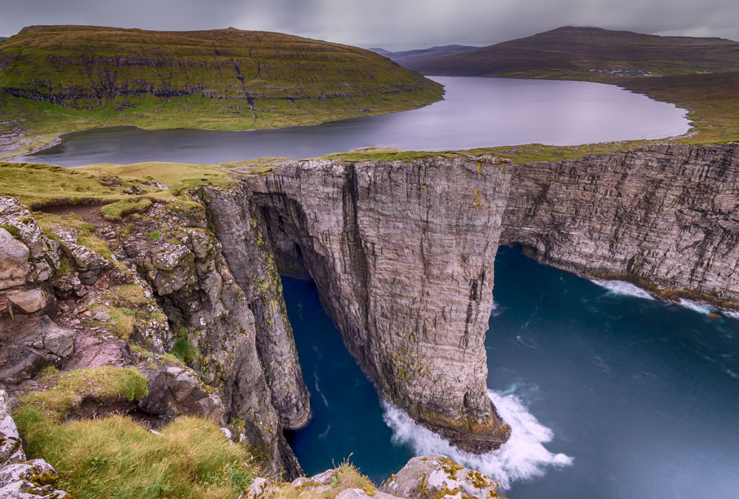
3. Lake Sørvágsvatn
Distance: 9km
Duration: 3-4 hours
Difficulty: Easy
One of the most popular hikes in the Faroes is the hike along the shores of Lake Sørvágsvatn to the viewpoints at Trælanípa and Bøsdalafossur waterfall. The trail skirts the lake, which is the largest in the Faroe Islands, before branching off up the Trælanípa escarpment.
Trælanípa (Slave Cliff) supposedly got its name from when Vikings pushed their unwanted slaves into the ocean.
ATLAS & BOOTS, SHUTTERSTOCK
Looking back towards the lake from the cliffs of Trælanípa gives the impression that Sørvágsvatn sits on the clifftops far above the ocean (when it, in fact, sits some distance back and is only 30-40m higher). The route continues round the promontory to Bøsdalafossur waterfall where the lake meets the ocean. Further on is the distinctive sea stack of Geitisskoradrangur.
Lake Sørvágsvatn is one of a number of trails on the islands to charge a fee for walking on private land. Starting in 2019, visitors are required to pay DKK200 ($30 USD) per adult to hike the trail.
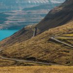
4. Slættaratindur
Distance: 7km
Duration: 2-3 hours
Difficulty: Moderate-hard
At 880m (2,890ft), Slættaratindur is the highest mountain in the Faroe Islands. The name translates as ‘flat summit’ and on a clear day, all 18 islands of the Faroe Islands can be seen from the summit.
It’s possible to hike to the summit from the village of Gjógv, which takes around four hours. However, most make the much shorter hike from the parking spot by the roadside near Eiðisskarð. You can either hike directly up to the summit and return the same way (quickest) or loop round to the left after the summit to enjoy more of the views to the west.
If you find yourself in the Faroes over the summer solstice (the longest day of the year falling between 20th and 22nd June) then you should join the Faroese who traditionally climb to watch the sun set late in the day and rise again shortly afterwards.
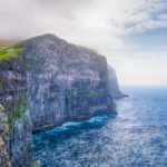
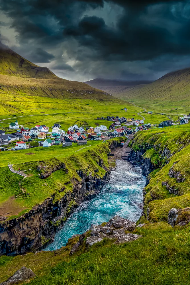
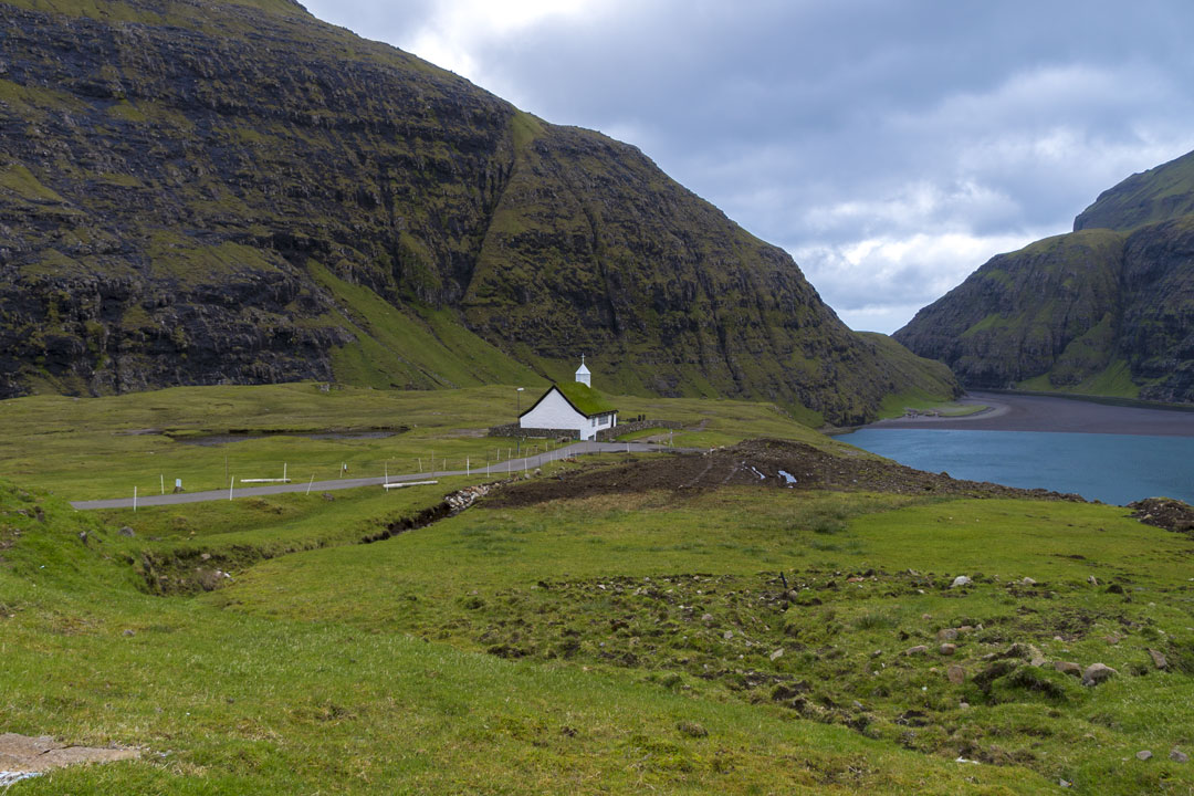
5. Saksun to Tjørnuvík
Distance: 14km
Duration: 5-6 hours
Difficulty: Moderate-hard
The remote village of Saksun is a popular sightseeing spot on the island, but few of the visitors make the hike up and over Tjørnuvíksskarð pass to the neighbouring village of Tjørnuvík.


Atlas & BOots
Saksun
Positioned alongside a lagoon in a natural amphitheatre, the tiny and isolated village of Saksun with its turf roofs, lonesome church and just 14 inhabitants is known for its tranquil atmosphere and dramatic surrounding mountains. Most visitors will just stroll down to the sandy shores and visit the unique standalone church.
However, the straightforward hike following a series of cairns to Tjørnuvík is a deeply rewarding one. The descent towards the village has excellent views throughout of the needle-like sea stacks of Eiðiskollur at the tip of the adjacent island of Eysturoy.
If you can organise transport, this can be done as a one-way hike, cutting the distance and time in half. Likewise, it can also be done in reverse starting at Tjørnuvík although the best views will always be behind you.
6. Drangarnir
Distance: 12km
Duration: 3-4 hours
Difficulty: Moderate
The famous sea stacks at Drangarnir and the islet of Tindhólmur are some of the most recognisable landmarks (seamarks?) in the Faroes. Images of them are used in endless promotional materials, from the national airline’s in-flight magazine to local salmon farms.
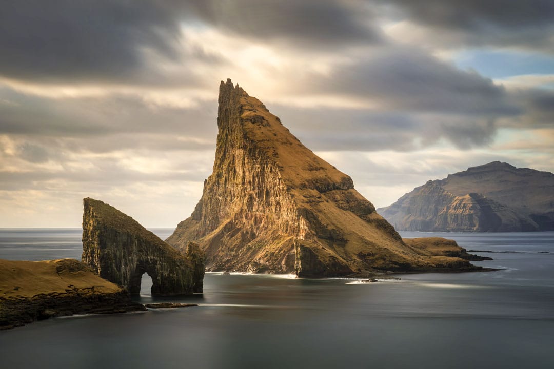
Drangarnir comprises two sea stacks – the arched Stóri Drangur and Lítli Drangur – which translate as large and small sea stack. They are banked by the imposing five-peaked islet of Tindhólmur.
The hike must be undertaken with a guide as the trail runs through private land, which is an important feeding and breeding area for livestock and wildlife. Guided walks run from 1st April to 1st October at 12pm on Wednesdays, Saturdays and Sundays and cost DKK550 ($85 USD) per person. Book via hiking.fo.
Best hikes in the Faroe Islands: the essentials
What: Exploring the best hikes in the Faroe Islands.
Where: We stayed at The Old Millar House, a charming cottage 1km from the centre of town. The cottage is warm and cosy with a traditional turf roof and access to a grotto-like garden.
There is a beach meters away (though it might be too chilly for swimming!) and the Sandá river runs practically past the doorstep. If you’re keen to sample the Faroese nightlife, you may wish to stay closer to the centre, but for those happy to retreat to cosy evenings, the Old Millar House is an excellent option.
Click here to get a discount on your first stay with Airbnb or find alternative accommodation on Booking.com.
Booking.comWhen: The best time to visit the Faroe Islands is from May to September. Late spring brings longer days (perfect for hiking), wildflowers and, of course, puffins. From mid-June to mid-August is when the puffins flock to land to nest. For two weeks on either side, you are still likely see some.
How: We hired a car from 62°N Car Rental and navigated our way around the island using Google Maps and the built-in sat-nav. Driving in the Faroe Islands is straightforward with the roads in good condition, easy to navigate and rarely busy. There is free parking at all the major sights. Read our guide to driving in the Faroe Islands for more information.
To visit Mykines, you must take a ferry from Sørvágur port (on Vagar). Check mykines.fo for the timetable (‘Travel Plan’) and book your tickets in advance.
A handful of hiking trails in the Faroe Islands have implemented restrictions regarding access to the area and either charge a fee or require a guide. An overview of these locations can be found here.
Visit Faroe Islands have also produced a hiking guide which covers 23 hiking routes and includes lots of practical information. It can be accessed online or downloaded as a PDF.
Finally, hiking.fo is an excellent resource with lots of suggested routes and several guided hikes for many of the popular routes.
We flew to the Faroe Islands with Atlantic Airways. Book flights via Skyscanner.
Enjoyed this post? pin it for later…