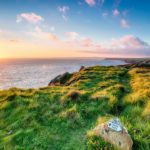
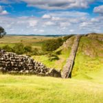
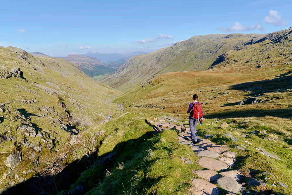
From the South Downs to Hadrian’s Wall, we explore England’s most popular hiking trails
Whether you’re an experienced hiker in need of fresh ideas or a first-timer hoping to get outdoors more, our list of England’s most popular hiking trails offers a wealth of options.
Home to over 100,000 trails, AllTrails is one of the world’s leading hiking apps. It has over 20 million users globally and is widely downloaded across the UK.
With reviews running in the hundreds of thousands, we believe the ‘AllTrails method’ is a great way to explore the country’s finest footpaths. We’ve selected England’s most popular hiking trails from the app’s archives, but there are of course thousands more to choose from. Over 7,500 in fact, and counting.
Everyone will have an opinion on what constitutes a great trail and popularity certainly does not equate to ‘the best’. If you prefer to hike in solitude then perhaps this list is best used as an index of trails to avoid! Either way, we hope you find it useful.
Many of the trails incorporate sections of England’s National Trails, long-distance footpaths or national parks. Where possible, we’ve linked to our content that covers the region in more depth.
England’s most popular hiking trails
AllTrails user reviews are calculated using a five-star rating system with one star being terrible, two stars poor, three stars average, four stars good and five stars excellent.
To find England’s most popular hiking trails, we’ve selected the highest-rated hikes according to their average rating on AllTrails.
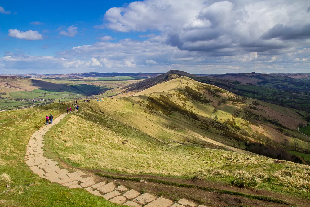
1. Castleton, Mam Tor and the Great Ridge Walk
Location: Peak District National Park
Distance: 12.7 km
Duration: 4-5 hours
Difficulty: Moderate
More info
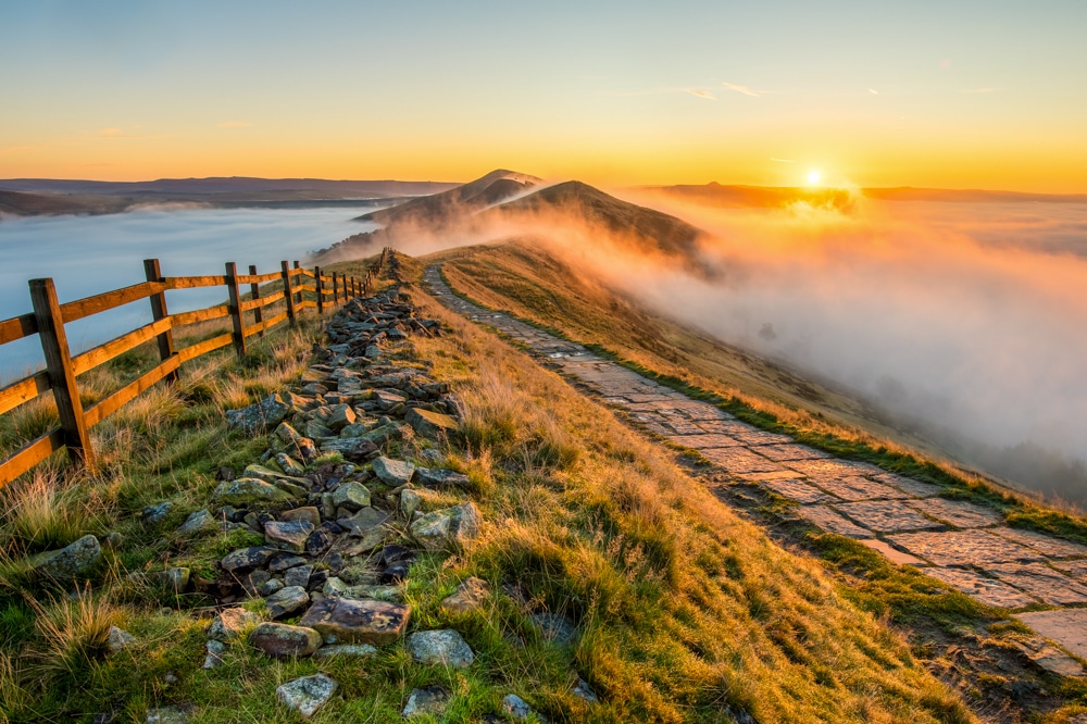
Wedged between the northern cities of Manchester and Sheffield, the Peak District may well be England’s most accessible wilderness. This ridge walk offers spectacular views of Edale Valley, Hope Valley and the edge of Kinder Scout.
2. Kinder Scout and Kinder Downfall
Location: Peak District National Park
Distance: 13.7km
Duration: 4-5 hours
Difficulty: Moderate
More info
Home to several of England’s most popular hiking trails, Kinder Scout features numerous times on this list. First up is this circular hill walk retracing the steps of the famous Kinder Scout mass trespass.
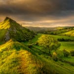
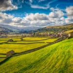
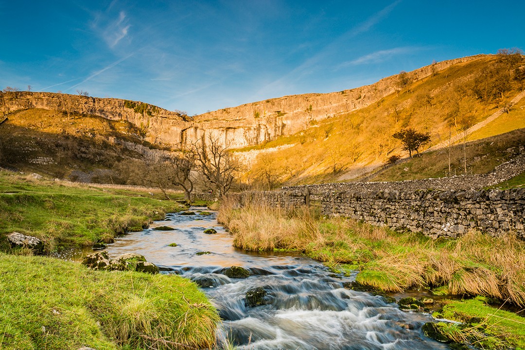
3. Janet’s Foss, Gordale Scar and Malham Cove
Location: Yorkshire Dales National Park
Distance: 7.6km
Duration: 2-3 hours
Difficulty: Moderate
More info
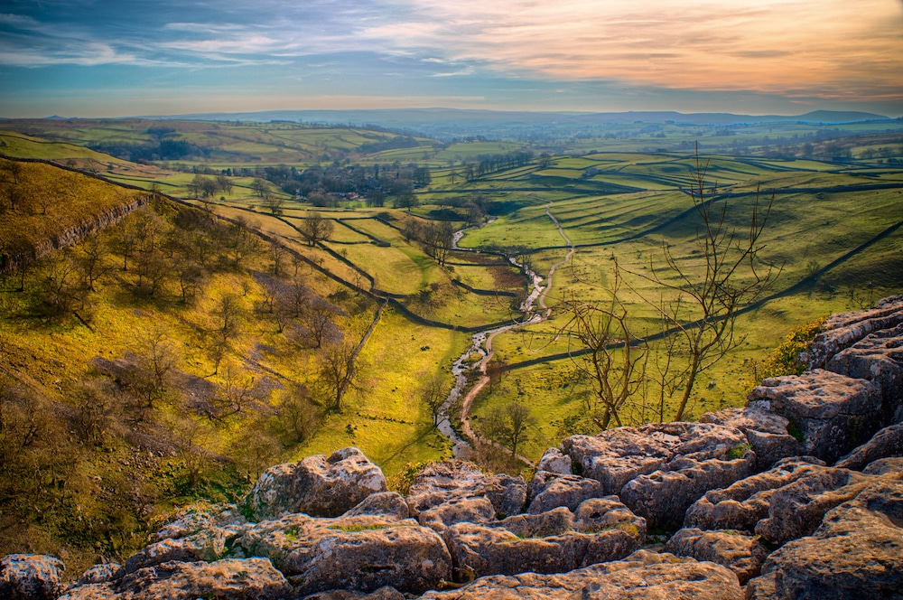
The Yorkshire Dales are home to some of England’s quintessential outdoor landscapes. This circular route from the village of Malham takes hikers through classic limestone scenery and visits three iconic Dales sites.
- 12 best hikes in the Yorkshire Dales National Park
- Highest mountains in the Yorkshire Dales
- In photos: the best views in the Yorkshire Dales
4. Dove Stone Reservoir Circular Walk
Location: Peak District National Park
Distance: 13.2km
Duration: 4-5 hours
Difficulty: Hard
More info
This celebrated bird-watching haunt is also popular with walkers due to its picturesque lakeside setting, striking waterfall views and unique rock formations.
5. The Roaches and Lud’s Church Circular Walk
Location: Peak District National Park
Distance: 12.2km
Duration: 4-5 hours
Difficulty: Moderate
More info
A fun ridge climb reveals fine views of East Cheshire, the Staffordshire Dales and sights such as Bosley Cloud and Kinder Scout.
6. Ingleton Waterfalls
Location: Yorkshire Dales National Park
Distance: 6.9km
Duration: 1-2 hours
Difficulty: Easy
More info
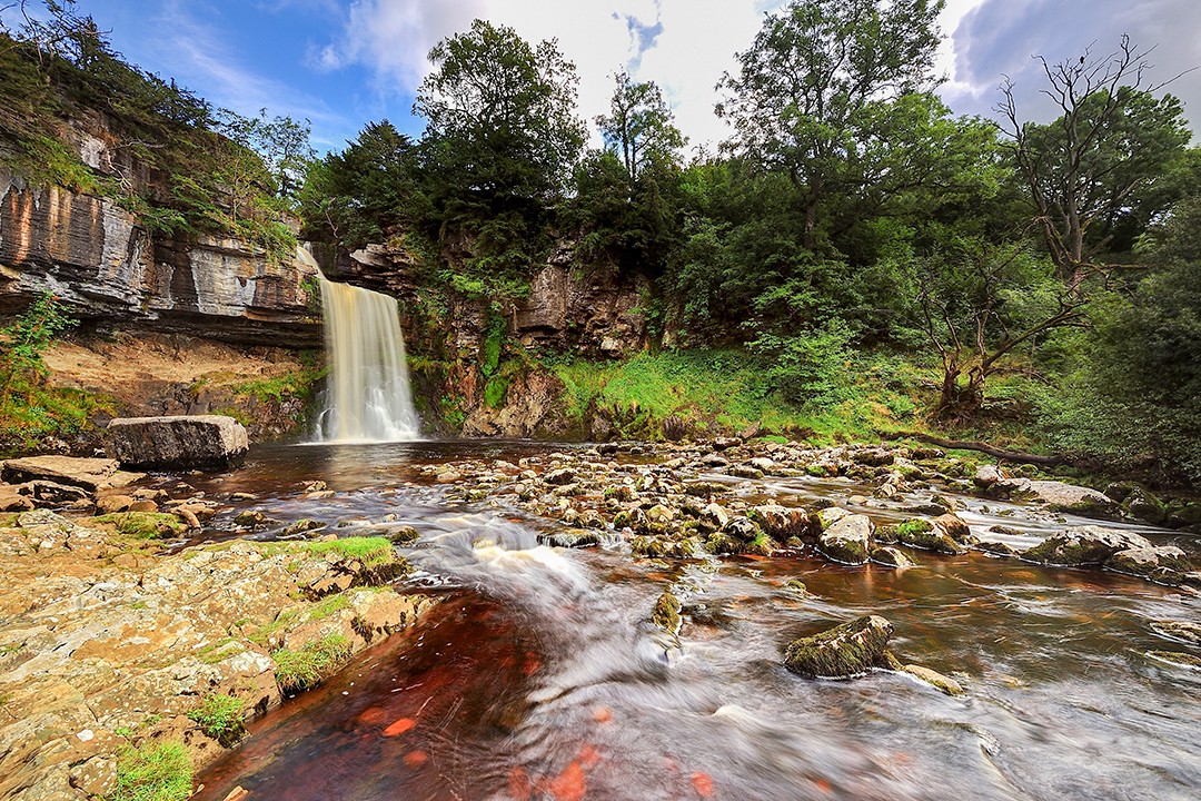
The circular route is one of the most popular walks in the Dales and offers some striking views of the cascades as well surrounding woodland. However, there is an entrance fee (£7 for adults, £3 for children) which goes against every hiking bone in my body.
7. Malham Tarn via Gordale Scar
Location: Yorkshire Dales National Park
Distance: 12.2km
Duration: 3-4 hours
Difficulty: Hard
More info
A circular and very challenging walk passing through some wonderful limestone scenery as it visits the iconic Dales sites of Janet’s Foss, Gordale Scar, Malham Tarn and Malham Cove.
8. Kinder Scout and Mam Tor Circular
Location: Peak District National Park
Distance: 17.2km
Duration: 5-6 hours
Difficulty: Hard
More info
Another option in this popular hiking region, the Kinder Scout and Mam Tor Circular enjoys rich scenery and a variety of terrain.
9. Box Hill, Lodge Hill and Juniper Hill Circular
Location: Surrey Hills Area of Outstanding Natural Beauty
Distance: 12.1km
Duration: 4-5 hours
Difficulty: Hard
More info
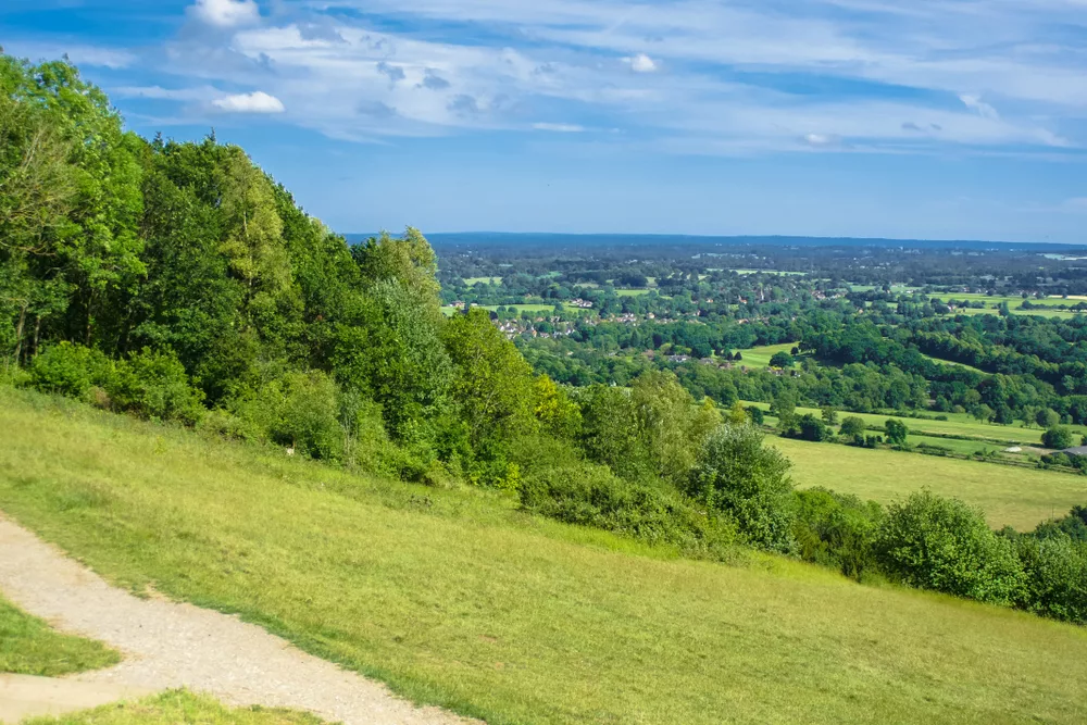
A varied route takes hikers down into the valley and back out through woods into open rolling fields.
10. Baslow Circular Walk via Curbar Edge and Froggatt
Location: Peak District National Park
Distance: 12.4km
Duration: 4-5 hours
Difficulty: Moderate
More info
This loop trail, located near Stoney Middleton in Derbyshire, is principally a riverside walk. Many visitors take advantage of the myriad outdoor activities available in the region.
11. Kinder Scout from Edale
Location: Peak District National Park
Distance: 14.3km
Duration: 4-5 hours
Difficulty: Hard
More info
Another popular path with Kinder Scout hikers, this route includes a steady climb followed by a scramble on to the moors via a riverbed.
12. Yorkshire Three Peaks
Location: Yorkshire Dales National Park
Distance: 39.4km
Duration: 8-12 hours
Difficulty: Hard
More info
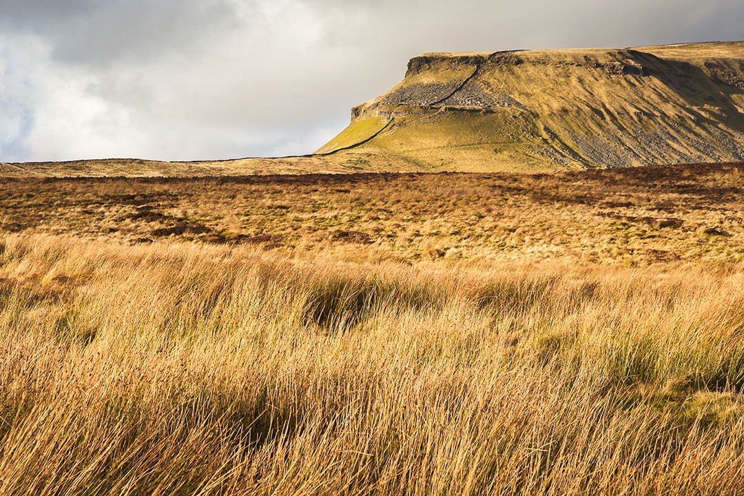
This challenging trail covers the peaks of Pen-y-ghent, Whernside and Ingleborough which form part of the Pennine Range. The Yorkshire Three Peaks Challenge is one of the most iconic walks in the Dales and takes in the park’s highest, second-highest and ninth-highest peaks.
13. Shining Tor and Goyt Valley Circular Walk
Location: Peak District National Park
Distance: 10.9km
Duration: 3-4 hours
Difficulty: Moderate
More info
The highest point in Cheshire is one of the Peak District’s must-do hikes. On a clear day, it’s possible to see Snowdon in Wales from the summit.
14. Kinder Scout and Edale Walk
Location: Peak District National Park
Distance: 12.9km
Duration: 4-5 hours
Difficulty: Moderate
More info
This route offers amazing views of the entire Kinder Scout landscape. At the highest point, there is a small scree scramble. It can get extremely windy on top, but the views more than make up for any discomfort.
15. Loughrigg Fell Circular
Location: Lake District National Park
Distance: 11.6km
Duration: 4-5 hours
Difficulty: Moderate
More info
A little surprising that this is the Lake District’s first appearance on the list! This outstanding tour around Loughrigg Fell enjoys magnificent views across the southern half of the Lakes including Lake Grassmere, Rydal Water and the Langdale Pikes.
16. Scafell Pike
Location: Lake District National Park
Distance: 9.2km
Duration: 4-5 hours
Difficulty: Hard
More info
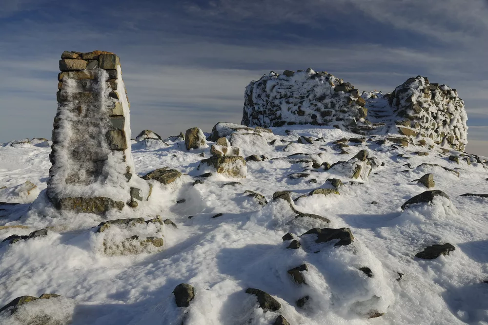
No list like this would be complete without England’s highest and most prominent peak. At 978m (3,208ft), Scafell Pike represents the roof of England and is always going to attract the crowds, despite being far from the most thrilling climb in the Lakes.
17. Silent Pool and Saint Martha’s Hill Circular
Location: Surrey Hills Area of Outstanding Natural Beauty
Distance: 9.3km
Duration: 2-3 hours
Difficulty: Moderate
More info
This loop walk in the Surrey Hills visits a number of popular attractions including Silent Pool, a stretch of the North Downs Way, Newlands Corner and St Martha’s Hill.
18. Pen-y-ghent
Location: Yorkshire Dales National Park
Distance: 10.0km
Duration: 3-4 hours
Difficulty: Moderate
More info
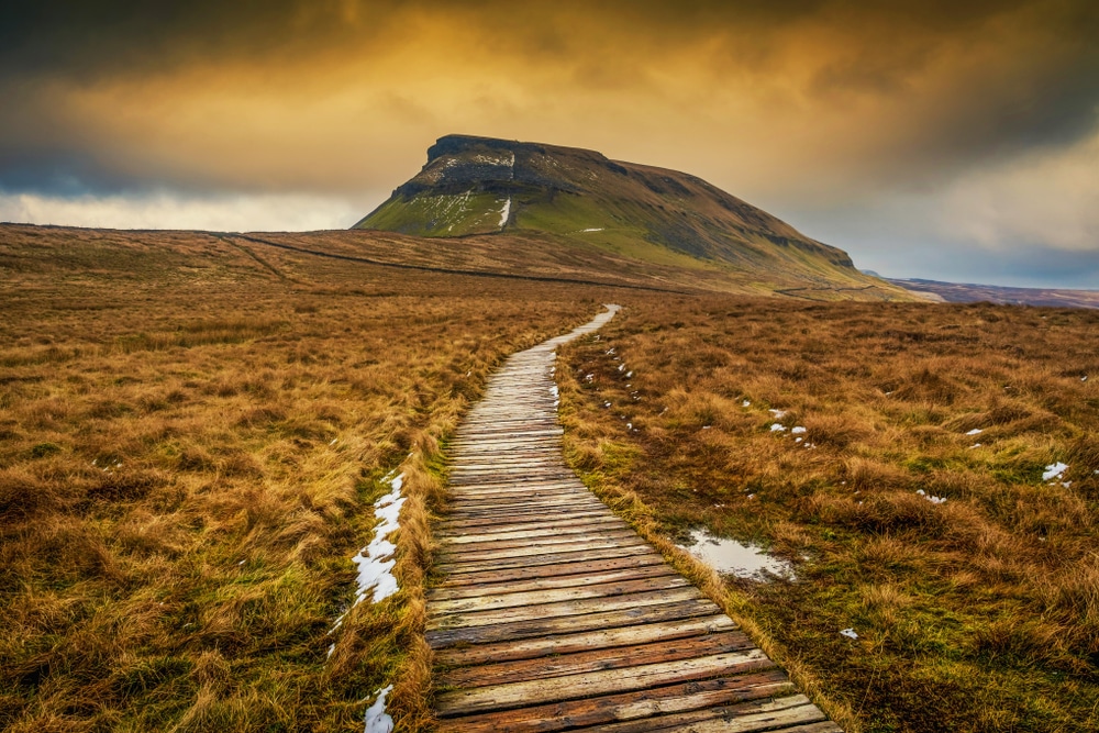
At 694m (2,277ft), Pen-y-ghent may only be the ninth-highest peak in the Yorkshire Dales, but it’s a proper little mountain and really looks the part. There’s a fun scramble below the summit plateau and magnificent views to be enjoyed from the top.
19. Flash and Three Shires Head
Location: Peak District National Park
Distance: 6.0km
Duration: 1-2 hours
Difficulty: Moderate
More info
This circular walk in the Staffordshire Moors begins from the village of Flash, which claims to be the highest in England. This is a pretty but windswept location high on the western gritstone moors.
20. City of London
Location: Southwark, London
Distance: 30.4km
Duration: 8-9 hours
Difficulty: Hard
More info
For those on a sight-seeing mission, this is the perfect trail. Take on world-famous attractions, uncover the capital’s hidden gems and absorb its endless culture, history and heritage.
21. Hadrian’s Wall Path
Location: Wallsend, Tyne and Wear
Distance: 130.7km
Duration: 6-7 days
Difficulty: Moderate
More info
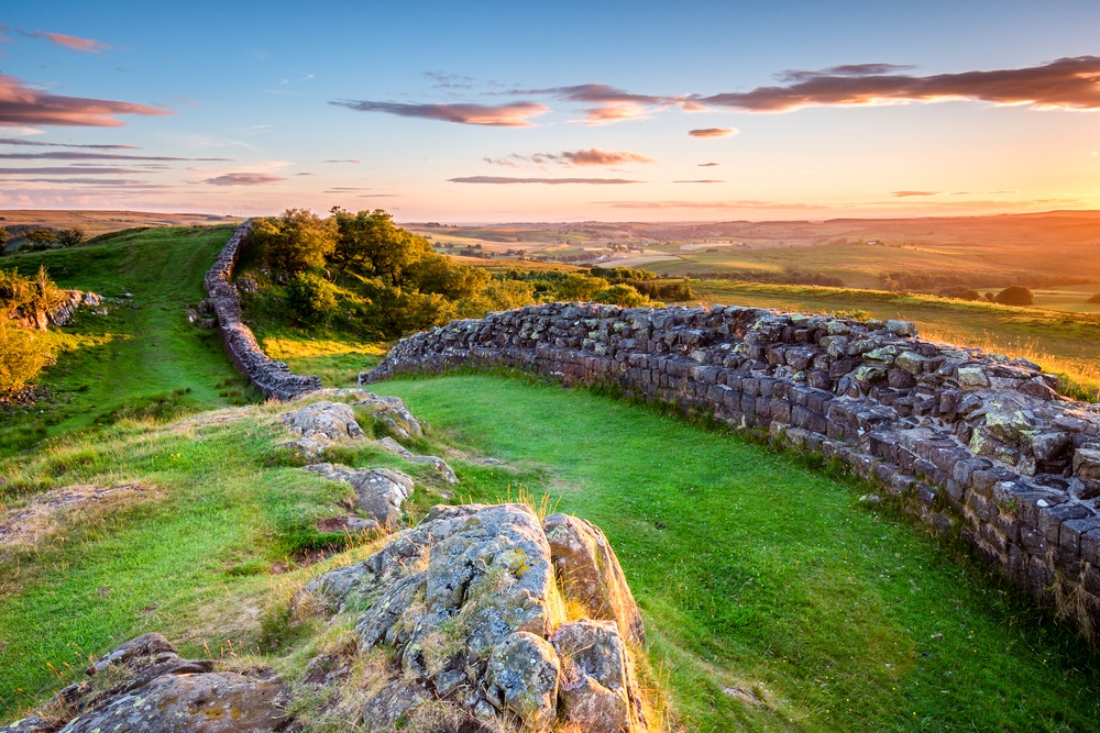
The UNESCO-listed Hadrian’s Wall is one of the the world’s best-preserved Roman sites. This classic long-distance trail is broken into six sections which all make for wonderful day hikes.
22. Fairfield Horseshoe
Location: Lake District National Park
Distance: 16.1km
Duration: 6-7 hours
Difficulty: Hard
More info
Technically, some may class this as mountaineering, but it really depends on the weather. On a fine summer’s day, it should just be a long hike. It is one of the classic walks in the Lake District and takes in the summits of Nab Scar, Great Rigg, Fairfield, Hart Crag, Dove Crag, High Pike and Low Pike.
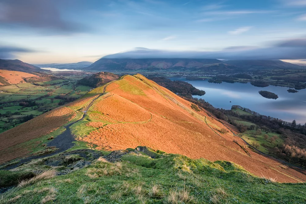
23. Cat bells via Allerdale Ramble
Location: Lake District National Park
Distance: 6.8km
Duration: 2-3 hours
Difficulty: Moderate
More info
This is a really rewarding little hike which enjoys sensational panoramic views over Keswick, Derwent Water and Borrowdale.
24. Helvellyn
Location: Lake District National Park
Distance: 6.8km
Duration: 3-4 hours
Difficulty: Moderate
More info
Ridge walks, as thrilling as they can be, are not everyone’s cup of tea. This alternative route up Helvellyn avoids those intimidating edges.
25. Scafell Pike from Seathwaite
Location: Lake District National Park
Distance: 17.5km
Duration: 6-7 hours
Difficulty: Hard
More info
An alternative route up to England’s highest point. This circular option is a more strenuous walk but offers more varied views.
26. Virginia Water Circular Walk
Location: Windsor Great Park
Distance: 6.8km
Duration: 1-2 hours
Difficulty: Easy
More info
The woodland shores of this magnificent lake are immensely popular among runners, walkers and those content to just relax and enjoy the view.
27. Ranmore Circular
Location: Surrey Hills Area of Outstanding Natural Beauty
Distance: 9.0km
Duration: 3-4 hours
Difficulty: Moderate
More info
A circular walk from Boxhill and Westhumble Station in the village of Westhumble, passing through the Polesden Lacey Estate, Ranmore Common and Denbies Vineyard.
28. Lullingstone Circular
Location: Lullingstone Country Park
Distance: 10.6km
Duration: 3-4 hours
Difficulty: Moderate
More info
This walk along the Darent Valley Path starts at Lullingstone Country Park Visitor Centre which is packed with information about the many delights to be discovered along this walk and throughout the North Downs.
29. Whernside Loop Trail
Location: Yorkshire Dales National Park
Distance: 12.9km
Duration: 4-5 hours
Difficulty: Moderate
More info
A fairly steep walk up the highest of the Yorkshire Peaks. With views of the surrounding areas and the Ribblehead Viaduct throughout, the trail provides a striking blend of nature and industry.
30. Ightham Mote and Knole Park Circular
Location: Sevenoaks, Kent
Distance: 13.8km
Duration: 3-4 hours
Difficulty: Moderate
More info
A walk through the beautiful landscape of Knole Park, not far from the Sevenoaks town centre. Knole Historic Deer Park straddles the Greensand Way and is a perfect course for walkers of all ages and abilities.
31. Bulkeley Hill and Maiden Castle
Location: Tarporley, Cheshire
Distance: 15.6km
Duration: 4-5 hours
Difficulty: Moderate
More info
This walk goes through National Trust land with spectacular views and follows the Sandstone Trail to Maiden Castle.
32. Mole Gap Trail
Location: Surrey Hills Area of Outstanding Natural Beauty
Distance: 9.5km
Duration: 3-4 hours
Difficulty: Moderate
More info
The Mole Gap Trail offers the opportunity to visit two historic market towns and the outstanding countryside of the Mole Gap, including England’s largest vineyard.
33. Epping Forest Main Path and Green Ride Circuit
Location: Epping Forest
Distance: 21.1km
Duration: 6-7 hours
Difficulty: Moderate
More info
This route takes you through the entirety of the Epping Forest, an area of ancient woodland within easy reach of London.
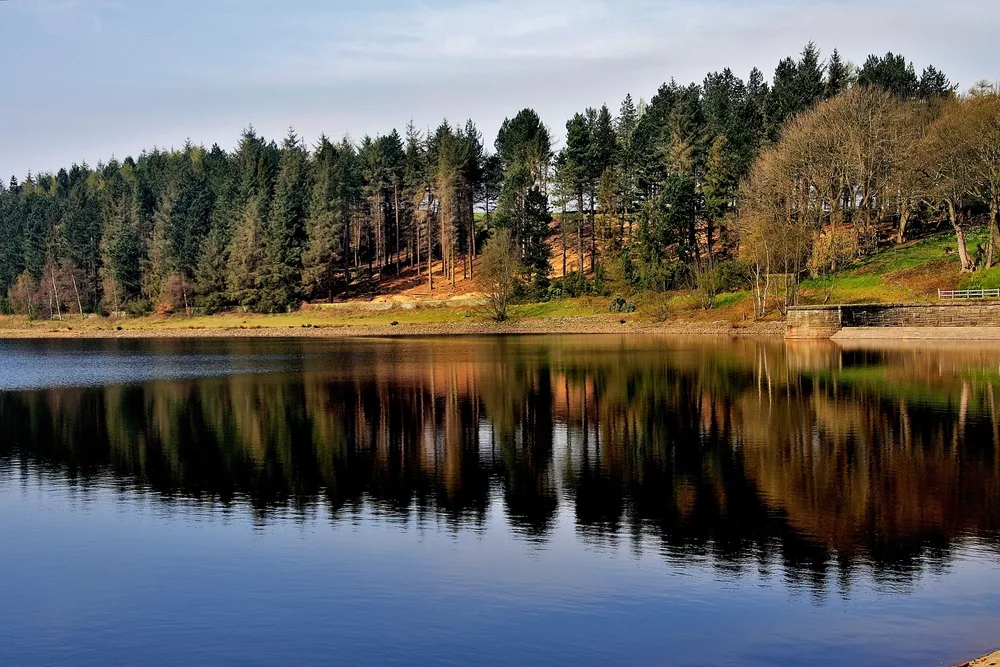
34. Greenbooth Reservoir Circular Walk
Location: Rochdale, Greater Manchester
Distance: 6.3km
Duration: 2 hours
Difficulty: Moderate
More info
A pretty walk never out of sight of water. In total, the trail circles the four linked reservoirs in the shadow of wind turbines and rolling hills.
35. Marsden Moor Walk
Location: Huddersfield, West Yorkshire
Distance: 13.5km
Duration: 4-5 hours
Difficulty: Moderate
More info
The Marsden Moor Estate is a large expanse of moorland in the South Pennines, easily accessed from Huddersfield. Criss-crossed with footpaths, there are trails to suit all abilities.
36. The Great Ridge: Hollins Cross, Rick Tor and Lose Hill
Location: Peak District National Park
Distance: 8.0km
Duration: 3-4 hours
Difficulty: Moderate
More info
This walk takes you from the car park on Mam Tor, up to the top and then along the ridge to Lose Hill. There’s a bit of up and down, but the route stays at a good height above the Hope Valley to the south and the Vale of Edale to the north thereby commanding striking views in all directions.
37. Fairholmes Derwent Valley
Location: Peak District National Park
Distance: 13.2km
Duration: 4-5 hours
Difficulty: Moderate
More info
This is a splendid route enjoying a range of scenery including rivers, waterfalls, marshland and woods.
38. White Coppice, Great Hill, and Anglezarke Circular
Location: Chorley, Lancashire
Distance: 14.8km
Duration: 4-5 hours
Difficulty: Moderate
More info
This area is littered with reservoirs that were built at the turn of the 19th century to supply water to the nearby cotton towns and mills. If you want to show off how picturesque Lancashire can be, then White Coppice which was once a busy industrial village is a fine place to start.
39. Malvern Hills Circular Walk
Location: Malvern Hills Area of Outstanding Natural Beauty
Distance: 15.9km
Duration: 5-6 hours
Difficulty: Hard
More info
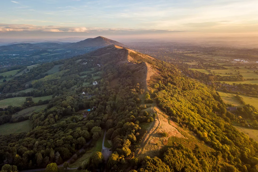
Many of the trails in the Malvern Hills offer sweeping panoramas and superb ridge walks. This route is a great place to start and certainly stretches the legs.
40. Farthing Downs and Happy Valley Loop
Location: Happy Valley Park
Distance: 7.9km
Duration: 2-3 hours
Difficulty: Moderate
More info
The Farthing Downs and Happy Valley Loop is a circular trail beginning in Old Coulsdon and taking in Happy Valley, Farthing Downs and London’s most southern public house, The Fox.
41. Bourton on the Water to Stow on the Wold Walk
Location: Cotswolds Area of Outstanding Natural Beauty
Distance: 16.7km
Duration: 5-6 hours
Difficulty: Moderate
More info
A beautiful walk starting with a gentle climb to the highest location in the Cotswolds, Stow on Water. It’s followed by a fantastic level return jaunt to Bourton on the Water.
42. Langsett Reservoir Circular
Location: Peak District National Park
Distance: 6.0km
Duration: 1-2 hours
Difficulty: Easy
More info
This is a lovely stroll around Langsett Reservoir near the villages of Langsett and Upper Midhope on the edge of the Peak District National Park.
43. Seven Sisters and Friston Forest Circular Walk
Location: South Downs National Park
Distance: 14.2km
Duration: 4-5 hours
Difficulty: Hard
More info
This vintage coastal circular walk takes in the dramatic natural beauty of Seven Sisters and Birling Gap. See number 90 for a shorter, more moderate point-to-point route.
44. Pendle Hill and Ogden Reservoir
Location: Forest of Bowland Area of Outstanding Natural Beauty
Distance: 7.9km
Duration: 2-3 hours
Difficulty: Moderate
More info
This is a no-nonsense well-walked approach to the top of Pendle Hill starting from the village of Barley.
45. Inspiring Views Trail
Location: Surrey Hills Area of Outstanding Natural Beauty
Distance: 9.0km
Duration: 3-4 hours
Difficulty: Moderate
More info
A circular walk within the Surrey Hills which celebrates the Inspiring Views project. the trail visits a number of viewpoints along with the sculptured seats and installations inspired by the landscape.
46. Cat Bells, Maiden Moor and High Spy
Location: Lake District National Park
Distance: 12.9km
Duration: 4-5 hours
Difficulty: Moderate
More info
This route takes hikers along the ridge from Cat Bells, across Maiden Moor and on to High Spy, before dropping down to Dale Head Tarn. The long return trek overlooks Newlands Beck. A beautiful and grand day out.
47. Edale and Grindsbrook Circular
Location: Peak District National Park
Distance: 25.1km
Duration: 8-9 hours
Difficulty: Moderate
More info
This full-day circular hike winds its way around a vast upland plateau with plunging views throughout. En route, walkers pass the dramatic waterfall of Kinder Downfall and over an entertaining scramble across Grindsbrook Clough.
48. Friday Street Hammer Circular
Location: Surrey Hills Area of Outstanding Natural Beauty
Distance: 9.8km
Duration: 3-4 hours
Difficulty: Moderate
More info
A circular walk from Friday Street, near Dorking in Surrey, taking in the Wotton Estate with great views plus rivers, hammer ponds, mills, farms and churches to enjoy.
49. Friday Street to Leith Hill Circular
Location: Surrey Hills Area of Outstanding Natural Beauty
Distance: 15.8km
Duration: 4-5 hours
Difficulty: Moderate
More info
A longer variation of the above which also takes in a waterfall and a broader mix of terrain such as a longer woodland section.
50. Banstead Woods Nature Walk
Location: Banstead Woods
Distance: 4.7km
Duration: 1-2 hours
Difficulty: Easy
More info
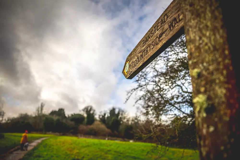
A circular walk discovering the hidden secrets and natural wonders of Banstead Woods, 250 acres of ancient woodland. Banstead Woods’ recorded history stretches back for nearly a thousand years, to the time of the Domesday Book in 1086.
51. The Tolkien Trail
Location: Forest of Bowland Area of Outstanding Natural Beauty
Distance: 10.8km
Duration: 3-4 hours
Difficulty: Easy
More info
Follow in the footsteps of J.R.R. Tolkien who spent a significant amount of his time at Stonyhurst College working on The Lord of the Rings during the Second World War. A number of names occurring in The Lord of The Rings are similar to those found locally including Shire Lane (in Hurst Green) and River Shirebourn (similar to the family name which built Stonyhurst).
52. Monsal Trail
Location: Peak District National Park
Distance: 15.6km
Duration: 4-5 hours
Difficulty: Moderate
More info
The Monsal Trail is a traffic-free route along the former Midland Railway line for walkers, cyclists, horse riders and wheelchair users through some of the Peak District’s most spectacular limestone dales.
53. Weavers Way: Frodsham to Northwich
Location: Frodsham, Cheshire
Distance: 20.9km
Duration: 5-6 hours
Difficulty: Moderate
More info
A walk from Frodsham to Northwich, which more or less follows the Weaver Way. the fairly level terrain follows mainly canal towpath or riverside paths, some country lanes and some road walking in town centres.
54. Godstone Paths, Ponds and Churches
Location: Godstone, Surrey
Distance: 6.0km
Duration: 1-2 hours
Difficulty: Moderate
More info
A circular walk from the pretty village of Godstone in Surrey, taking you on a simple loop through the surrounding fields and lanes via old mills and the adjacent village of Tandridge.
55. Seaford to Eastbourne
Location: South Downs National Park
Distance: 22.7km
Duration: 6-7 hours
Difficulty: Moderate
More info
Some would say this is the best way to experience the Seven Sisters cliffs. The trail passes Cuckemere Haven, the Seven Sisters and Beachy Head, and finishes at Eastbourne’s promenade and pier.
56. Lover’s Leap and Dove Hole Walk
Location: Dovedale National Nature Reserve
Distance: 11.1km
Duration: 3-4 hours
Difficulty: Moderate
More info
Dove Dale is a beautiful place to visit, but the walk can get busy when the sun is out. Most only go as far as the stepping stones five minutes from the car park, but for those who continue, the crowds thin out and the scenery opens up.
57. Buttermere Circuit from Gatesgarth
Location: Lake District National Park
Distance: 6.9km
Duration: 2-3 hours
Difficulty: Easy
More info
Paths on this much-used circuit have been improved over the years, so much so that some have come to resemble highways! The ever-popular trail includes a miners’ tunnel, a brief scramble and a visit to the delightful village of Buttermere.
58. Otter Trail and Hawksley Memorial Garden via Itchen
Location: Bambridge Park Garden Centre
Distance: 5.8km
Duration: 1-2 hours
Difficulty: Easy
More info
A circular walk from the village of Allbrook in Hampshire. The Otter Trail was created by Hampshire and the Isle of Wight Wildlife Trust and takes hikers along part of the Itchen Navigation Path and through Otterbourne Park Woods.
59. Long Mynd Circular
Location: Shropshire Hills Area of Outstanding Natural Beauty
Distance: 13.2km
Duration: 4-5 hours
Difficulty: Moderate
More info
This pleasant hike has something for everyone and is a great way to see the Shropshire Hills. There is a fun climb up from Carding Mill to the waterfall, which can be quite challenging and rocky in places. Expect to see ponies, sheep and wild horses in the hills with fine views throughout.
60. South Downs Way
Location: South Downs National Park
Distance: 153km
Duration: 8-10 days
Difficulty: Moderate
More info
This classic long-distance footpath follows the ancient routes and droveways along the chalk escarpment and ridges of the South Downs from Winchester in Hampshire to Eastbourne in East Sussex.
61. Fairy Glen Loop Trail
Location: Wigan, Greater Manchester
Distance: 6.6km
Duration: 2 hours
Difficulty: Moderate
More info
This straightforward walk with its pretty streams, idyllic waterfalls, dramatic cliff faces, wooden bridges and shady woodland trails is a delightful way to visit Fairy Glen near the Lancashire village of Parbold.
62. Ladybower Reservoir Circular Walk
Location: Peak District National Park
Distance: 27.5km
Duration: 8-9 hours
Difficulty: Hard
More info
This is a long trail but it traverses a gentle landscape on well-made paths and offers idyllic views throughout for only a small amount of effort.
63. Whiteleaf to Chequeurs Walk
Location: Chiltern Hills Area of Outstanding Natural Beauty
Distance: 11.3km
Duration: 3-4 hours
Difficulty: Moderate
More info
Plenty of hills and spectacular views, the walk takes hikers through the Prime Minister’s country retreat of Chequers. The authorities once tried – and failed – to divert the footpath around the Chequers Estate.
64. Cheddar Gorge
Location: Mendip Hills Area of Outstanding Natural Beauty
Distance: 6.0km
Duration: 2-3 hours
Difficulty: Hard
More info
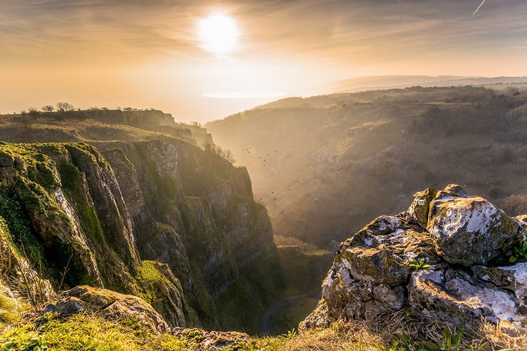
One of Britain’s most spectacular natural landmarks. Its awe-inspiring cliffs and subterranean stalactite caves reveal numerous secrets about our prehistoric ancestors.
65. Greenfield Waterfall
Location: Peak District National Park
Distance: 9.8km
Duration: 3-4 hours
Difficulty: Moderate
More info
This is a beautiful trail with great views at the top. It can get very wet and boggy en route, so sturdy waterproof boots are essential.
66. Seathwaite Circular
Location: Keswick, Cumbria
Distance: 7.9km
Duration: 1-2 hours
Difficulty: Moderate
More info
This route doesn’t top out on any mountains. Instead, it ambles its way along and around the Borrowdale Valley. A great way of seeing the area’s big hills without actually climbing any of them.
67. Thor’s Cave
Location: Peak District National Park
Distance: 8.5km
Duration: 2-3 hours
Difficulty: Moderate
More info
This is an exciting trail with contrasting terrain: roads, paths, steep hills and steps. The variety makes it more enjoyable and a bit more of a workout.
68. West Lulworth to Ringstead Bay Circular
Location: Dorset Area of Outstanding Natural Beauty
Distance: 18.3km
Duration: 5-6 hours
Difficulty: Moderate
More info
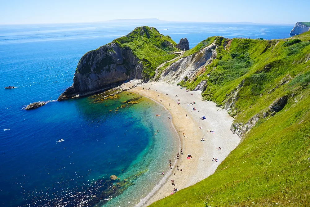
The scenery around the Lulworth area is remarkable and boasts some of the most dramatic geological features along the Jurassic Coast UNESCO World Heritage Site, including Lulworth Cove and Durdle Door.
69. Otford Circular
Location: Sevenoaks, Kent
Distance: 8.9km
Duration: 2-3 hours
Difficulty: Moderate
This circular walk begins in Otford where hikers can visit the world’s largest scale model of the solar system, the Otford Solar System.
70. Coledale Circular Walk
Location: Lake District National Park
Distance: 15.6km
Duration: 6-7 hours
Difficulty: Hard
More info
Also known as the Coledale Horseshoe, this trail is a hefty footslog over the Wainwright Fells surrounding the glacial hanging valley of Coledale, above Braithwaite near Keswick.
71. Balcombe and Ardingly Reservoir Extended Circular Walk
Location: Haywards Heath, West Sussex
Distance: 12.7km
Duration: 3-4 hours
Difficulty: Moderate
More info
This circular route explores a delightful area of rural West Sussex featuring an idyllic landscape of rolling fields, woodland, duck ponds, country lanes and farmland.
72. Old Glossop and B-29 Crash Site
Location: Peak District National Park
Distance: 13.4km
Duration: 4-5 hours
Difficulty: Moderate
More info
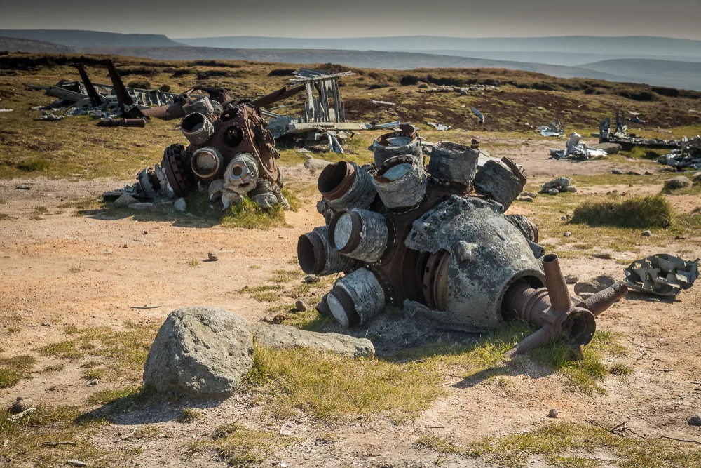
This walk takes hikers up a captivating but rarely visited ridge onto Bleaklow – the Peak District’s second-highest mountain. A highlight of the trail is the 1948 B-29 Superfortress plane crash site. The plane was on a short flight from Lincolnshire to Burtonwood when it struck the mountain in low cloud, killing all 13 crew members.
73. Bath Skyline Walk
Location: Cotswolds Area of Outstanding Natural Beauty
Distance: 9.3km
Duration: 2-3 hours
Difficulty: Moderate
More info
An enjoyable walk around Bath City with splendid views of the city throughout. There are lots of benches en route on which to soak up the spectacle.
74. Derwent Water Circular Walk
Location: Lake District National Park
Distance: 17.4km
Duration: 5-6 hours
Difficulty: Moderate
More info
There can surely be no better walk in the Lake District that offers so much with no height gained. This easygoing circuit of Derwent Water makes for an attractive day hike.
75. Arundel River Walk
Location: South Downs National Park
Distance: 11.6km
Duration: 2-3 hours
Difficulty: Easy
More info
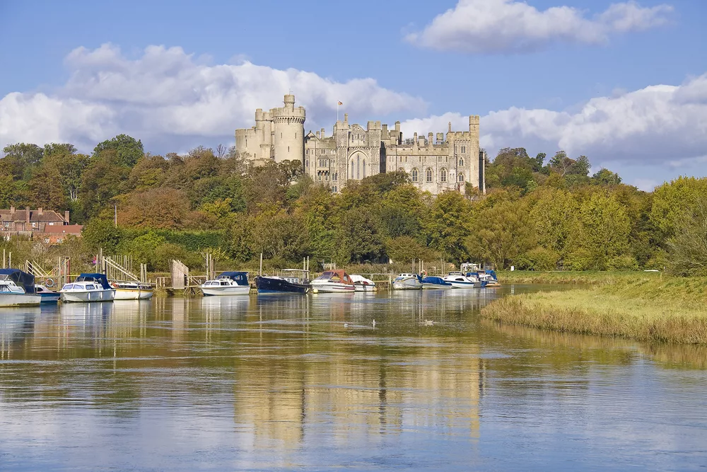
Arundel – located inside the Arun Valley alongside its namesake, the Arun River – is nestled between England’s South Coast and the South Downs National Park. Its most famous landmark, Arundel Castle, is delightful from every angle.
76. Nab’s Head, Samlesbury Bottoms and Hoghton Bottoms
Location: Preston, Lancashire
Distance: 7.9km
Duration: 1-2 hours
Difficulty: Moderate
More info
This walk is mainly on paths and farm tracks (some muddy). It starts and ends on quiet lanes and country roads – but is rural throughout – with the odd cottage or mill passed en route.
77. Malham Cove and Gordale Scar
Location: Yorkshire Dales National Park
Distance: 13.0km
Duration: 4-5 hours
Difficulty: Moderate
More info
Another walk around Malham, this time focusing on Malham Cove and Gordale Scar.
78. Farley Mount and Parnholt Circular
Location: Winchester, Hampshire
Distance: 9.7km
Duration: 2-3 hours
Difficulty: Moderate
More info
This is a pretty walk around the Farley Mount area. This is popular geocaching route for anyone that way inclined.
79. Limpsfield Circular Walk
Location: Limpsfield, Surrey
Distance: 7.9km
Duration: 2-3 hours
Difficulty: Moderate
More info
A circular walk near the village of Limpsfield in Surrey close to the Kent border. The walk explores several sections of woodland common – including High Chart and Limpsfield Common – set along the slopes of the Greensand Ridge.
80. Helvellyn via Striding Edge
Location: Lake District National Park
Distance: 13.5km
Duration: 5-6 hours
Difficulty: Hard
More info
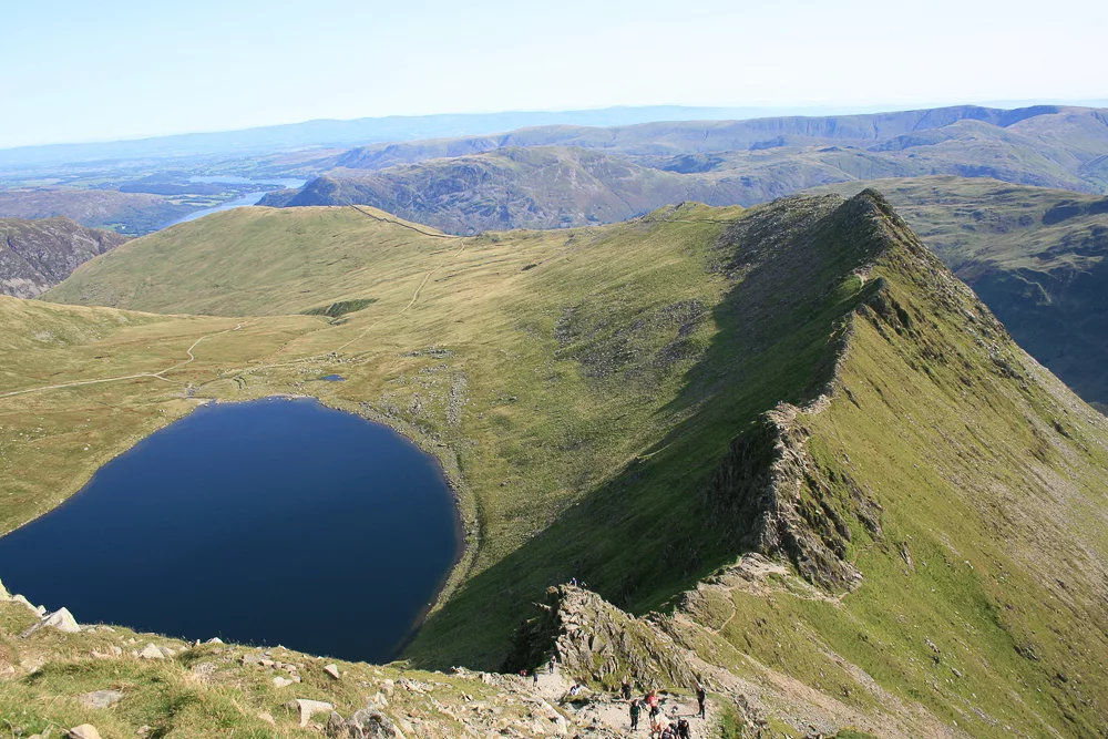
Probably England’s most famous ridge walk, Striding Edge is a hairy but thrilling affair with sheer drops on both sides. The final scramble to the summit of Helvellyn is hard going. The trail can be exceptionally slippery when wet.
81. Orrest Head Circular Walk
Location: Lake District National Park
Distance: 5.0km
Duration: 1-2 hours
Difficulty: Moderate
More info
This trail enjoys spectacular views over Lake Windermere and the surrounding fells for relatively little effort.
82. Old Man of Coniston Circuit
Location: Lake District National Park
Distance: 9.0km
Duration: 3-4 hours
Difficulty: Hard
More info
This is a tough but rewarding walk over good paths and tracks with some steep inclines and declines throughout. It follows a circular route from a parking area on Walna Scar road.
83. Bamford Edge and Stanage Edge Circular
Location: Peak District National Park
Distance: 9.2km
Duration: 2-3 hours
Difficulty: Moderate
More info
Another Peak District classic. The awesome cliffs of Stanage Edge offer magnificent views across some of the Peak District’s most famous landscapes including the Derwent and Hope Valleys, Mam Tor and Kinder Scout.
84. Finsbury Park Station to Trafalgar Square
Location: London
Distance: 8.5km
Duration: 2-3 hours
Difficulty: Easy
More info
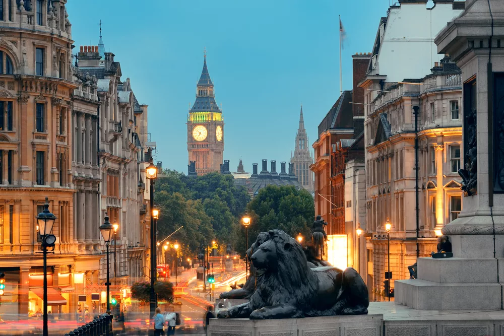
An urban hike from North London’s Finsbury to Trafalgar Square in Central London. On the way, hikers will pass myriad famous landmarks as well as countless parks, gardens, theatres, museums, local shops, restaurants and bars.
85. Cumbria Way
Location: Ulverston, Cumbria
Distance: 129.6km
Duration: 6-8 days
Difficulty: Moderate
More info
The Cumbria Way is a famous long-distance path through the Lake District. It spans the entirety of the route from Ulverston to Carlisle, mostly within the national park. The route is a mostly flat path, but there is a number of exposed ridges offering fantastic views.
86. Epping Forest Circular
Location: Epping Forest
Distance: 8.9km
Duration: 2-3 hours
Difficulty: Moderate
More info
A significantly shorter variant on the aforementioned Epping Forest day hike. This trail is half the distance and leaves plenty of time for a pub visit.
87. Styal and Airport Circular
Location: Wilmslow, Cheshire
Distance: 5.3km
Duration: 1-2 hours
Difficulty: Moderate
More info
A circular walk from Styal village through the Bollin valley and back past the runway of Manchester Airport. After the walk you can explore Styal village with its thatched cottages and half-timbered buildings.
88. Hawes End, Cat Bells, and Derwent Circular
Location: Lake District National Park
Distance: 6.6km
Duration: 2-3 hours
Difficulty: Moderate
More info
Described as the perfect Lake District introductory hike, this short but sweet loop trail takes in a fine little hill, meadows of wild flowers and the odd mild scramble.
89. Waverley Medieval Circular
Location: Thursley Common National Nature Reserve
Distance: 10.0km
Duration: 3-4 hours
Difficulty: Moderate
More info
An undulating circular walk from Tilford village passing close to Sands village and the historic ruins of Waverley Abbey. From the top of Crooksbury Hill there are sprawling views across the South Downs on a clear day.
90. Seven Sisters
Location: South Downs National Park
Distance: 11.7km
Duration: 3-4 hours
Difficulty: Moderate
More info
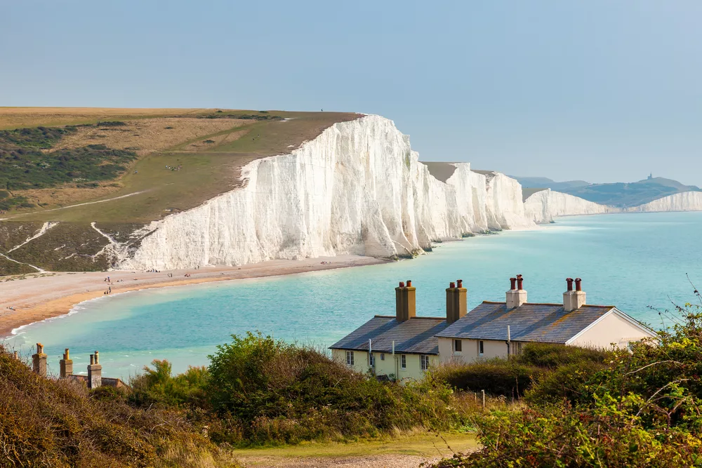
This breezy walk from Birling Gap along the chalky clifftops of the Seven Sisters is a coastal classic and follows the South Downs Way along the cliffs to Exceat. This moderately challenging walk between the South Downs and the sea offers chances to spot some wildlife and pause at archaeological sites.
91. Skiddaw
Location: Lake District National Park
Distance: 10.0km
Duration: 3-4 hours
Difficulty: Hard
More info
England’s third-highest mountain is, unsurprisingly, home to exceptional panoramas of the Northern Fells. The out-and-back trail up the Jenkin Hill path from Gale Road Car Park is the most popular route. It can be easily be extended to/from Keswick.
92. Ashford, Monsal Dale and Shacklow Wood
Location: Peak District National Park
Distance: 9.3km
Duration: 3-4 hours
Difficulty: Moderate
More info
On a late spring day, this relatively gentle walk comes alive with bird song, lambs, bluebells and the scent of wild garlic! The inclines are not too fierce although the path is steep and rocky heading into Great Shacklow Wood.
93. Hampstead Heath Circular Walk
Location: Hampstead Health
Distance: 7.4km
Duration: 2-3 hours
Difficulty: Easy
More info
This route has many different options but all lead through a beautiful forested area offering extended views of the city as well as the Hill Garden and Pergola.
94. Dogmersfield and the Basingstoke Canal
Location: Hook, Hampshire
Distance: 7.9km
Duration: 2-3 hours
Difficulty: Moderate
More info
A relaxing walk across the fields and lanes around Dogmersfield, a small and tranquil village in Hampshire. The Basingstoke Canal runs through the area and a beautiful lake (Tundry Pond) can be seen in the grounds of Dogmersfield House.
95. Buttermere Haystacks Circular Walk
Location: Lake District National Park
Distance: 12.9km
Duration: 4-5 hours
Difficulty: Moderate
More info
This exciting trail begins at the little Church in Buttermere, follows the lakeside track, then turns up through the deep green moorland surrounding Buttermere Fell before continuing to Haystacks.
96. The Three Churches of Steventon, Ashe and Deane
Location: Ashe Park, Hampshire
Distance: 9.2km
Duration: 2-3 hours
Difficulty: Moderate
More info
A loop walk consisting of byways and field tracks from Steventon in Hampshire. It begins at Steventon Church which has strong connections with Jane Austen (her father and two brothers were rectors here).
97. Entwistle and Wayoh Reservoirs
Location: Darwen, Lancashire
Distance: 7.1km
Duration: 2-3 hours
Difficulty: Easy
More info
A circular walk near Darwen in Lancashire, taking in the beautiful moorland and woodland areas that sit between two reservoirs: Wayoh Reservoir and Turton and Entwistle Reservoir.
98. Wye and the North Downs Circular Walk
Location: Kent Downs Area of Outstanding Natural Beauty
Distance: 7.6km
Duration: 2-3 hours
Difficulty: Moderate
More info
This circular walk in the North Downs, close to Wye village and within the Kent Downs Area of Outstanding Natural Beauty, is one of southeast England’s most popular hiking trails. The route follows a stretch of the North Downs Way with outstanding views, then passes the famous hillside chalk crown figure before dropping down into the pretty village of Wye.
99. Cotswold Way
Location: Chipping Camden, Gloucestershire
Distance: 164.2km
Duration: 8-10 days
Difficulty: Moderate
More info
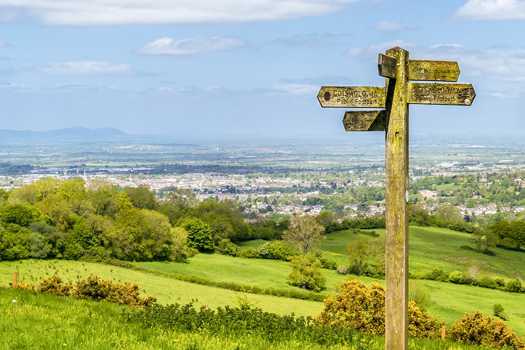
The Cotswold Way is a 164km-long National Trail running between Chipping Campden and the city of Bath. This relatively easy long-distance footpath meanders over the Cotswold escarpment and is known for its pleasant, if not spectacular, views.
100. Curbar Gap Circular Walk
Location: Peak District National Park
Distance: 9.3km
Duration: 2-3 hours
Difficulty: Moderate
More info
This little walk covering three edges and a stone circle wraps up our list of England’s most popular hiking trails. With superb views, no noticeable gradients, and paths crisscrossing the landscape, this trail suits every hiking ability.
Enjoyed this post? pin it for later…